Abadín
| Abadín municipality | ||
|---|---|---|
 Santa María Church
|
||
| coat of arms | Map of Spain | |

|
|
|
| Basic data | ||
| Autonomous Community : |
|
|
| Province : | Lugo | |
| Comarca : | Terra Chá | |
| Coordinates | 43 ° 22 ′ N , 7 ° 29 ′ W | |
| Height : | 500 msnm | |
| Area : | 196.1 km² | |
| Residents : | 2,367 (Jan 1, 2019) | |
| Population density : | 12.07 inhabitants / km² | |
| Postal code : | E-27730 | |
| Municipality number ( INE ): | 27001 | |
| Nearest airport : | A Coruña Airport | |
| administration | ||
| Mayor : | José María López Rancaño (2007) | |
| Website : | www.abadin.es | |
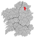
| Location of the municipality | ||

|
||
Abadín is a small Spanish town in the province of Lugo in the north of the autonomous region of Galicia .
geography
The municipality is located in the Comarca Terra Chá and is crossed by the Xistral and Neda ridges and the Labrada and Abadín rivers. The average altitude is around 500 m. The highest point is the Lombo Pequeno with 1015 m .
There are 13 Mámoas in the municipality .
climate
The climate is characterized by dry summers and cold, rainy winters. The mean annual temperature is 10 ° C, the amount of precipitation is relatively high at 1799 mm per year.
Population development

Web links
Commons : Abadín - collection of images, videos and audio files
Individual evidence
- ↑ Cifras oficiales de población resultantes de la revisión del Padrón municipal a 1 de enero . Population statistics from the Instituto Nacional de Estadística (population update).
- ↑ Xabier Moure: MÁMOAS DE GALIZA / GALICIA (PROVINCIA DE LUGO) ( Spanish ) onosopatrimonio.blogspot.com. Retrieved April 9, 2020.
