Chantada
| Chantada municipality | ||
|---|---|---|
 Chantada Town Hall
|
||
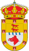
| coat of arms | Map of Spain | |

|
|
|
| Basic data | ||
| Autonomous Community : | Galicia | |
| Province : | Lugo | |
| Comarca : | Chantada | |
| Coordinates | 42 ° 36 ′ N , 7 ° 46 ′ W | |
| Height : | 503 msnm | |
| Area : | 176.73 km² | |
| Residents : | 8,192 (Jan 1, 2019) | |
| Population density : | 46.35 inh / km² | |
| Postal code : | 27500 (Chantada) 27512 (Laxe & Mato) 27514 (Belesar) 27515 (Arriba & Nogueira) 27517 (Merlán & Sabadelle) 27518 (Arcos, Mariz & San Martiño) 27595 (Veiga) |
|
| Municipality number ( INE ): | 27016 | |
| administration | ||
| Official language : | spanish and galician | |
| Mayor : | Manuel Lorenzo Varela Rodríguez ( INTA ) (since 2011) |
|
| Address of the municipal administration: | Plaza de España (Cantón) N ° 1 27500 Chantada - Lugo (Galicia) Telephone: 982 440 011 |
|
| Website : | www.concellodechantada.org | |
| Location of the municipality | ||

|
||
Chantada is a Municipio ( Galician Concello ) and at the same time the administrative seat of the Comarca Chantada of the same name ( Province of Lugo , Autonomous Community of Galicia ).
geography
In the north of Chantada borders the Municipio Taboada , followed clockwise by the Municipios O Saviñao , Pantón , Carballedo and Rodeiro , the latter belonging to the Province of Pontevedra . The highest point is Mount Faro at 1,187 m above sea level. The Ribeira Sacra region , known for the wine-growing region of the same name, is of particular importance to Chantada . Notable waters are the adjacent Río Miño , Río Asma and Río Enviande .
The A-72 that begins in Monforte de Lemos ends in Chantada .
Population development
In 2014, 8,553 people lived in the community, of whom 868 were children and adolescents up to and including 14 years of age (10.15%), 5,051 people aged between 15 and 64 years (59.05%) and 2,634 senior citizens (30.79%). The percentage of the Galician- speaking population was 68.33%.
In 1900 there were just over 15,000 inhabitants in the municipality. In 1981 there were still just under 14,500 inhabitants. Since then, the population density has continued to decline.

Parroquias in Chantada
Adá (Santa Baia) , Arcos (Santa María) , Argozón (San Vicente) , Belesar (San Bartolomeu) , Bermún (Santa María) , Brigos (San Salvador) , Camporramiro (Santa María) , Chantada (Santa Mariña) , Esmeriz ( Santa Mariña) , Esmoriz (San Xillao) , Fornas (San Cristovo) , A Grade (San Vicente) , A Laxe (San Xoán) , Líncora (San Pedro) , Mariz (San Martiño) , O Mato (San Xillao) , Merlán (San Tomé) , O Monte (San Miguel) , Mouricios (San Cristovo) , Muradelle (San Paio) , Nogueira de Miño (Santa María) , Pedrafita (Santa Baia) , Pereira (San Mamede) , Pesqueiras (Santa María) , Requeixo (Santiago) , Sabadelle (Santa María) , San Fiz de Asma , San Pedro de Viana , San Salvador de Asma , San Xurxo de Asma , Santa Cruz de Viana , Santa Uxía de Asma , Santiago de Arriba , A Sariña (San Vicente ) , Veiga (San Xoán) and Vilaúxe (San Salvador)
politics
|
The municipal council was newly elected in 2015. |
A total of 13 seats
|
Since the local elections in 2011, Manuel Lorenzo Varela Rodríguez of the Independentes Terras Do Asma (INTA) group of voters , who was a member of the Partido Popular de Galicia (PPdeG) from 1995 to 2007, was the mayor of the municipality .
Sports
The football club SD Chantada (Sociedad Deportiva Chantada), founded in 1970, plays in the Northern group of the Galician regional league. Home stadium is the Campo Municipal Sangoñedo.
Sons and daughters
- Francisco González Rodríguez (* 1944), banker and manager
- Roberto Fernández Alvarellos (* 1979), football player
- Fran Vázquez (born 1983), basketball player
Web links
Individual evidence
- ↑ Cifras oficiales de población resultantes de la revisión del Padrón municipal a 1 de enero . Population statistics from the Instituto Nacional de Estadística (population update).
- ↑ Population figures see INE


