Seeache (Isar)
|
Seeache ( A ), Walchen ( D ) (Ache, Achen, Achenbach) |
||
|
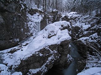
Walchenklamm |
||
| Data | ||
| Water code | AT : 2-6-25, DE : 1616 | |
| location | Tyrol , Austria and Bavaria , Germany | |
| River system | Danube | |
| Drain over | Isar → Danube → Black Sea | |
| source |
Achensee 47 ° 29 ′ 48 ″ N , 11 ° 42 ′ 29 ″ E |
|
| Source height | 929 m above sea level A. | |
| muzzle |
Sylvensteinsee (Isar) Coordinates: 47 ° 34 ′ 57 " N , 11 ° 34 ′ 38" E 47 ° 34 ′ 57 " N , 11 ° 34 ′ 38" E |
|
| Mouth height | 767 m above sea level NN | |
| Height difference | 162 m | |
| Bottom slope | 9.5 ‰ | |
| length | 17.1 km | |
| Catchment area | 233.38 km² | |
| Discharge at the Walchen A Eo gauge : 230 km² Location: 4.8 km above the mouth |
NNQ (11/27/1985) MNQ 1949–2006 MQ 1949–2006 Mq 1949–2006 MHQ 1949–2006 HHQ (08/23/2005) |
119 l / s 458 l / s 3.5 m³ / s 15.2 l / (s km²) 128 m³ / s 413 m³ / s |
| Left tributaries | Unteraubach, Blaserbach, Dollmannsbach, Taschbach, Hühnerbach | |
| Right tributaries | Ampelsbach, Klammbach , Pittenbach | |
The river from Achensee to Isar is called Seeache or Ache in Austria and Walchen in Germany . In Bavarian maps the name of the Tyrolean river section is indicated with Achenbach . The course of the river in the northern half of the Achental loops around the northeast corner of the Karwendel Mountains, separating it from the Mangfall Mountains . As a lake it is the natural outflow of the Achensee . It leaves the lake at the northern end and drains the northern Achental near Achenkirch . Since the construction of the Achensee power plant in the Inn Valley , however, a large part of the Achensee water has flowed into the Inn . Near the Kaiserwacht at the Achenpass , the river turns increasingly west. As Walchen he reaches the Isar through the Walchenklamm . The natural mouth has sunk in the Sylvenstein reservoir since the late 1950s .
The Ache is classified in water quality class II.
Individual evidence
- ↑ a b TIRIS - Tyrolean regional planning and information system
- ↑ Directory of creek and river areas in Bavaria - Isar river area, page 8 of the Bavarian State Office for the Environment, as of 2016 (PDF; 2.5 MB)
- ^ Deutsches Gewässerkundliches Jahrbuch Danube region 2006 Bavarian State Office for the Environment, p. 188, accessed on October 4, 2017, at: bestellen.bayern.de (PDF, German, 24.2 MB).
- ↑ according to the official Austrian map
-
↑
Email request to the authorities:
-
Ministry of Life, Department VII / 3 = Hydrographisches Zentralbüro (HZB): “In Austria, geographical names are the responsibility of the municipalities.
Despite intensive efforts, no uniform solution has yet been achieved. " - Federal Office for Metrology and Surveying (BEV), Department 14: “According to information from Mr. Pockstaller (Head of the Achenkirch municipal office), only the name Seeache is used locally. Therefore this name can also be found on our menu.
The hydrographic portal of the Federal Ministry of Agriculture and Forestry is not meaningful, because we used an earlier name there at some point and not updated later. "
-
Ministry of Life, Department VII / 3 = Hydrographisches Zentralbüro (HZB): “In Austria, geographical names are the responsibility of the municipalities.
- ↑ eHYD - the access to hydrographic data of Austria
- ↑ Archived copy ( memento of the original dated November 9, 2013 in the Internet Archive ) Info: The archive link was inserted automatically and has not yet been checked. Please check the original and archive link according to the instructions and then remove this notice.
- ↑ TK or DTK C 8734 case
- ↑ Federal Ministry of Agriculture, Forestry, Environment and Water Management (ed.): Saprobiological water quality of the flowing waters of Austria. As of 2005. ( PDF ( Memento of the original from December 22, 2015 in the Internet Archive ) Info: The archive link was inserted automatically and has not yet been checked. Please check the original and archive link according to the instructions and then remove this notice. )
