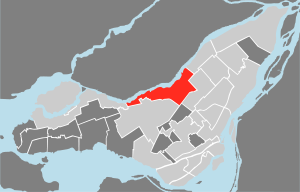
Ahuntsic-Cartierville
| Ahuntsic-Cartierville | |
|---|---|

|
|
| city | Montreal |
| surface | 24.2 km² |
| Residents | 126,891 (2011) |
| native language |
French : 53.7% English : 5.2% Other: 41.1% |
| Community number | REM23 |
| Website | Arrondissement |
Ahuntsic-Cartierville ( a.yn.ˈtsik / kartje.vil ) is one of 19 arrondissements of the city of Montreal in the Canadian province of Quebec . In 2011 the 24.2 km² district had 126,891 inhabitants.
geography
Ahuntsic-Cartierville is located in the center of the Île de Montréal along the banks of the Rivière des Prairies . The district also includes a few small islands in the river: Île aux Chats, Île Perry and Île de la Visitation . Neighboring arrondissements of the city of Montreal are Pierrefonds-Roxboro in the west, Saint-Laurent in the south, Villeray-Saint-Michel-Parc-Extension in the east and Montréal-Nord in the north. In addition, Ahuntsic-Cartierville borders in the southeast on the independent municipality of Mont-Royal .
history
In 1696 a settlement called Sault-au-Récollet was built on the river bank. It gained some importance as a trading post as barges had to be unloaded at this point to avoid a rapids. Until 1721, the Sulpizians operated the Notre-Dame-de-Lorette mission station here for the conversion of the natives. In 1751 the parish church Visitation de la Bienheureuse-Vierge-Marie was completed. In the course of the 19th century, other villages emerged in the area. In 1845 the self-governing district Sault-au-Récollet was founded, which brought together the various settlements.
The community area gradually shrank through several splits. It started in 1897 by Ahuntsic, which immediately received city status. The place name is reminiscent of a Huron of the same name , who is said to have been the first native inhabitant to be converted to Christianity around 1620. In 1898 the municipality of Saint-Joseph-de-Bordeaux was founded. It got its name from a realtor who came from the French city of Bordeaux . The community achieved city status in 1907 and shortened the name to Bordeaux.
In 1906 the Cartierville community, named after George-Étienne Cartier , was founded. Saraguay, located in the far west, separated from this in turn in 1914. The northern half of the remaining part of Sault-au-Récollet separated in 1910, resulting in the city of Montréal-Nord . In the same year Ahuntsic and Bordeaux were incorporated into Montreal, followed in 1916 by Cartierville and the southern half of Sault-au-Récollet. Saraguay remained independent until 1964. Today the Arrondissement Ahuntsic-Cartierville consists of the entire area of the former Sault-au-Récollet, with the exception of Montréal-Nord.
population
According to the 2011 census, Ahuntsic-Cartierville had 126,891 inhabitants, which corresponds to a population density of 5243 inhabitants / km². Of the respondents, 53.7% said French and 5.2% English were their mother tongue. Other important languages include Arabic (10.7%), Italian (5.3%), Spanish (4.3%), Greek (3.0%), Haitian (2.5%) and Armenian (2, 2%).
Attractions
- Visitation de la Bienheureuse-Vierge-Marie church
- Bois-de-Liesse Natural Park
- Île-de-la-Visitation Natural Park
Web links
- Website of the Arrondissement of Ahuntsic-Cartierville (French)
- History of Ahuntsic-Cartierville (French)
Individual evidence
- ↑ Ahuntsic. Commission de toponymie Québec, accessed September 2, 2011 (French).
- ↑ Bordeaux. Commission de toponymie Québec, accessed September 2, 2011 (French).
- ↑ Annuaire statistique de l'agglomération de Montréal, recensement de 2011. (PDF, 728 kB) City Council of Montreal, Statistics Canada, 2011, accessed on February 25, 2014 (French, Statistical Yearbook of the Agglomeration of Montreal 2011).
Coordinates: 45 ° 33 ′ 1 ″ N , 73 ° 40 ′ 15 ″ W.
