Alliance (Nebraska)
| Alliance | |
|---|---|
 Alliance (Nebraska) |
|
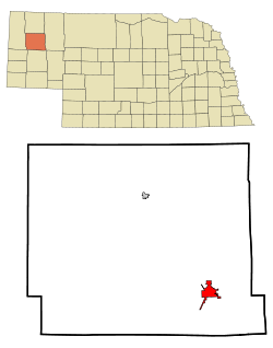
| Location in county and state | |
| Basic data | |
| Foundation : | 1888 |
| State : | United States |
| State : | Nebraska |
| County : | Box Butte County |
| Coordinates : | 42 ° 6 ′ N , 102 ° 53 ′ W |
| Time zone : | Mountain ( UTC − 7 / −6 ) |
| Residents : | 8,491 (as of 2010) |
| Population density : | 690.3 inhabitants per km 2 |
| Area : | 12.4 km 2 (about 5 mi 2 ) of which 12.3 km 2 (about 5 mi 2 ) are land |
| Height : | 1209 m |
| Postal code : | 69301 |
| Area code : | +1 308 |
| FIPS : | 31-00905 |
| GNIS ID : | 0834978 |
| Website : | www.cityofalliance.net |
| Mayor : | Dan Kusek |
Alliance (also Grand Lake ) is the county seat of Box Butte County in the US state of Nebraska .
history
Alliance was founded on 1888 in the Sandhills in newly created Box Butte County. In the course of the land grabbing, the small town "Grand Lake" was founded in 1887, but when the "Burlington and Missouri River Railroad" reached the region a year later, it was renamed "Alliance". Since animal husbandry was an important factor here from the beginning, the Nebraska Stock Growers Association was founded in 1889 to include a. Counteract problems with cattle theft. The city grew quickly. Just two years after it was founded, it had 890 residents. Although three fires between 1892 and 1893 destroyed parts of the city, the population rose to over 2,200 in 1896. In response to the fire, the fire brigade was founded and a water tower and a brick factory were built. In the election for the county seat, Alliance was able to prevail against Hemingford in 1899. From June 21 to July 5, 1899, the Box Butte County Courthouse was moved by rail from Hemingford to Alliance. Although the Homestead Act of 1862 originally granted only 160 acres of land to each “homesteader” , in 1904 this number was increased to 640 acres in the so-called Kincaid Act . This decision was made because the number of farmers in the region was decreasing due to the poor agricultural cultivation of the area. The measure is having an effect. The population rose further to 6,000 in 1920. Largely spared from the Great Depression , the city was able to benefit from the New Deal . A new water tower, a power plant and irrigation systems for the surrounding farmland were built in the 1930s. In 1942 the “Alliance Air Base” was established, which in 1953 became the property of the city as Alliance Municipal Airport . The next few decades were marked by slow but steady industrial growth. In particular, the Burlington Northern Railroad was expanded.
Demographics
| Population development | |||
|---|---|---|---|
| Census | Residents | ± in% | |
| 1890 | 829 | - | |
| 1900 | 2535 | 205.8% | |
| 1910 | 3105 | 22.5% | |
| 1920 | 4591 | 47.9% | |
| 1930 | 6669 | 45.3% | |
| 1940 | 6253 | -6.2% | |
| 1950 | 7891 | 26.2% | |
| 1960 | 7845 | -0.6% | |
| 1970 | 6862 | -12.5% | |
| 1980 | 9920 | 44.6% | |
| 1990 | 9765 | -1.6% | |
| 2000 | 8959 | -8.3% | |
| 2010 | 8491 | -5.2% | |
According to the United States Census 2000 , Alliance has 8,959 residents, of whom 4,352 are men and 4,567 are women.
sons and daughters of the town
- James Emanuel (1921–2013), university professor, essayist and poet
Attractions
- Carhenge is nearby . A visitor center has existed since 2006.
Individual evidence
- ↑ Fitzpatrick, Lilian L. Nebraska Place-Names. 1960. Edited by G. Thomas Fairclough and includes selections from "The Origin of the Place-Names of Nebraska" by JT Link. Lincoln, NE: University of Nebraska Press, 1964. 227 pages. p20
- ↑ Page no longer available , search in web archives:

