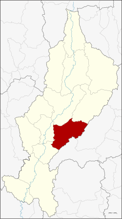
Amphoe Mae Tha (Lampang)
|
Mae Tha แม่ทะ |
|
|---|---|
| Province: | Lampang |
| Surface: | 810.5 km² |
| Residents: | 59,991 (2013) |
| Population density : | 77.8 U / km² |
| ZIP : | 52150, 52220 |
| Geocode : | 5210 |
| map | |

|
|

Amphoe Mae Tha ( Thai อำเภอ แม่ทะ , pronunciation: ʔāmpʰɤ̄ː mɛ̂ː tʰáʔ ) is a district ( Amphoe - administrative district) in the eastern part of Lampang Province . The Lampang Province is located in the northern region of Thailand .
geography
Neighboring districts are (from the south clockwise) Amphoe Sop Prap , Ko Kha , Mueang Lampang and Mae Mo of Lampang province and Long and Wang Chin of Phrae province .
history
Mae Tha is of archaeological interest due to the discovery of processed river pebbles that are around 700,000 years old. Homo erectus bones from this period have not yet been discovered.
administration
Provincial Administration
Mae Tha County is divided into ten tambon ("subdistricts" or "parishes"), which are further subdivided into 95 muban ("villages").
| No. | Surname | Thai | Muban | Pop. |
|---|---|---|---|---|
| 1. | Mae Tha | แม่ทะ | 10 | 6,944 |
| 2. | Well Khrua | นา ครัว | 12 | 10,218 |
| 3. | Pa Tan | ป่า ตัน | 9 | 6,275 |
| 4th | Ban Kio | บ้าน กิ่ว | 10 | 4,499 |
| 5. | Ban Bom | บ้าน บ อม | 6th | 2,703 |
| 6th | Nam Cho | น้ำ โจ้ | 10 | 10,052 |
| 7th | Don Fai | ดอน ไฟ | 8th | 4,286 |
| 8th. | Hua Suea | หัว เสือ | 12 | 6,527 |
| 10. | Wang Ngoen | วัง เงิน | 9 | 3.714 |
| 11. | San Don Kaeo | สันดอน แก้ว | 9 | 4,773 |
Local administration
There are five municipalities with "small town" status ( Thesaban Tambon ) in the district:
- Na Khrua (Thai: เทศบาล ตำบล นา ครัว ) consisting of parts of the Tambon Na Khrua.
- Pa Tan Na Khrua (Thai: เทศบาล ตำบล ป่า ตัน นา ครัว ) consisting of the complete Tambon Pa Tan and parts of Tambon Na Khrua.
- Siri Rat (Thai: เทศบาล ตำบล สิริ ราช ) consisting of the complete Tambon San Don Kaeo.
- Mae Tha (Thai: เทศบาล ตำบล แม่ทะ ) consisting of the complete tambon Mae Tha.
- Nam Cho (Thai: เทศบาล ตำบล น้ำ โจ้ ) consisting of the complete Tambon Nam Cho.
There are also five " tambon administration organizations " ( องค์การ บริหาร ส่วน ตำบล - Tambon Administrative Organizations, TAO)
- Ban Kio (Thai: องค์การ บริหาร ส่วน ตำบล บ้าน กิ่ว ) consisting of the complete tambon Ban Kio.
- Ban Bom (Thai: องค์การ บริหาร ส่วน ตำบล บ้าน บ อม ) consisting of the complete tambon Ban Bom.
- Don Fai (Thai: องค์การ บริหาร ส่วน ตำบล ดอน ไฟ ) consisting of the complete tambon Don Fai.
- Hua Suea (Thai: องค์การ บริหาร ส่วน ตำบล หัว เสือ ) consisting of the complete Tambon Hua Suea.
- Wang Ngoen (Thai: องค์การ บริหาร ส่วน ตำบล วัง เงิน ) consisting of the complete tambon Wang Ngoen.
Individual evidence
- ^ Higham and Thosarat (1998), p. 23
- ^ GG Pope, S. Barr, A. Macdonald and S. Nakabanlang: "Earliest radiometrically dated artifacts from Southeast Asia". Current Anthropology, 27, 275-278 (1986).
- ↑ 2013 population statistics ( Thai ) Department of Provincial Administration. Retrieved October 27, 2014.
literature
- Charles Higham and Rachanie Thosarat: Prehistoric Thailand: from early settlement to Sukhothai . Bangkok: River Books (1998). ISBN 974-8225-30-5 .
Web links
Coordinates: 18 ° 8 ' N , 99 ° 31' E

