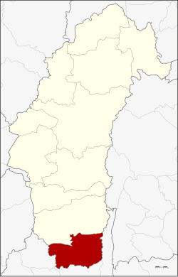
Si Thep district
|
Si Thep ศรีเทพ |
|
|---|---|
| Province: | Phetchabun |
| Surface: | 810 km² |
| Residents: | 70,454 (2013) |
| Population density : | 78.1 U / km² |
| ZIP : | 67170 |
| Geocode : | 6706 |
| map | |

|
|
Amphoe Si Thep ( Thai : อำเภอ ศรีเทพ ; phonetic: District Sri Thep ) is a district ( Amphoe - administrative district) in the province of Phetchabun . Phetchabun Province is located in the southeastern part of the northern region of Thailand .
geography
The southernmost district of Phetchabun Province is located in the valley of the Mae Nam Pa Sak (Pa-Sak River) .
Neighboring districts are (clockwise from north): Amphoe Wichian Buri (Phetchabun Province) and Amphoe Lam Sonthi , Amphoe Chai Badan and Amphoe Khok Charoen of Lop Buri Province .
history
The Si Thep area was already populated in prehistoric times. During excavations in 1988 a large settlement from the late Iron Age with five graves at a depth of four meters was found, surrounded by a ditch . In the completely preserved grave of a woman with her head facing east, a bronze clasp and a 50 cm long pointed iron tool were found. A carnelian bead lay in the neck area .
In the 6th or 7th century a certain Bhavavarman ruled a community of the Zhenla ( Chenla ) culture, who had a temple built for Shiva . At the same time there are references to the practice of Buddhism in the mountains of Thamorat, where images were found in a cave. The historical city of Si Thep was built in the Khmer Empire and was probably an important town as early as the 7th and 8th centuries, which is due to the mountain ranges that run through the north-south. The historian Prince Damrong Rajanubhab found the ruins of the city when he visited Monthon Phetchabun in 1905 as part of the thesaphiban administrative reform of King Chulalongkorn (Rama V) . Today the area is the Si Thep Historical Park .
The Si Thep district was established on December 13, 1970 as a "branch circle" ( King Amphoe ) from parts of the Wichian Buri district . It got full amphoe status on August 8, 1976.
administration
Provincial Administration
The district of Si Thep is divided into seven tambon ("sub-districts" or "municipalities"), which are further subdivided into 105 muban ("villages").
| No. | Surname | Thai | Muban | Pop. |
|---|---|---|---|---|
| 1. | Si Thep | ศรีเทพ | 16 | 10,617 |
| 2. | Sa Kruat | สระ กรวด | 17th | 15.173 |
| 3. | Khlong Krachang | คลอง กระจัง | 18th | 13,861 |
| 4th | Well, Sanun | นา สนุ่น | 21st | 11,460 |
| 5. | Khok Sa-at | โคก สะอาด | 13 | 6,710 |
| 6th | Nong Yang Thoi | หนอง ย่าง ทอย | 13 | 9,667 |
| 7th | Pradu Ngam | ประดู่ งาม | 8th | 2,966 |
Local administration
There are two municipalities with "small town" status ( Thesaban Tambon ) in the district:
- Sawang Watthana (Thai: เทศบาล ตำบล สว่าง วัฒนา ) consisting of parts of the Tambon Sa Kruat.
- Khok Sa-at (Thai: เทศบาล ตำบล โคก สะอาด ) consisting of the complete tambon Khok Sa-at.
In addition, there are six " tambon administration organizations " ( องค์การ บริหาร ส่วน ตำบล - Tambon Administrative Organizations, TAO)
- Si Thep (Thai: องค์การ บริหาร ส่วน ตำบล ศรีเทพ ) consisting of the complete tambon Si Thep.
- Sa Kruat (Thai: องค์การ บริหาร ส่วน ตำบล สระ กรวด ) consisting of parts of the tambon Sa Kruat.
- Khlong Krachang (Thai: องค์การ บริหาร ส่วน ตำบล คลอง กระจัง ) consisting of the complete Tambon Khlong Krachang.
- Na Sanun (Thai: องค์การ บริหารส่วน ตำบล นา สนุ่น ) consisting of the complete Tambon Na Sanun.
- Nong Yang Thoi (Thai: องค์การ บริหาร ส่วน ตำบล หนอง ย่าง ทอย ) consisting of the complete tambon Nong Yang Thoi.
- Pradu Ngam (Thai: องค์การ บริหาร ส่วน ตำบล ประดู่ งาม ) consisting of the complete tambon Pradu Ngam.
Individual evidence
- ^ Higham and Thosarat (1998), p. 145
- ↑ Woodward (2005), p. 1 f.
- ↑ 2013 population statistics ( Thai ) Department of Provincial Administration. Retrieved November 2, 2014.
literature
- Charles Higham and Rachanie Thosarat: Prehistoric Thailand: from early settlements to Sukhothai . Bangkok: River Books 1998. ISBN 9748225305 .
- Hiram Woodward: The Art and Architecture of Thailand: from prehistoric times to the thirteenth century . 2. A. Leiden: Brill 2005. ISBN 9004144404 .
Web links
- More information about Amphoe Si Thep from amphoe.com (in Thai). Retrieved November 18, 2019
Coordinates: 15 ° 27 ' N , 101 ° 4' E