Anabar Plateau
| Anabar Plateau
Анабарское плато
|
||
|---|---|---|
| Highest peak | nameless mountain ( 905 m ) | |
| location | Krasnoyarsk region , Siberia , Russia | |
| part of | Central Siberian mountain country | |
|
|
||
| Coordinates | 70 ° 0 ′ N , 108 ° 0 ′ E | |
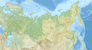
The Anabar Plateau ( Russian Анабарское плато ) is a mountain range in the north of the Central Siberian mountainous region, up to 905 m high . It spreads in the northeast of the Krasnoyarsk Territory and in the northwest of the Sakha Republic (Yakutia) in the northern part of Siberia and Russia ( Asia ).
geography
location
The Anabar Plateau lies on average just under 400 km north of the Arctic Circle and is located south-southeast of the Taimyr Depression , the central part of the North Siberian lowlands . It forms the extreme north of the Central Siberian mountainous country, the landscape of which merges west of the plateau to the Putorana Mountains and drops to the north-northeast into the Popigai crater .
Rivers
The larger rivers of the Anabar Plateau, which have mostly dug deep into the rocky landscape, include the Great Kuonamka as the source of the eponymous and northeast flowing Anabar , the Kotui with its tributary Kotuikan in the west and the Popigai in the north; the river basin of the Olenjok lies somewhat to the east of the plateau and beyond that that of the Lena .
Localities
There are only a few settlements on the Anabar Plateau; however, the village of Popigai lies to the east on the Popigai River and the village of Chatanga to the north on the Chatanga River .
Geology and flora
From a geological point of view, the Anabar Plateau is interspersed with crystalline granites and slates and metamorphic rocks such as gneisses . The vegetation in the high areas consists mainly of mosses and lichens from the tundra and in the area of the boreal coniferous forest ( taiga ) to the south of it consists of sparse larch forests , the trees of which thrive sparsely up to a maximum of 450 m .
climate
The climate on the Anabar Plateau is harsh , because in winter the thermometer drops to an average of −40 ° C and in summer the average temperature in the lower plateau areas is around 12 ° C. The waters are in the cold season, low runoff of ice covered. If, in the short summer, the permafrost soil thaws more and more as a result of climate change and ice and snow melt, strong floods often occur, especially in the first few weeks of the ice and snow melt .
Individual references and sources
- ↑ Анабар.RU , website about Anabar and Anabar Plateau, on anabar.ru (Russian)
- ↑ a b Temperature information according to the article Altopiano dell'Anabar from Italian Wikipedia (accessed on November 22, 2011)
