Andritsena-Krestena
|
Municipality of Andritsena-Krestena Δήμος Ανδριτσαίνας-Κρεστένων (Ανδρίτσαινα-Κρέστενα) |
||
|---|---|---|
|
|
||
| Basic data | ||
| State : |
|
|
| Region : | West Greece | |
| Regional District : | Elis | |
| Geographic coordinates : | 37 ° 34 ′ N , 21 ° 47 ′ E | |
| Area : | 422.334 km² | |
| Residents : | 14,109 (2011) | |
| Population density : | 33.4 inhabitants / km² | |
| Seat: | Krestena | |
| LAU-1 code no .: | 3904 | |
| Districts : | 3 municipal districts | |
| Local self-government : |
1 city district 31 local communities |
|
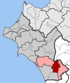
| Location in the region of Western Greece | ||
Andritsena-Krestena ( Greek Ανδρίτσαινα-Κρέστενα ) is a municipality on the Peloponnese peninsula in the south of the Greek region of western Greece . The administrative seat of the municipality is Krestena.
location
The municipality of Andritsena-Krestena is located in the west of the Peloponnese peninsula on the border between western Greece and the Peloponnese region . Neighboring communities are Pyrgos and Archea Olymbia in the north. Gortynia and Megalopoli in the northeast and east and Ichalia in the southwest belong to the Peloponnese region. Zacharo is to the southwest.
The municipality extends from the Gulf of Kyparissia in the west to the Lykeo in the south. The Alfios forms from the southeast to the north the natural border with the neighboring communities.
Administrative division
The municipality was formed after the administrative reform in 2010 from the merger of the former municipalities of Skillounda , Alifira and Andritsena . The administrative seat of the municipality is Krestena. The former municipalities have since formed municipal districts. The municipality is further subdivided into the municipality of Krestena and 31 local communities.
| Parish | Greek name | code | Area (km²) | Residents 2011 | City districts / local communities (Δημοτική / Τοπική Κοινότητα) |
location |
|---|---|---|---|---|---|---|
| Skillounda | Δημοτική Ενότητα Σκιλλούντος | 390401 | 194,409 | 10.303 | Krestena, Vrina, Grekas, Gryllos, Diasella, Kallikomo, Kalyvakia, Kato Samiko, Makrisia, Platiana, Ploutochori, Raches, Samiko, Skilloundia, Trypiti, Frixa | |
| Alifira | Δημοτική Ενότητα Αλιφείρας | 390402 | 96.678 | 2.008 | Alifira, Amygdalees, Vresto, Kallithea, Livadaki, Myronia | |
| Andritsena | Δημοτική Ενότητα Ανδριτσαίνης | 390403 | 131.247 | 1,798 | Andritsena, Dafnoula, Dragogi, Thisoa, Koufopoulo, Linistena, Matesi, Rovia, Sekoulas, Fanari | |
| total | 3904 | 422,334 | 14,109 | |||
Individual evidence
- ↑ Results of the 2011 census at the National Statistical Service of Greece (ΕΛ.ΣΤΑΤ) (Excel document, 2.6 MB)
- ↑ Law 3852/2010, «Νέα Αρχιτεκτονική της Αυτοδιοίκησης και της Αποκεντρωμένης Διοίκησης - Πρόγραμμα Καλης. ΦΕΚ 87 A / 7.6.2010, Άρθρο 1. Σύσταση δήμων. P. 1788. PDF Online (Greek)


