Archaeological landscape of the Sassanids in the Fars region
| Archaeological landscape of the Sassanids in the Fars region | |
|---|---|
|
UNESCO world heritage |
|
| National territory: |
|
| Type: | Culture |
| Criteria : | ii, iii, iv |
| Surface: | 639 ha |
| Buffer zone: | 12,715 ha |
| Reference No .: | 1568 |
| UNESCO region : | Asia and Pacific |
| History of enrollment | |
| Enrollment: | 2018 ( session 42 ) |
Under the name Archaeological Landscape of the Sassanids in the Fars Region , UNESCO has summarized a number of archaeological monuments in the southeast of the Iranian province of Fars , which are registered on the UNESCO World Heritage List. These are structural remains of the Sassanid Empire from the 3rd to the 7th century AD.
background
The Sassanids were a Persian royal dynasty, whose name is derived from the alleged progenitor Sassan . The first historically tangible ruler of the family was Ardaschir I , originally sub-king in the Persis region , which, like large parts of the Middle East, belonged to the Parthian Empire . In the 220s AD, Ardaschir succeeded in subjugating the entire Parthian territory from Persis in a very short time. The great empire he founded essentially extended from Mesopotamia in the west to today's Pakistan in the east (at the time of its greatest expansion, it extended significantly further in the west, to Asia Minor and Egypt ).
The center of the empire was formed in what is now the Iranian province of Fars, from which the Sassanids originally came. The residential city of Ardaschir, Firuzābād , as well as that of his son and successor Shapur I , Bishapur , today form the main part of the UNESCO World Heritage Site "Archaeological Landscape of the Sassanids in the Fars Region". In addition to the two sites themselves, which are remarkable in terms of urban planning, the fortress and palace complexes of the two rulers as well as some of the characteristic Sassanid rock reliefs have been preserved there. This art form reached its heyday in the period in question and developed into an essential element of Sassanid rulers' propaganda. In religious terms, Zoroastrianism was decisive in the Sassanid epoch , which is reflected in the archaeological findings through fire temples .
registration
The eight archaeological sites of the "Archaeological Landscape of the Sassanids in the Fars Region" were inscribed on the list of UNESCO World Heritage Sites on June 30, 2018 as part of the 42nd meeting of the World Heritage Committee . The relevant application was submitted in 2017 by the Organization for Cultural Heritage, Crafts and Tourism , a government agency of the Iranian state. Iran had already entered the archaeological findings around the city of Firuzābād on the list of proposals for the UNESCO World Heritage Site in 1997.
In its decision, the World Heritage Committee considered points (ii), (iii) and (iv) of the catalog of criteria for the list of world cultural heritage to be fulfilled. The three criteria relate to (ii) the exchange of different cultures expressed in the protected cultural property, (iii) the outstanding representativeness of a (in this case architectural) cultural tradition and (iv) special forms of use of natural resources and the Interaction between humans and the environment. The UNESCO website provides a summary of the "Archaeological Landscape of the Sassanids in the Fars Region":
"The archaeological landscape reflects the optimized utilization of natural topography and bears witness to the influence of Achaemenid and Parthian cultural traditions and of Roman art, which had a significant impact on the architecture of the Islamic era."
"The archaeological landscape reflects the optimized use of the natural environment and testifies to the cultural influence of Achaemenid and Parthian traditions as well as Roman art , which had a decisive influence on the architecture of the Islamic era."
Archaeological sites
The archaeological sites, which were jointly included in the UNESCO World Heritage Site, are located in the vicinity of three cities in the province of Fars, Firuzābād , Bischapur and Sarvestan .
| Archaeological site | image | location | description |
|---|---|---|---|
| Ghal'eh Dokhtar |

|
Firuzabad 28 ° 55 '15 " N , 52 ° 31' 48" O |
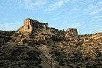
Strongly fortified, representative palace of the first Sassanid ruler Ardaschir I, built in his early reign, before the victory over the Parthian Empire, on a steep rock near his new capital Ardeschir Chure (see below). |
| Relief with the investiture of Ardashir I. |

|
Firuzabad 28 ° 55 '0 " N , 52 ° 32' 15" O |
Rock relief near the Ghal'eh Dokhtar, separated from it by a river. Shown is the coronation of Ardaschir I by the Zoroastrian creator god Ahura Mazda (detailed illustration above in the chapter "Background" ). |
| Victory relief of Ardashir I. |

|
Firuzabad 28 ° 54 '36 " N , 52 ° 32' 27" O |
Largest of the Sassanid rock reliefs, also created under Ardaschir I and located between Ghal'eh Dokhtar and the second residence of the ruler. It shows the king's victory over the last Parthian ruler Artabanos IV. |
| Ardeschir Chure (now Firuzābād ) |

|
Firuzabad 28 ° 51 ' N , 52 ° 32' O |
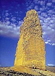
The circular residence city of the founder of the empire Ardaschir I, also known as Gur . Twenty streets led into the center of the city, where there was a representative palace or government building, of which only a tower-like building known as the Minar has survived today. |
| Palace of Ardashir I. |

|
Firuzabad 28 ° 53 '53 " N , 52 ° 32' 21" O |
Second residence of Ardaschir I, eight kilometers from Ardeschir Chure and, unlike the Ghal'eh Dokhtar, designed more for a representative effect than for easy defense. The facility consisted of an entrance hall and two adjoining halls, each covered with a dome. The complex also had a tile-lined pond that was fed by a natural spring. |
| Bishapur |

|
Bischapur 29 ° 47 ' N , 51 ° 34' E |
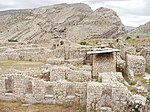
Residence city of the second Sassanid ruler Shapur I, which was laid out in a checkerboard pattern based on the Greco-Roman model. In the immediate vicinity there are the remains of a representative palace complex as well as a total of six rock reliefs from the 3rd and 4th centuries, which glorify Shapur and his successors. |
| Schapur Cave |

|
Bischapur 29 ° 48 ′ 25 ″ N , 51 ° 36 ′ 47 ″ E |
Cave in the mountains northeast of the royal seat of Bishapur, in which the eight meter high colossal statue of Shapur I was located, which was carved out of a stalagmite. Possibly it is the tomb of this king. |
| Sarvestan Palace |

|
Sarvestan 29 ° 11 ′ 44 " N , 53 ° 13 ′ 52" E |
Mud brick ruins south of today's city of Sarvestan, which are interpreted as a palace complex or as a fire temple from Sassanid times and dated to the 7th century, i.e. the late phase of Sassanid architecture. |
Web links
- Archaeological landscape of the Sassanids in the Fars region on the UNESCO World Heritage Center website ( English and French ).
Individual evidence
- ↑ Four sites added to UNESCO's World Heritage List. Communication from the UNESCO World Heritage Center dated June 30, 2018, accessed on December 23, 2018.
- ↑ Documents for the nomination of the Archaeological Landscape of the Sassanids in the Fars Region for UNESCO World Heritage Site. UNESCO World Heritage Center website, accessed December 24, 2018.
- ^ Firuzabad Ensemble. UNESCO World Heritage Center website, accessed December 23, 2018.
- ↑ Decision 42 COM 8B.21: Sassanid Archaeological Landscape of Fars Region (Islamic Republic of Iran). UNESCO World Heritage Center website, accessed December 24, 2018.
- ^ Entry on the archaeological landscape of the Sassanids in the Fars region. UNESCO World Heritage Center website, accessed December 23, 2018.

