
Hyrcanic forest
- Not to be confused with the Herkynian Forest
| Hyrcanic forests | |
|---|---|
|
UNESCO world heritage |
|
_4.jpg)
|
|
| Hyrcanic rainforest in Gilan Province , Iran |
|
| National territory: |
|
| Type: | nature |
| Criteria : | (ix) |
| Surface: | 129,484.74 ha |
| Buffer zone: | 177,128.79 ha |
| Reference No .: | 1584 |
| UNESCO region : | Asia and Pacific |
| History of enrollment | |
| Enrollment: | 2019 ( session 43 ) |
The Hyrcanic Forest is a mountain forest protruding from a lowland near the southern coast of the Caspian Sea in Azerbaijan and Iran . It extends over an area of 55,000 square kilometers. Part of the Iranian portion of Hyrcanian forest was in the 2019 World Heritage of UNESCO added.
Word origin

Hyrcania was the ancient Greek name for Varkāna ("land of wolves") in ancient Persian .
location

This ecosystem is located in the ancient landscape of Hyrcania on the southern Caspian Sea . In the southeast of Azerbaijan and includes the Lenkoran Lowlands and the Talysh Mountains . In Iran it stretches along the coast of the Caspian Sea, as well as the northern slopes of the Elburs Mountains ; there the forest area is 30,400 km² and thus has most of the forest. In the southern part it goes over into the Elburs steppe forest region at greater heights .
The climate of the ecoregion is humid subtropical , oceanic in higher and northern locations and humid continental in the mountains . The annual rainfall is between 900 mm in the north to 2900 mm in the south, which makes this ecosystem considerably more saturated than the desert regions , semi- desert regions and steppes in its border areas. The southern areas meet the requirements for a rainforest of temperate latitudes of 2000 mm of precipitation per year.
flora
.JPG)


The coastal plains of the Caspian Sea were once covered by black alder forests ( Alnus glutinosa ). The rivers in the coastal plain were bordered by the silver poplar ( Populus alba ), the Caucasian wingnut ( Pterocarya fraxinifolia ) and the Caucasian alder ( Alnus subcordata ), but the areas are now almost completely built over or are used for agriculture. In the lower heights of the Talysh and Elbursgebirge there are different forests with ironwood ( Parrotia persica ), the Caucasian zelkove ( Zelkova carpinifolia ), the silk tree ( Albizia julibrissin ) and ebony ( Diospyros lotus ) as well as with holly ( Ilex hyrcana ), butcher's broom Ruscus hyrcanus ) and bindweed ( Smilax excelsa ). The iron timber is for the Talysh Mountains and Northern Iran endemic , wherein there may be a considerable density of tree stands. Lichen-covered branches have grown together here and only dead leaves can be found in the deep shadow of the forest floor. In autumn the yellow leaves of the ironwood tree turn a delicate lilac color . In the extreme east of the Elburs Mountains (Golestan) oak and maple trees dominate, with beech trees to the west (Gilan) being more common. In the Hyrkanian forests there is hardly any dead wood, as the dead wood rots quickly due to the warm and humid climate.
The middle heights are dominated by the oriental beech ( Fagus orientalis ), oak ( Quercus spp.), Hornbeam ( Carpinus spp.), And sweet chestnut ( Castanea sativa ). In this beech forest level there are larger, inaccessible primeval forests of a virgin quality that is unique in the northern hemisphere, i.e. in an almost untouched condition (even without any historical influence from earlier cultures). This and the fact that these Hyrkanian forests were largely spared from the icing of the northern hemisphere during the Ice Age, give them the quality status of a so-called “hot spot” today. In the international biodiversity discussion, this means the concentration of so-called endemic species that only occur in one place and nowhere else, i.e. represent an irretrievable gene pool.
The higher mountain and sub-alpine zones are characterized by steppes , macchia and the Persian oak . Alpine tundra and pastures are in the highest elevations.
fauna
The Caspian tiger ( Panthera tigris virgata ), now extinct, once lived here . Other larger mammals that still exist today are the Persian leopard ( Panthera pardus saxicolor = ciscaucasica ), the Eurasian lynx ( Lynx lynx ), the brown bear ( Ursus arctos ), the wild boar ( Sus scrofa ), the wolf ( Canis lupus ), the golden jackal ( Canis aureus ), the reed cat ( Felis chaus ), the Transcaucasian badger ( Meles canescens ), the red deer and the otter ( Lutra lutra ). Even in the Middle Ages the mountain wisent lived there . The ecological area is also an important resting place for migratory birds between Russia and Africa and forms a key habitat for many bird species . The prominent animal species include the gray goose ( Anser anser ), the white-fronted goose ( Anser albifrons ), the little bustard ( Tetrax tetrax ), the brown ibis ( Plegadis falcinellus ), the spoonbill ( Platalea leucorodia ), the night heron ( Nycticorax nycticorax ), the red-necked goose ( Branta ruficollis ), the peregrine falcon ( Falco peregrinus ), the Dalmatian pelican ( Pelecanus crispus ), the cattle egret ( Bubulcus ibis ), the black heron ( Ardeola ralloides ), the greater flamingo ( Phoenicopterus roseus ) and the white-headed duck ( Oxyura ) leu .

brown bear

Persian leopard

Eurasian lynx

wolf
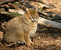
Pipe cat

Otter

Dalmatian pelican

Greater Flamingo


Nature reserves
Nature reserves in Azerbaijan
- Gizil-Agach State Reserve - 88.4 km²
- Hirkan National Park - 427.97 km²
- Zuvand National Park - 15 km²
Nature reserves in Iran
- Golestan National Park - 918.9 km²
- Jahannama Conservation Area - 384 km²
- Alborz nature reserve - 134 km²
- Lisar Nature Reserve - 352,044 km²
- Siah Keshim Conservation Area - 416 km²
- Dodangeh nature reserve
- Miankaleh Conservation Area - 376 km²
- Selkeh nature reserve
- Dashtenaz nature reserve - 56 km²
- Findiqliq National Park - 24 km²
- Gasht-Rodkan Nature Reserve - 574 km²
- Javaherdasht nature reserve - 266 km²
- Beles Cow Nature Reserve - 135 km²
- Vaz nature reserve - 152 km²
- Do Dangeh and Boola Conservation Area - 430 km²
World natural heritage
An area of seven percent of the Hyrcanic forest in Iran was included in the list of World Heritage Sites by UNESCO in 2019 under the title "Hyrcanic Forests" as a World Heritage Site. UNESCO cites high biodiversity as the reason for inclusion as advertising. Due to its relatively strong isolation, the region is home to a large number of animal and plant species that are only found there, threatened or already extinct elsewhere.
The world heritage site comprises 15 areas, which are spread over three provinces. According to UNESCO, these regions are representative of the different characteristics of the Hyrcanic region and the Hyrcanic forest ecosystem. The 15 areas are as follows:
![]() Map with all coordinates of the world heritage components: OSM
Map with all coordinates of the world heritage components: OSM
| ID | Name and place | Country (province) | Coordinates | surface | Buffer zone |
|---|---|---|---|---|---|
| 1584-001 | Golestan (North) | Iran ( Golestan ) | 37 ° 25 ′ 17 ″ N , 55 ° 43 ′ 27 ″ E | 17,873.18 ha | 64,300.77 hectares |
| 1584-002 | Golestan (South) | Iran (Golestan) | 37 ° 20 '26 " N , 55 ° 43' 32" E | 10,658.08 ha | |
| 1584-003 | Abr (east) | Iran (Golestan) | 36 ° 48 ′ 45 " N , 54 ° 56 ′ 42" E | 6,672.52 ha | 23,323.35 hectares |
| 1584-004 | Abr (west) | Iran (Golestan) | 36 ° 48 ′ 57 ″ N , 55 ° 6 ′ 3 ″ E | 10,991.08 ha | |
| 1584-005 | Jahan Nama | Iran (Golestan) | 36 ° 39 ′ 55 ″ N , 54 ° 24 ′ 6 ″ E | 11,339.73 hectares | 26,862.83 hectares |
| 1584-006 | Boola | Iran ( Mazandaran ) | 36 ° 5 ′ 56 " N , 53 ° 23 ′ 38" E | 17,516.47 ha | 12,344.21 ha |
| 1584-007 | Alimestan | Iran (Mazandaran) | 36 ° 10 ′ 25 " N , 52 ° 24 ′ 14" E | 394.30 ha | 845.98 ha |
| 1584-008 | Vaz (East) | Iran (Mazandaran) | 36 ° 16 ′ 45 " N , 52 ° 7 ′ 30" E | 2,218.16 hectares | 3,720.15 hectares |
| 1584-009 | Vaz (West) | Iran (Mazandaran) | 36 ° 18 '27 " N , 52 ° 3' 40" E | 4,692.37 hectares | |
| 1584-010 | Kojoor | Iran (Mazandaran) | 36 ° 32 ′ 46 " N , 51 ° 40 ′ 4" E | 14,891.80 ha | 9,628.50 ha |
| 1584-011 | Chahar-Bagh | Iran (Mazandaran) | 36 ° 15 ′ 31 ″ N , 51 ° 13 ′ 2 ″ E | 6,886.44 hectares | 2,663.80 ha |
| 1584-012 | Khoshk-e-Daran | Iran (Mazandaran) | 36 ° 43 '38 " N , 51 ° 3' 50" E | 214.47 ha | 39.08 ha |
| 1584-013 | Siahroud-e-Roudbar | Iran ( Gilan ) | 36 ° 53 ′ 59 " N , 49 ° 40 ′ 19" E | 11,197.40 hectares | 15,897.40 hectares |
| 1584-014 | Guest Roudkhan | Iran (Gilan) | 37 ° 3 '56 " N , 49 ° 9' 10" E | 10,541.13 ha | 16,015.37 hectares |
| 1584-015 | Lisar | Iran (Gilan) | 37 ° 56 ′ 8 ″ N , 48 ° 49 ′ 56 ″ E | 3,397.61 ha | 1,487.35 hectares |
Web links
- Articles on World Wildlife (English)
- Article in Livy of Hyrcania
Individual evidence
- ↑ a b c Caspian Hyrcanian mixed forests (PA0407) . World Wildlife Fund. Retrieved January 7, 2011.
- ↑ Ornamental plants from Azerbaijan . Missouri Botanical Garden. Retrieved January 7, 2011.
- ↑ Wilhelm Bode and HD Knapp (eds.): Protection of biological diversity and integrated management of the Caspian forests (Northern Iran). [bilingual German / Farsi]. Federal Agency for Nature Conservation, Bonn-Bad Godesberg 2005, ISBN 3-7843-3912-3 (Nature Conservation and Biological Diversity; 12)
- ↑ VG Heptner, AA and AG Bannikov Nasimovich: Mammals of the Soviet Union (Mlekopitayushchie Sovetskogo Soyuza) English edition. Volume 1: Artiodactyla and Perissodactyla. Smithsonian Institution Libraries and The National Science Foundation, Washington, DC 1988 (translated for the Smithsonian Institution by PM Rao, first published by Vysshaya Shkola Publishers Moscow, 1961), pp. 557-599
- ^ A b Hyrcanian Forests: Multiple locations (15). UNESCO website, accessed June 7, 2019 .

Cultural heritage: Chogha Zanbil (1979) | Persepolis (1979) | Meidan-e Emam, Isfahan (1979) | Tacht-i Suleiman (2003) | Pasargadae (2004) | Bam and its cultural landscape (2004) | Soltaniye (2005) | Bisotun (2006) | Armenian monasteries in Iran : St. Thaddeus Monastery , Monastery St. Stephanos and Chapel of Dzordzor (2008) | Historical hydraulic system from Shushar (2009) | Ensemble Sheikh Safi al-din Khānegāh and shrine in Ardabil (2010) | Historical bazaar complex of Tabriz (2010) | The Persian Garden (2011) | Isfahan Friday Mosque (2012) | Gonbad-e Qaboos (2012) | Golestan Palace (2013) | Shahr-I Sokhta (2014) | Maymand Cultural Landscape (2015) | Susa (2015) | The Persian Qanats (2016) | Historic city of Yazd (2017) | Archaeological Landscape of the Sassanids in the Fars Region (2018)
Natural heritage: Lut Desert (2016) | Hyrcanic Forests (2019)