Arrés
| Municipality of Bailo: Arrés | ||
|---|---|---|

|
||
| coat of arms | Map of Spain | |
 Help on coat of arms |
|
|
| Basic data | ||
| Autonomous Community : | Aragon | |
| Province : | Huesca | |
| Comarca : | Jacetania | |
| Coordinates | 42 ° 33 ′ N , 0 ° 50 ′ W | |
| Residents : | 36 (2015) INE | |
| Postal code : | 22751 | |
| Area code: | 22044000300 | |
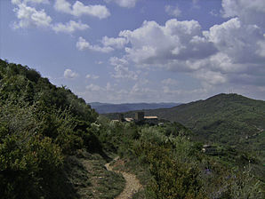
Arrés is a Spanish town in the foothills of the Pyrenees on the edge of the Camino de Santiago . It is located in the Comarca Jacetania in the province of Huesca in the autonomous community of Aragon . It belongs to the municipality ( municipio ) Bailo .
Geography and history
Arrés is like most villages in the valley , the Canal de Berdún is called, on a hill and is designed as a fortified village. The church is dedicated to St. Colomba.
It is first mentioned in 850 in the chronicle of the monastery of San Juan de la Peña . A document dated May 15, 1090 reports the exchange of some properties between the monastery and King Sancho Ramírez , including Arrés. It changed hands frequently. Another change is known for 1294: from Artal de Alagón it passed to King Jaime II of Aragón , at the end of the 15th century it finally belonged to the Señorío de Rueda. The never-so-large town had three households in the 16th century.
During the 1990s, volunteers rebuilt the former village school teacher's house and set up a pilgrims' hostel there. The constant flow of pilgrims since the hostel opened seems to have helped the place to revitalize itself: in the meantime, other houses have also been made habitable again.
Web links
← Previous location: Puente la Reina de Jaca | Arrés | Next town: Martés →
Somport | Candanchú | Canfranc Estación | Canfranc Pueblo | Villanúa | Castiello de Jaca | Jaca | Santa Cilia | Puente la Reina de Jaca | Arrés | Martés | Mianos | Artieda | Ruesta | Undués de Lerda | Sangüesa | Rocaforte | Liédana | Lumbier | Nardués | Aldunate | Izco (Navarre) | Abinzona | Salinas de Ibargoiti | Monreal | Yarnoz | Otano | Ezperun | Guerendain | Tiebas | Campanas | Biurran | Ucar (Navarre) | Enériz | Eunate | Puente la Reina
