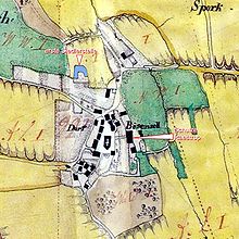
Bösensell
|
Bösensell
municipality Send
Coordinates: 51 ° 54 ′ 56 ″ N , 7 ° 28 ′ 46 ″ E
|
|
|---|---|
| Height : | 64 m above sea level NN |
| Area : | 21.55 km² |
| Residents : | 2853 (Dec. 31, 2012) |
| Population density : | 132 inhabitants / km² |
| Incorporation : | 1st January 1975 |
| Postal code : | 48308 |
| Area code : | 02536 |
|
Village center Bösensell (April 12, 2014)
|
|
Bösensell ( Low German Baisensell ) is a district of the municipality of Senden in the Coesfeld district and is located 15 km west of Münster .
history
People settled in this area as early as 5000 BC. Traces have been found in the neighboring Uphoven, around eight kilometers away, which show that people lived here around 7,000 years ago.
Bösensell was first mentioned in a document around the year 890 in a document from Werden Abbey , where the place was still called Basinseli.
From Basinseli to Bösensell
The name Basinseli changed over the centuries via Baisensell and Buzenzele to Bösensell.
Around 1148 Bösensell was the center of the manorial cathedral capitular office Bösensell.
Until the municipal reorganization on January 1, 1975, when Bösensell was incorporated into Senden, the place belonged to the Roxel office in the Münster district . That is why Bösensell's Protestant Christians still belong to the Evangelical Church Community of Roxel and not to the Church of Senden.
special locations
- The Laerbrockkreuz on the border with the neighboring towns Schapdetten and Havixbeck marks the point at which the three districts Dreingau , Stevergau met and Scopinggau and between the 13th and 17th centuries diets were held.
- House Ruhr from the 16./17. Century was redesigned in 1742 by the Westphalian Baroque master builder Johann Conrad Schlaun .
- Haus Alvinghof was built by Johann Conrad Schlaun in 1749 as a summer residence for the episcopal vice-chancellor Christian Friedrich von und zur Mühlen .
- The parish church of St. John Baptist (named after John the Baptist ) was completed in 1917 during the First World War . The Baumberger sandstone church tower comes from an older church. The nave is built with Ibbenbürener sandstone, which is more weather-resistant. The choir stalls date from 1525.
Incorporation
On January 1, 1975 Bösensell was incorporated into the municipality of Senden. A small part of the area came to Nottuln .
Population development
Lived in Bösensell on:
- June 6, 1961: 1423 inhabitants
- May 27, 1970: 1488 inhabitants
- June 30, 1974: 1701 inhabitants
- November 30, 2004: 2529 inhabitants
- December 31, 2005: 2661 inhabitants
- December 31, 2006: 2727 inhabitants
- December 31, 2007: 2943 inhabitants
- December 31, 2012: 2853 inhabitants
Business
For non-residents, the appearance of Bösensell is primarily characterized by the Südfeld industrial park located on the southern outskirts directly on the L551 . In addition, there is the Am Dorn industrial park in the immediate vicinity of the A43 motorway , in which a heavily frequented truck stop with games library, restaurant and travel and long-distance driver service was located. In the meantime, further commercial facilities have opened in the immediate vicinity. These companies, as well as the traders in the area of the actual town center, are organized in the Bösensell trade association .
Transport links
- Railway: The Bösensell station (established in 1897) is on the Wanne-Eickel-Hamburg railway line . The Niers-Haard-Express Essen – Münster stops here every half hour . He comes hourly from Mönchengladbach – Krefeld – Duisburg.
- Motorway: The A43 can be reached via the Senden junction.
- Federal and state roads: The B235 begins at the motorway slip road to the A43 and goes south via Senden to Witten . The L551 (formerly B51 ) runs parallel to the A43. To the north you can get to Havixbeck via the L550 .
- An extensive network of trails invites you to go on bike tours.
- Rest area: Since May 2006, Bösensell has had a truck stop just before the A43 motorway junction.
- Bus: The S90 in the direction of Lüdinghausen Busbahnhof and Münster Bült stops at Park and Ride Square.
literature
- Helga Kraneburg: History of the parish of St. Johannes in Bösensell . In: Send. A history of the municipality of Senden with Bösensell, Ottmarsbocholt, Venne. Send parish, Senden 1992.
- Municipality of Senden (Ed.): Send. A history of the municipality of Senden with Bösensell, Ottmarsbocholt, Venne. , Send 1992, ISBN 978-3-9802977-0-7 .
Web links
- Side of the district of Bösensell
- Official website of the municipality of Senden
- Bösensell in the Westphalia Culture Atlas
Individual evidence
- ↑ Population of the municipality of Senden
- ↑ Martin Bünermann, Heinz Köstering: The communities and districts after the municipal territorial reform in North Rhine-Westphalia . Deutscher Gemeindeverlag, Cologne 1975, ISBN 3-555-30092-X .
- ^ Federal Statistical Office (ed.): Historical municipality directory for the Federal Republic of Germany. Name, border and key number changes in municipalities, counties and administrative districts from May 27, 1970 to December 31, 1982 . W. Kohlhammer, Stuttgart / Mainz 1983, ISBN 3-17-003263-1 , p. 314 .


