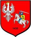
Błażowa
| Błażowa | ||
|---|---|---|

|
|
|
| Basic data | ||
| State : | Poland | |
| Voivodeship : | Subcarpathian | |
| Powiat : | Rzeszów | |
| Gmina : | Błażowa | |
| Area : | 4.23 km² | |
| Geographic location : | 49 ° 53 ' N , 22 ° 6' E | |
| Height : | 230 m npm | |
| Residents : | 2174 (Dec. 31, 2016) | |
| Postal code : | 36-030 | |
| Telephone code : | (+48) 17 | |
| License plate : | RZE | |
| Economy and Transport | ||
| Next international airport : | Rzeszów-Jasionka | |
| administration | ||
| Website : | www.blazowa.itl.pl | |
Błażowa is a city in Poland in the Subcarpathian Voivodeship . It is the seat of a town-and-country municipality in the powiat Rzeszowski .
Geographical location
The city is located on the Ryjak River in the Subcarpathian Mountains ( Dynów Mountains ).
history
The first written mention of the place comes from the year 1429 ( agrorum Blazowiensium ), then Blaszowa (1430), Blazowa (1432?), Blazow (1436), Blaszow (1453), Blazowa (1508), Blazeiowa (1629), Błażowa ( 1794). The possessive name is derived from the personal name Błaż (Polish Błażej, German Blaise ) with the suffix -owa.
In 1432 a Roman Catholic parish was established.
In 1624 the Tatars invaded the area. They pillage both in the city and in the surrounding villages. 1672 was also a difficult year for the city, as again Tartars, but also Cossacks caused destruction in the city. During the Great Northern War , Swedish troops marched into Błażowa in 1704. In 1770 the place owned by Prince Alexander Jakob Lubomirski received market rights.
As a result of the first partition of Poland , the place fell to Austria in 1772 . In 1790 the first fire brigade was founded by Henryk Fleming . The weavers 'association was founded in 1884 and a weavers' school the following year. In 1895 the previously existing fire brigade was converted into a volunteer fire brigade . The neo-Gothic church was built between 1896 and 1900 under the direction of the architect Jan Sasa-Zubrzycki . In 1907 a fire raged in the city and largely destroyed it. A few stone buildings, including the church, were spared. After the end of the First World War , the city became part of Poland, which was re-established by the peace treaty of Brest-Litovsk in 1918 .
When the Second World War broke out , the city was occupied by the Wehrmacht in September 1939 . That same year, Jews were in the city deported ; in February 1942 there were about 1,100 Jews in the city. In the summer of that year they were deported and murdered. In 1944 the Wehrmacht had to withdraw due to pressure from the Red Army , the area was occupied by the Soviet Army and the city became part of Poland.
In 1950 a state kindergarten was established. During an administrative reform in Poland, the city was part of the newly formed Rzeszów Voivodeship on 1975 . After its dissolution, Błażowa was part of the Subcarpathian Voivodeship from 1999.
In 2002 the gimnazjum received im. Anny Jenke a new building.
Buildings
- Neo-Gothic church, built between 1896 and 1900
- Manor house, built in the 18th and 19th centuries century
local community
In addition to the town of Błażowa, the municipal and rural community also includes the school authorities ( sołectwo ):
- Białka,
- Błażowa Dolna
- Błażowa Górna
- Futoma,
- Kąkolówka,
- Kąkolówka-Ujazdy,
- Lecka,
- Nowy Borek,
- Piątkowa.
traffic
There are no major roads through the city. Voivodeship Road 878 can be reached about seven kilometers to the north via a smaller country road. This leads to the district town of Rzeszów and the European route 40 running there . The voivodship road 884, which runs south, is just about as far away.
The Rzeszóz Airport is the nearest international airport. It is located about 26 kilometers north of Błażowa.
Personalities
- Cwi Elimelech Szapiro (1841–1924), rabbi in the city from 1900 to 1914
sons and daughters of the town
- Jakob Moneta (1914–2012), trade unionist and journalist
Web links
- Błażowa . In: Filip Sulimierski, Władysław Walewski (eds.): Słownik geograficzny Królestwa Polskiego i innych krajów słowiańskich . tape 1 : Aa-Dereneczna . Sulimierskiego and Walewskiego, Warsaw 1880, p. 246 (Polish, edu.pl ).
- Błażowa . In: Filip Sulimierski, Władysław Walewski (eds.): Słownik geograficzny Królestwa Polskiego i innych krajów słowiańskich . tape 15 , part 1: Abablewo – Januszowo . Walewskiego, Warsaw 1900, p. 163 (Polish, edu.pl ).
- City website (Polish)
- Website of the gimnazjum im. Anny Jenke (Polish)
Individual evidence
- ^ Tomasz Jurek (editor): Słownik Historyczno-Geograficzny Ziem Polskich w Średniowieczu. Edycja elektroniczna .
- ↑ Kazimierz Rymut , Barbara Czopek-Kopciuch: Nazwy miejscowe Polski: historia, pochodzenie, zmiany . 1 (AB). Polska Akademia Nauk . Instytut Języka Polskiego, Kraków 2004, p. 221 (Polish, online ).
- ↑ Południowo-Wschodni Instytut Nauk w Przemyślu: Miasta ziemi przemyskiej i sanockiej w drugiej połowie XVII iw XVIII wieku, 1993, p. 27
- ↑ gimnazjum roughly corresponds to a Realschule, while liceum roughly corresponds to the German grammar school.

