Barueri
| Município de Barueri "Flor vermelha que encanta"
Barueri
|
|||
|---|---|---|---|
|
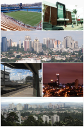
Image montage Barueri
|
|||
|
|
|||
| Coordinates | 23 ° 30 '39 " S , 46 ° 52' 33" W | ||
 Location of the municipality in the state of São Paulo Location of the municipality in the state of São Paulo
|
|||
| Symbols | |||
|
|||
| founding | November 11, 1560 (first settlement) (459 years old) March 26, 1949 (city emancipation) (71 years old) |
||
| Basic data | |||
| Country | Brazil | ||
| State | São Paulo | ||
| ISO 3166-2 | BR-SP | ||
| Metropolitan area | São Paulo metropolitan area | ||
| height | 719 m | ||
| Waters | Rio Tietê | ||
| climate | subtropical, cfb | ||
| surface | 65.7 km² | ||
| Residents | 240,749 (2010) | ||
| density | 3,664.3 Ew. / km² | ||
| estimate | 274,182 (July 1, 2019) | ||
| Parish code | IBGE : 3505708 | ||
| Post Code | 06401 | ||
| Telephone code | (+55) 11 | ||
| Time zone | UTC −3 | ||
| Website | barueri.sp (Brazilian Portuguese) | ||
| politics | |||
| City Prefect | Rubens Furlan (2017-2020) | ||
| Political party | PSDB | ||
| Culture | |||
| Patron saint | Nossa Senhora da Conceição da Escada | ||
| economy | |||
| GDP | 47,088,302 thousand R $ 177,735 R $ per person (2016) |
||
| HDI | 0.786 (2010) | ||
Barueri , officially Portuguese Município de Barueri , is a city in the Brazilian state of São Paulo , about 25 km northwest of the city of São Paulo , to whose urban agglomeration it belongs. Barueri is part of the São Paulo metropolitan area and one of the country's main financial centers. Barueri is one of the richest cities in Brazil. As of July 1, 2019, an estimated 274,182 people lived in Barueri on 65.7 km².
history
According to historians, the city goes back to a church and settlement founded by the Jesuit José de Anchieta in 1560. The connection to the railway network in 1875 brought a surge in growth. Barueri was until its legal independence in 1948 (Lei Estadual n.º 233) of the Distrito de Barueri of the municipality of Santana de Parnaíba , the emancipation as a self-governing municipality took place on March 26, 1949.
City structure
Barueri is divided into 16 bairros (roughly districts):
|
Sports
Barueri has with Grêmio Barueri from 2009 for the first time a club in the first Brazilian soccer league, the Series A . Gremio also had successes in sports such as basketball and volleyball. After disagreements with the city administration, the club moved to Presidente Prudente , 600 km away, in 2010 , but returned in May 2011. The team plays in the Barueri Arena, which opened in 2006 and initially had 17,000 spectator seats in 2007; in 2010 the capacity was expanded to 35,000. In the meantime, SE Palmeiras from São Paulo, FC São Paulo and FC Santos played some of their home games here in the 2010 premier league season.
In the meantime, the Campinas Futebol Clube from Campinas , co-founded by the former international Careca , has been transferred to Barueri and renamed SC Barueri .
Barueri hosted some of the 2006 Women's Basketball World Cup games .
Web links
- City Prefecture website , Prefeitura Municipal (Brazilian Portuguese)
- Citizen portal Barueri
- City Council website , Câmara Municipal (Brazilian Portuguese)
Individual evidence
- ↑ Barueri climate: average temperature, weather by month, Barueri weather averages. In: de.climate-data.org. Retrieved September 26, 2019 .
- ↑ a b c IBGE : Barueri: Panorama. Retrieved September 26, 2019 (Brazilian Portuguese).
- ^ Rubens Furlan 45 (Prefeito). In: todapolitica.com. Eleições 2016, accessed September 26, 2019 (Brazilian Portuguese).
- ↑ Barueri - História. In: cidades.ibge.gov.br. IBGE , accessed September 26, 2019 (Brazilian Portuguese).
- ↑ Barueriportal: Bairros de Barueri


