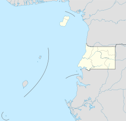
Bata (city)
|
Bata Bata |
||
|---|---|---|
|
|
||
| Coordinates | 1 ° 51 ' N , 9 ° 46' E | |
| Symbols | ||
|
||
| Basic data | ||
| Country | Equatorial Guinea | |
| Continental region | ||
| province | Littoral | |
| ISO 3166-2 | GQ-LI | |
| height | 5 m | |
| surface | 2500 km² | |
| Residents | 290,000 (2015) | |
| density | 116 Ew. / km² | |
| Telephone code | (+240) 08 | |
Bata is the capital of Equatorial Guinea's mainland region Mbini and the province of Litoral and the second seat of the National Parliament. Bata had about 290,000 inhabitants in 2015 and is the largest city in the country. It is located on the Atlantic Ocean and has a seaport with ferry services to Malabo and Douala as well as Bata Airport . Since 1965 the city has been the seat of the Roman Catholic diocese of Bata .
Population development
In 1907, Bata was a small Spanish military post with 137 residents, including 21 Spaniards, nine French, four Germans and three British. In 1983 the city already had 24,400 inhabitants, by 1994 the number had doubled to 50,000, in 2001 it was 132,200 and rose to 290,000 by 2015.
climate
Due to the proximity to the equator , the temperatures are subject to only minor fluctuations during the year. The average values are between 24 ° C in July and August and 26 ° C in February and March. However, the monthly rainfall varies greatly. It is only 46–57 mm in July and August and 424 mm in October. The humidity is around 80%. The water temperatures fluctuate between 26.4 ° C and 29.4 ° C.
Paseo Marítimo
The Paseo Marítimo promenade stretches for 4.6 km along the beaches from Ukomba to Iyubu. In the middle is the old port of Bata with the 63 m high, A-shaped Torre de la Libertad , in which there is a restaurant with a panoramic view.
port
The port of Bata is the most important in the country. It plays an important role in the transport of energy, goods and raw materials to the continental part of Equatorial Guinea. Between 2009 and 2019, the Chinese company China Road and Bridge Corporation expanded it to 324,000 m², with a pier of 20,000 DTW and a further pier of 50,000 DTW for a total of 11 berths. The newly constructed buildings cover an area of 22,000 m². The cost was one billion CFA francs and was borne by the state. It was inaugurated on July 30, 2019.
education
The Universidad Nacional de Guinea Ecuatorial (UNGE), founded in 1995, has the faculties of medicine, education, engineering, humanities and religious studies on its campus in Bata. However, in contrast to the campus in Malabo , there are no student dormitories.
Sports
The Estadio de Bata is the largest football stadium in the country and was one of the venues for the 2012 and 2015 African Cup of Nations .
Sons and daughters
- Miguel Angel Nguema Bee (* 1969), Roman Catholic religious, Bishop of Ebebiyin
- Ben Manga (* 1974), German soccer player
See also
Web links
Individual evidence
- ↑ Bata et ses alentours guineequariale-info.net , accessed on June 25, 2020 (French)
- ↑ Equatorial Guinea - Major Cities citypopulation.de , accessed on June 24, 2020
- ↑ Klima Bata climate-data.org , accessed on June 24, 2020
- ↑ Paseo Maritimo de Bata (picture gallery) bkarchitects.net , accessed on June 24, 2020 (English)
- ↑ Concluye el proyecto de ampliación y modernización del Puerto de Bata, el más grande Guinea Ecuatorial guineainfomarket.com , August 7, 2019, accessed on June 25, 2020 (Spanish)
- ↑ UNGE - Servicios universitarios unge.education , accessed on June 25, 2020 (Spanish)


