Beiershausen
|
Beiershausen
City of Bad Hersfeld
Coordinates: 50 ° 49 ′ 32 " N , 9 ° 38 ′ 58" E
|
|
|---|---|
| Height : | 212 (209-265) m |
| Area : | 2.95 km² |
| Residents : | 274 (Jul. 1, 2002) |
| Population density : | 93 inhabitants / km² |
| Incorporation : | December 31, 1971 |
| Postal code : | 36251 |
| Area code : | 06625 |
|
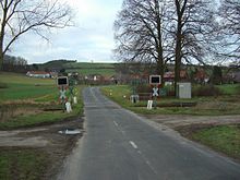
Beiershausen (Asbach in the background and Kohlhausen on the right)
|
|
Beiershausen is a village with about 300 inhabitants in East Hesse about 6 km southwest of Bad Hersfeld on the federal highway 62 .
The houses follow the Falkenbach and nestle against the north-western slopes of the Aulaberges (342.4 m above sea level ), the Mittelberg ( 358.5 m above sea level ) and the Langenberg. To the south-east, beyond the main road and the Bad Hersfeld – Treysa railway line , also known as the “Knüllwaldbahn”, the Fulda flows past the village. The built-up area is 209 m above sea level. NN on the main road and rises to 265 m above sea level. NN on the slopes of the Mittelberg.
history
Beiershausen, a historic Hessian farming village, was first mentioned in a document in 1332 . In 1393 the nobles of Milnrode , who at the time of Abbot Berthold (1366-1388) had herfeld fiefdoms in Beigershusin, sold the village of Beigershusin to Hersfeld for "repurchase". During the Thirty Years' War , Beiershausen “became completely desolate”.
On December 31, 1971, Beiershausen was incorporated into the district town of Bad Hersfeld.
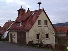
The place still shows how the first settlers used the special features of the landscape. In the center of the village, the farms are crowded together and yet, in their diversity, they are an expression of rural independence. The village is still largely preserved in its original appearance. The numerous, clearly structured farms with their farm buildings, kitchen gardens and orchards, the characteristic street spaces with their corridors and old corners can still be seen today.
Population development
Population development of Beiershausen. The data from 1930 to 1970 come from census results. For 1997 the data come from the registration office.
| year | 1840 | 1867 | 1895 | 1930 | 1939 | 1950 | 1961 | 1970 | 1994 | 1997 | 2002 | 2004 |
|---|---|---|---|---|---|---|---|---|---|---|---|---|
| Residents | 155 | 137 | 119 | 138 | 171 | 268 | 218 | 278 | 303 | 314 | 274 | 307 |
Culture and sights
Pfaffenwaldfriedhof
In 1938 the Pfaffenwald camp was set up as a "Reichsautobahnlager" to accommodate the forced laborers employed in the construction of the Asbachtalbrücke in the Pfaffenwald west of Beiershausen. From 1942 to spring 1945 it was used as a transit, death, birth and abortion camp for foreign forced laborers. Those who died in the camp were buried by the camp inmates themselves in a provisional cemetery in the forest of prospects in the Rothäckern. In 1958/59 soldiers of the Bundeswehr created a forest cemetery ( ⊙ ), which was completed in 1960/61 by the Hessian state government and the Volksbund Deutsche Kriegsgräberfürsorge and opened to the public on May 14, 1961.
literature
- Susanne Hohlmann: Pfaffenwald: death and birth camps 1942–1945. National Socialism in North Hesse - Writings on Regional Contemporary History, Issue 2, Ed .: Gesamtthochschule Kassel, Kassel, 1984, ISBN 3-88122-171-9 ( digitized version )
- The wooden cross in the forest . In: Die Zeit Nr. 51/1958, December 18, 1958, accessed on January 8, 2017
Individual evidence
- ^ Federal Statistical Office (ed.): Historical municipality directory for the Federal Republic of Germany. Name, border and key number changes in municipalities, counties and administrative districts from May 27, 1970 to December 31, 1982 . W. Kohlhammer GmbH, Stuttgart and Mainz 1983, ISBN 3-17-003263-1 , p. 397 .
- ↑ Between the forester's house Falkenbach in the south and the source of the Wolfsgraben in the north ( Electorate of Hesse 1840-1861 - 65. Niederaula. Historical maps. In: Landesgeschichtliches Informationssystem Hessen (LAGIS).).
- ↑ Hohlmann, p. 80
- ^ "The wooden cross in the forest", Zeit , December 18, 1958
- ^ Volksbund Deutsche Kriegsgräberfürsorge: Beiershausen "Pfaffenwald", forest cemetery
- ↑ "Worthy memory", in: Hersfelder Zeitung , December 9, 2013
Web links
- Beiershausen, Hersfeld-Rotenburg district. Historical local dictionary for Hessen. In: Landesgeschichtliches Informationssystem Hessen (LAGIS).
- Beiershausen


