Cathus
|
Cathus
City of Bad Hersfeld
Coordinates: 50 ° 52 ′ 50 ″ N , 9 ° 46 ′ 27 ″ E
|
||
|---|---|---|
| Height : | 227 (206-240) m | |
| Area : | 3.49 km² | |
| Residents : | 981 (Dec. 30, 2004) | |
| Population density : | 281 inhabitants / km² | |
| Incorporation : | December 31, 1971 | |
| Postal code : | 36251 | |
| Area code : | 06621 | |
|
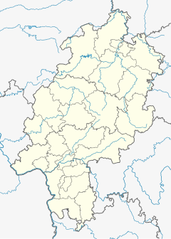
Location of Kathus in Hessen |
||
|
View from Petersberg to Kathus
|
||
Kathus is a village with about 1000 inhabitants in East Hesse, about 5 km east of Bad Hersfeld .
Most of the place is on the slope of 340.4 m above sea level. NN high Gellenberg, which is northwest of the village. The built-up area is 206 m above sea level. NN on the Solz and rises to 240 m above sea level. NN on the slopes of the Gellenberg.
The district can be reached via Kreisstraße 2, which branches off from Bundesstraße 62 in the Sorga district of Bad Hersfeld . The public transport is carried out by the Rhön energy bus GmbH with the line 3 of the bus and the line 7 for the student traffic.
history
The Katanes court was first mentioned in 874, when the owner Katanes and his wife Reginhilt donated their estate to the Fulda monastery. From 1003 the place was a Fulda enclave in the hersfeld area until the farm was sold in 1353 with the consent of Abbot Heinrich von Fulda to the citizen Hermann Brückenmüller from Hersfeld. In 1426 the Hersfeld Abbey acquired half of the estate. Later the settlement "Kattes" belonged completely to Hersfeld and was assigned to the Propstei Petersberg by the abbot . The Petersberg administrative district, to which Kathus belonged, arose from the provost's office. Ecclesiastically too, Kathus belonged to Petersberg with his church built in 1386. The Hessian bailiff von Friedewald attacked the Kathus area in 1495.
Since December 31, 1971, the formerly independent town has belonged to Bad Hersfeld as a district. Until the modern era Kathus was strongly influenced smallholder and a high proportion of workers who as commuters in the industry were employed from Bad Hersfeld. In the recent past, Kathus has developed into a place which, as a typical suburb , accommodates partly traditional, partly “new” residents. The Kathuser dialect is a mixture of both dialects because of its peripheral location to Thuringia and the Rhön .
The nickname of the Kathus residents is "the poachers" - possibly a reference to the backwardness of the somewhat remote town that was once present.
Population development
Kathus only had 16 households in 1610. In 1747 there were already 37 households.
Population development of Kathus. The data from 1930 to 1970 come from census results. For 1997 the data come from the registration office.
| year | 1823 | 1840 | 1867 | 1895 | 1930 | 1939 | 1950 | 1961 | 1970 | 1994 | 1997 | 2004 |
|---|---|---|---|---|---|---|---|---|---|---|---|---|
| Residents | - | 370 | 462 | 410 | 600 | 633 | 853 | 847 | 870 | 961 | 1003 | 981 |
geology
The so-called lake hole, a sinkhole , about one kilometer northeast of the town center at about 300 m above sea level. Located above sea level, has a diameter of about 80 meters. There is water in the almost circular funnel and forms a natural lake over 16 meters deep. It was created by subrosion in the rock layer of the Zechstein . This rock layer begins about 490 meters below the lake hole. The 490 meters above the Zechstein essentially consist of the lower and middle red sandstone . These rock layers are criss-crossed by fault lines, so that water reaches the Zechstein and leaches it. This created a cavity that led to collapses in the overburden. As a result, the conical sinkhole funnel formed on the surface. Increased sodium and chlorine levels in the surface water indicate a mixture with the salt solution in the Zechstein.
According to palynological and stratigraphic investigations of the sediments in the sinkhole, it is assumed that the sea hole formed in the Eem warm period ( crack / Würm interglacial), i.e. around 120,000 years ago. The lake hole continues to grow through further break-ins. The last major break-in took place on February 13-14, 1969; in the process, the water level fell by almost five meters for a short time and a rifle house on the edge was destroyed.
On a floating island in the lake and on the banks, bog birches , ear willows , beaked sedge , broad-leaved cattails and yellow loosestrife grow on the basis of a feverish clover lawn .
Web links
- Private page about Kathus
- Alfred Finkenwirth, Siegfried Holtz: Origin and age of the sinkhole "Seeloch" near Bad Hersfeld (short version) on the website of the Johann Christian Senckenberg University Library in Frankfurt
- Kathus, Hersfeld-Rotenburg district. Historical local dictionary for Hessen. In: Landesgeschichtliches Informationssystem Hessen (LAGIS).
- Twins in a six-pack: Extraordinary children's blessing in Kathus on hna.de.
Individual evidence
- ↑ Dr. Groscurth: Villages of the district of Hersfeld In: Mein Heimatland, December 1961, Volume 19. (Supplement to the Hersfelder Zeitung )
- ^ Federal Statistical Office (ed.): Historical municipality directory for the Federal Republic of Germany. Name, border and key number changes in municipalities, counties and administrative districts from May 27, 1970 to December 31, 1982 . W. Kohlhammer GmbH, Stuttgart and Mainz 1983, ISBN 3-17-003263-1 , p. 396 .
- ↑ Swallowed by the earth . In: Hersfelder Zeitung , January 20, 2013; accessed on July 25, 2019.
- ↑ "Mining Office: Burglaries are also possible with us. Well-known example: Kathuser Seeloch ” . In: Hersfelder Zeitung, November 2, 2010.


