Bellavista District (Callao)
| Bellavista district | |||
|---|---|---|---|
 Location of the Bellavista district in Callao (marked in red) |
|||
| Symbols | |||
|
|||
| Basic data | |||
| Country | Peru | ||
| region | Callao | ||
| province | Callao | ||
| Seat | Bellavista | ||
| surface | 4.6 km² | ||
| Residents | 74,851 (2017) | ||
| density | 16,415 inhabitants per km² | ||
| founding | October 6, 1915 | ||
| ISO 3166-2 | PE-CAL | ||
| Website | www.munibellavista.gob.pe (Spanish) | ||
| politics | |||
| Alcalde District | Daniel Juan Malpartida Filio (2019-2022) |
||
| Political party | Por Ti Callao | ||
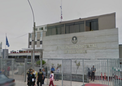
| District Administration Building | |||
Coordinates: 12 ° 3 ′ 45 ″ S , 77 ° 7 ′ 46 ″ W
The Bellavista district is located in the constitutional province of Callao in the central west of Peru . The district was established on October 6, 1915. It has an area of 4.56 km². At the 2017 census, 74,851 people lived in the district. In 1993 the population was 71,665, in 2007 75,163. The district is identical to the 34 m high town of Bellavista .
Geographical location
The Bellavista district is located in the south of the Callao province a few meters from the Pacific coast. It has a rectangular shape with a lengthwise extension in east-west direction of almost 5 km and a width of about 780 m. The Bellavista district belongs to the Lima metropolitan area and is completely urban.
The Bellavista district is bordered to the south by the district La Perla , in the west and north by the district of Callao , on the east by the district Lima and on the southeast by the district San Miguel (the last two in the province of Lima ).
Web links
- Municipalidad Distrital de Bellavista
- Peru: Province of Callao (districts) at www.citypopulation.de


