Berchtesgaden high throne
| Berchtesgaden high throne | ||
|---|---|---|
|
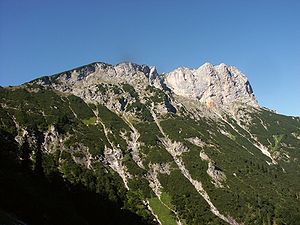
View from the Stöhrweg to the |
||
| height | 1972 m above sea level NHN | |
| location | Bavaria , Germany | |
| Mountains | Untersberg , Berchtesgaden Alps | |
| Dominance | 11.5 km → Mannlgrat | |
| Notch height | 1279 m ↓ Hallthurm | |
| Coordinates | 47 ° 41 '39 " N , 12 ° 59' 10" E | |
|
|
||
| Normal way | from Hintergern over the Leiterl | |
|
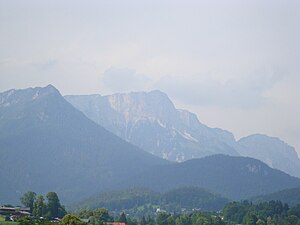
Berchtesgaden Hochthron (Unterberg) of Schonau of view |
||
The Berchtesgadener Hochthron is at 1972 m above sea level. NHN the highest peak of the Untersberg massif in the Berchtesgaden Alps in the Berchtesgadener Land district , Bavaria ( Germany ).
It is considered one of the best vantage points in the Berchtesgadener Land, as it offers a clear view of the Berchtesgaden valley basin and all nine mountain ranges of the Berchtesgaden Alps, the Chiemgau Alps , the Austrian mountains of the Salzkammergut and the Tennengebirge .
geography
The Berchtesgadener Hochthron rises around 7 km north of Berchtesgaden and around 8 km east-southeast of Bad Reichenhall . The border with Austria runs around 1.5 km north.
About 470 m (as the crow flies) west of the mountain peak is at 1895 m above sea level. NN the Stöhrhaus , an alpine club hut that is managed in summer . At the foot of the precipices of the summit lie the source areas of the Almbach , which flows through the Almbachklamm into the Berchtesgadener Ache coming from the south , as well as the Rothmannbach.
Ascent
Several marked trails lead to the summit of the Berchtesgadener Hochthron, most of which require surefootedness and good physical condition:
- from Hallthurm (between Bad Reichenhall and Bischofswiesen) via Reisenkaser, Leiterl and Stöhrhaus in 3 hours
- from Bischofswiesen (district of Aschau) via Stöhrweg, Leiterl and Stöhrhaus in 3.5 hours
- from Maria Gern via Hintergern, Stöhrweg, Leiterl and Stöhrhaus in 3 hours (normal route)
- from Ettenberg via Ludlgraben, Scheibenkaser, Leiterl or Mittagsloch and Stöhrhaus in 3 hours
- from Ettenberg via Ludlgraben, Hochkampschneid, Grubenkaser and Grubenpfad in 3 hours (positions I , mostly unmarked, partly insured)
- from the mountain station of the Untersbergbahn (cable car) on the Geiereck ( 1805 m above sea level ) via the Salzburger Hochthron ( 1853 m above sea level ) and the high plateau with Schellenberger ice cave and Rauheck in 2.5 hours
Climbing
The Berchtesgadener Hochthron breaks off to the east and south with massive, partly overhanging rock faces. Above all, the numerous climbing routes on the south face are among the most popular and historically most significant in the Berchtesgaden Alps. The climbs range from the Old South Face, which is often climbed in November ( difficulty level III + ), to sport climbing in the IX. Degree. Since 2007 there has been a difficult via ferrata on the east face of the Berchtesgadener Hochthron , the Berchtesgadener Hochthronsteig ( degree of difficulty C / D ). The entrance is reached from Ettenberg (or crossing over from the Leiterl) via the Scheibenkaser.
Galileo test environment
Close to the Stöhrhaus is one of the six transmission systems that serve as pseudolites in the GALILEO test and development environment (GATE) of the European satellite navigation system Galileo to simulate navigation satellites.
Web links
- Berchtesgadener Hochthron on Peakbagger.com (English)
Individual evidence
- ↑ Bernhard Kühnhauser: Alpine Club Guide Berchtesgaden Alps with Hochkönig . 20th edition. Bergverlag Rother , Munich 2011, ISBN 978-3-7633-1127-9 , pp. 439-440 .


