Bessunger gravel pit
| Bessunger gravel pit | ||
|---|---|---|

|
||
| Geographical location | near Darmstadt-Bessungen , Hessen ( Germany ) | |
| Tributaries | Saubach | |
| Drain | underground into a blind lake | |
| Islands | no | |
| Places on the shore | Darmstadt | |
| Data | ||
| Coordinates | 49 ° 50 '51 " N , 8 ° 38' 51" E | |
|
|
||
|
particularities |
- former quarry pond |
|
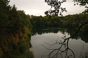
The Bessunger gravel pit is a quarry pond near Darmstadt-Bessungen in southern Hesse at the northwestern foot of the Odenwald . It is part of the Bessunger Kiesgrube nature reserve .
Geographical location and natural allocation
The Bessunger gravel pit is located on the southern edge of Darmstadt-Bessungen a few meters east of the Heidelberger Straße leading south to Darmstadt-Eberstadt . It belongs to the natural spatial main unit group Northern Upper Rhine Lowland (No. 22) and in the main unit Bergstrasse (226) to the sub-unit Bessunger Hang (226.7).
Origin and history
The "Bessunger Kies" was mentioned for the first time in 1701. In the 18th century, gravel extraction experienced a heyday in connection with the large princely building projects. New gravel pits were created: the gravel pit that still exists today in the south of Bessungen and a gravel pit that no longer exists on Nieder-Ramstädter Strasse near Herdweg.
Several small gravel pits were also opened on Steinberg in Bessungen, some of which existed until the 20th century. In the late 19th century, the “Darmstadt Beautification Association” was only able to prevent the gravel pit owners from digging up the rest of their strength.
The last Bessunger gravel pit, on Heidelberger Landstrasse, came into the possession of the Mitteldorf company after the First World War, which mined “1 a golden yellow Bessunger Kies” here until 1978.
Bessunger Kiesgrube nature reserve
The landscape of the Bessunger Kiesgrube and its surroundings form the nature reserve Bessunger Kiesgrube ( CDDA -Nr. 318193; designated 1997; 11.78 hectares ). For a few decades, primeval forest-like vegetation with dense forest has formed there.
In the nature reserve, the Bessunger Kiesgrube quarry pond spreads out with steep and rocky banks and a smaller lake just under 200 m east of it.
See also
Individual evidence
- ^ Stadtlexikon Darmstadt, Konrad Theiss Verlag, Stuttgart, 2006, p. 81 f.
- ↑ Map services of the Federal Agency for Nature Conservation ( information )

