Bubble Mountain (Swabian Alb)
| Bubble mountain | ||
|---|---|---|
|
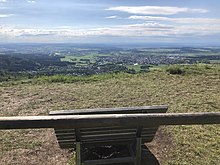
On the left the bladder mountain, on the right the Heiligenkopf , in the foreground the Bisingen district of Thanheim |
||
| height | 886 m above sea level NHN | |
| location | Baden-Wuerttemberg , Germany | |
| Mountains | Swabian Alb | |
| Coordinates | 48 ° 17 '56 " N , 8 ° 57' 45" E | |
|
|
||
| rock | White Jura | |
The Blasenberg is 886.3 m above sea level. NHN high mountain on the southwestern Swabian Alb north of the Albstadt district of Onstmettingen in the Zollernalb district .
The mountain lies on the European main watershed on the Alb eaves . The source of the Danube tributary Schmiecha lies just a little to the south on the Alb plateau , to the north and east of the Albtrauf are the sources of Zimmerbach and Klingenbach , which both drain towards the Neckar and Rhine .
Hiking trails
From the Zollersteighof near Onstmettingen in the north, the Main-Neckar-Rhein-Weg (main hiking trail 3) and the Schwäbische-Alb-Nordrand-Weg (main hiking trail 1) run by the Swabian Alb Association along the edge of the slope via Blasenberg and Heiligenkopf to the Stich car park . The Main-Neckar-Rhein-Weg leads around the valley of the Klingenbach in the south to the Irrenberg opposite. A local hiking trail marked with a blue triangle leads down to Thanheim between Blasenberg and Heiligenkopf .
The Albstadt premium hiking trail Traufgang 3 Zollernburg Panorama also leads over the bladder mountain .


