Bruck Waasen
| Bruck-Waasen (former municipality) | ||
|---|---|---|
|
|
||
| Basic data | ||
| Pole. District , state | Grieskirchen (GR), Upper Austria | |
| Judicial district | Grieskirchen (GBZ 4081) | |
| Pole. local community | Peuerbach | |
| Coordinates | 48 ° 19 '40 " N , 13 ° 46' 20" E | |
| height | 377 m above sea level A. | |
| Residents of the stat. An H. | 2336 (January 1, 2017) | |
| Building status | 711 (2001 ) | |
| surface | 28.38 km² | |
| Post Code | 4722 Bruck-Waasen | |
| prefix | + 43/7276 (Bruck-Waasen) | |
| Statistical identification | ||
| Counting district / district | Bruck; Waasen (40819 002; 003) | |
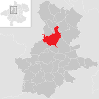
 Location of the former community in the Grieskirchen district |
||
| Independent municipality until the end of 2017 KG: 44201 Bruck, 44215 Waasen 44 localities Source: STAT : local directory ; BEV : GEONAM ; DORIS |
||
Until December 31, 2017, Bruck-Waasen was an independent municipality with 2336 inhabitants (as of January 1, 2017) with the main town of Bruck an der Aschach in Upper Austria in the Grieskirchen district in the Hausruckviertel . The community was in the judicial district of Peuerbach .
On November 6, 2016, a vote took place as to whether Bruck-Waasen should be merged with the neighboring communities of Peuerbach and Steegen . The majority of the residents of Peuerbach and Bruck-Waasen voted in favor, the majority of the residents of Steegen against. Thus only Bruck-Waasen was merged with Peuerbach. The merged community continues the name Stadtgemeinde Peuerbach .
geography
Geographically, the former community was 377 m above sea level in the Hausruckviertel. The extension was 7.5 km from north to south and 8.6 km from west to east. The total area was 28.38 km². Around ten percent of the area is forested, around 80% is used for agriculture.
Structure of the former municipality
The former municipality comprised the following 44 localities (population on January 1, 2017 by locality):
- Adenbruck (63)
- Aichet (31)
- Blind person (18)
- Fire sites (31)
- Breitau (78)
- Bruck an der Aschach (160)
- Book (115)
- Dunkenedt (13)
- Eckartsroith (51)
- Erleinsdorf (30)
- Trees (13)
- Freiling (9)
- Fox Stroke (132)
- Gschwendthäuser (16)
- Höhenstein (402)
- Holzleithen (16)
- Hötzmannsberg (27)
- Hub (30)
- Itzling (18)
- Kastlingeredt (81)
- Mittereibach (18)
- Mühlbrenning (61)
- Niederaching (22)
- Niederensfelden (19)
- Niederweiding (23)
- Walnut (11)
- Oberaching (26)
- Oberndorf (56)
- Oberngrub (18)
- Oberweiding (22)
- Parz near gates (18)
- Pfarrhofheuberg (176)
- Prambeckenhof (23)
- Ratzling (19)
- Slate lift (112)
- Sölden an der Straß (43)
- Staureth (7)
- Stefansdorf (75)
- Untereibach (7)
- Unterheuberg (76)
- Usting (90)
- Waasen (17)
- Waasnerau (46)
- Winkl (17)
The community consisted of two cadastral communities :
- Bruck (1,108.22 ha)
- Waasen (1,730.91 ha)
history
Originally located in the eastern part of the Duchy of Bavaria, the area has belonged to the Duchy of Austria since the 12th century. Since 1490 it has been assigned to the Principality of Austria ob der Enns . During the Napoleonic Wars , the area was occupied several times.
Since 1918 the area has belonged to the federal state of Upper Austria. After the connection of Austria to the German Reich on 13 March 1938, the area belonged to the Upper Danube , 1945 was carried out the restoration of Upper Austria.
On January 1, 2018, the municipality merged with the neighboring municipality of Peuerbach .
Population development
In 1991 the community had 2212 inhabitants according to the census, in 2001 it had 2302 inhabitants. From January 1, 2017, the last figure before the merger with Peuerbach was 2336 inhabitants.
Culture and sights
politics
Until the end of 2017, Peter Sattlberger ( ÖVP ) was the last mayor of the community.
coat of arms
Blazon (official description) of the municipal coat of arms:
- "Divided; above in gold a black, red-tongued, growing ibex, below in blue three silver, two-to-one rings. "
The church colors were blue-white-green.
The municipal coat of arms, awarded in 1988, combines the coat of arms of two aristocratic families who were once owners of the Bruck an der Aschach estate. The ibex is the coat of arms of Count Strattmann, the three rings come from the coat of arms of the Vatershaimer, which died out in 1493.
Web links
- 40803 - Bruck-Waasen. Community data, Statistics Austria .
More information about the municipality of Bruck-Waasen on the geo-information system of the federal state of Upper Austria .
Individual evidence
- ↑ Upper Austria: Two municipalities are merging orf.at, November 6, 2016, accessed November 6, 2016.
- ^ Ordinance of the Upper Austria. State government regarding the union of the municipalities of Bruck-Waasen and Peuerbach , accessed on December 6, 2017
- ↑ Population on January 1, 2017 by location (Excel file, 835 kB); accessed on June 15, 2017
- ↑ Herbert Erich Baumert: The coats of arms of the cities, markets and communities of Upper Austria, 8th supplement (1988–1991) , in Oberösterreichische Heimatblätter, Issue 3, 1992, p. 293 f. ( online (PDF) in the forum OoeGeschichte.at)


