
Peuerbach
|
Borough Peuerbach
|
||
|---|---|---|
| coat of arms | Austria map | |
 |
|
|
| Basic data | ||
| Country: | Austria | |
| State : | Upper Austria | |
| Political District : | Grieskirchen | |
| License plate : | GR | |
| Surface: | 39.36 km² | |
| Coordinates : | 48 ° 21 ' N , 13 ° 46' E | |
| Height : | 390 m above sea level A. | |
| Residents : | 4,650 (Jan 1, 2020) | |
| Postal code : | 4722 | |
| Area code : | 07276 | |
| Community code : | 4 08 35 | |
| NUTS region | AT311 | |
| UN / LOCODE | AT PRB | |
| Address of the municipal administration: |
Rathausplatz 1 4722 Peuerbach |
|
| Website: | ||
| politics | ||
| Mayor : | Wolfgang Oberlehner ( ÖVP ) | |
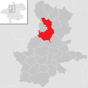
| Location of Peuerbach in the Grieskirchen district | ||
  |
||
 Peuerbach, church square |
||
| Source: Municipal data from Statistics Austria | ||

Peuerbach is a municipality in Upper Austria in the Grieskirchen district in the Hausruckviertel with 4650 inhabitants (as of January 1, 2020). The community is located in the judicial district of Grieskirchen .
On November 6, 2016, there was a vote on whether Peuerbach should be merged with the neighboring communities of Bruck-Waasen and Steegen . The majority of the residents of Peuerbach and Bruck-Waasen voted in favor, the majority of the residents of Steegen against. Thus Peuerbach will be merged with Bruck-Waasen. The merged community continues the name Stadtgemeinde Peuerbach .
geography
Peuerbach lies at an altitude of 390 m above sea level. A. in the Hausruckviertel. The extension is 11.0 km from north to south and 7.4 km from west to east. The total area is 39.36 km². 10.9% of the area is forested, 79.6% of the area is used for agriculture.
Neighboring municipalities:
- Altschwendt
- Heiligenberg
- Kallham
- Michaelnbach
- Natternbach
- Neukirchen am Walde
- Poetting
- Saint Willibald
- Steegen
- Waizenkirchen
Community structure
Since the merger with Bruck-Waasen on January 1, 2018, the municipality now comprises 58 villages, previously 14 (residents as of January 1, 2020):
- Achleiten (65)
- Adenbruck (62)
- Aichet (31)
- Besenberg (80)
- Blind person (16)
- Fire sites (28)
- Breitau (86)
- Bruck an der Aschach (160)
- Book (118)
- Dunkenedt (11)
- Eckartsroith (57)
- Erleinsdorf (29)
- Trees (13)
- Freiling (11)
- Fox Stroke (145)
- Greinsfurth (23)
- Gschwendthaus (20)
- Haargassen (10)
- Höhenstein (418)
- Holzleithen (13)
- Hötzmannsberg (28)
- Hub (29)
- Itzling (20)
- Kastlingeredt (84)
- Köppensteegen (8)
- Leithen (15)
- Mittereibach (16)
- Mühlbrenning (54)
- Niederaching (21)
- Niederensfelden (20)
- Niederweiding (23)
- Walnut (12)
- Oberaching (25)
- Oberndorf (54)
- Oberngrub (14)
- Oberweiding (22)
- Parz near gates (17)
- Peuerbach (1628)
- Pfarrhofheuberg (181)
- Prambeckenhof (20)
- Pühret (37)
- Ranna (27)
- Ratzling (18)
- Slate lift (116)
- Sölden an der Straß (41)
- Spielmannsberg (38)
- Staureth (6)
- Stefansdorf (74)
- Steingruneredt (33)
- Wet (135)
- Thomasberg (51)
- Untereibach (6)
- Unterheuberg (76)
- Untertreßleinsbach (127)
- Usting (93)
- Waasen (16)
- Waasnerau (52)
- Winkl (17)
The community consists of three cadastral communities (area: as of December 31, 2017):
- Bruck (1108.22 ha)
- Peuerbach (1100.87 ha)
- Waasen (1730.91 ha)
history
Originally located in the eastern part of the Duchy of Bavaria, the place belonged to the Duchy of Austria since the 12th century . Peuerbach received market rights in 1280. Since 1490 it has been assigned to the Principality of Austria ob der Enns . The place is best known for its role in the Peasant Wars (1625/26). In the politically and religiously confused period between 1620 and 1660, a large number of Peuerbach exiles left their homeland. During the Napoleonic Wars , the place was occupied several times.
Since 1918 the place belongs to the federal state of Upper Austria. After the " Anschluss of Austria " to the German Reich on March 13, 1938, the place belonged to the Gau Oberdonau . In 1945 Upper Austria was restored.
In 1995 Peuerbach received city rights.
On January 1, 2018, the municipality merged with the neighboring municipality of Bruck-Waasen .
Population development

Economy and Infrastructure
traffic
train
Peuerbach is the end point of a branch line of the Linz Local Railway .
Street
Peuerbach is located on Eferdinger Straße (B129).
education
- Bruck elementary school
- Peuerbach elementary school
- New Middle School Peuerbach (with sports branch)
- State Music School Peuerbach
Culture and sights


- Peuerbach Castle : The Peuerbach Castle Museum houses the Georg von Peuerbach exhibition, the Peasant War Museum and the Upper Austria. National crib.
- Parish church Peuerbach
- Astrolabe clock on the town hall
- Cometor
- Musikverein Peuerbach (founded in 1870) - also responsible for the Steegen community
- Open space Schifferhub
- Steindlbach outdoor seating area
leisure
- Star movie cinema
- various pubs and inns
- outdoor pool
- climbing hall
- Ice rink (only in winter)
- Football / tennis court
Sports
The Peuerbach New Year's Eve run has been taking place since 1997 , one of the busiest road races in Austria, which was held in Natternbach from 1981 to 1996 .
In Peuerbach there are two sports clubs, the Union Peuerbach and the ASKÖ Bruck-Peuerbach.
politics
Due to the merger of the municipalities, the municipal council was dissolved on January 1, 2018. It had 25 members by the end of 2017:
- 14 ÖVP
- 4 SPÖ
- 4 FPÖ
- 3 greens
The city council had 7 members:
- 4 ÖVP
- 1 each SPÖ, FPÖ and Greens
- mayor
- 1850–1855: New Year's Eve Terpinitz
- 1855: Mathias Lißberger
- 1855–1864: Karl Mayrhofer
- 1864–1867: Karl Stöbner
- 1867–1870: Franz Wezlmayr
- 1870–1879: Alois Spanlang
- 1879–1883: Ignaz Starzengruber
- 1883–1886: Franz Hoflehner
- 1886–1917: Heinrich Pramendorfer
- 1917–1938: Josef Heuberger
- 1938–1945: Alois Trappmaier
- 1945–1947: Alois Schmidauer
- 1947–1961: Johann Peham
- 1961–1990: Rudolf Orthofer
- 1990–2001: August Falkner (ÖVP)
- 2001–2017, 2018–: Wolfgang Oberlehner (ÖVP)
- From January 1, 2018 until the election of the mayor on April 8, 2018, business was carried out on an interim basis by the government commissioner Andreas Wenzl appointed by the state of Upper Austria.
- On April 8, 2018, the town council and mayor were re-elected after the merger. ÖVP candidate Wolfgang Oberlehner received 43.8 percent of the vote, SPÖ candidate Fritz Peham received 24.3 percent. On April 22, 2018, there was a runoff between the two candidates, in which Wolfgang Oberlehner (ÖVP) prevailed with 52.85 percent of the vote.
- Former mayor of Bruck-Waasen
- 1873–1906: Johann Zehetmayr
- 1906: Johann Humer
- 1906–1912: Anton Lugmair
- 1912–1942: Josef Wohlmair
- 1942–1945: Alois Trappmair
- 1945–1946: Alois Schmidauer
- 1946–1955: Johann Zauner
- 1955–1967: Josef Aschauer
- 1967–1984: August Mayrhuber
- 1984–1997: Rudolf Mayr
- 1997–2006: Josef Emprechtinger
- 2006–2017: Peter Sattlberger (ÖVP)
Parish partnership
coat of arms
Blazon (official description) of the municipal coat of arms:
- “In blue, a silver, square gate structure with open red gate wings and three battlements with black shooting holes. In the openwork gate opening on a green three-hill starting from the base of the shield, a black raven turned left, a golden oak branch with three acorns in its beak. "
Personalities
- Heinrich Barucher (* around 1390), Benedictine and longstanding pastor, canon lawyer at the Univ. Vienna, mentor of Georg von Peuerbach
- Georg von Peuerbach (1423–1461), astronomer at the University of Vienna and pioneer of the Copernican worldview
- Johann Gotthard Hayberger (1695–1764), baroque master builder and mayor of Steyr
- Maximilian Heyß (1808–1867), lawyer and politician
- Walter Knoglinger (1928–2012), journalist, publicist and sailing sports official
- Günther Sallaberger (* 1940), politician (SPÖ)
- Walter Entholzer (* 1953), doctor and politician (ÖVP)
- Manfred Hebenstreit (* 1957), artist
- Reinhold Entholzer (* 1959), politician (SPÖ)
- Doris Schmidauer (* 1963), politician (Greens) and wife of the incumbent Austrian Federal President Alexander van der Bellen
- Klaus Klaffenböck (* 1968), racing driver, sidecar world champion and winner of the Isle of Man TT
literature
- Julius Strnadt : Peuerbach. An attempt at legal history. In: Yearbook of the Upper Austrian Museum Association. Volume 27, Linz 1868, pp. 1–634, PDF (46 MB) on ZOBODAT
Web links
- 40819 - Peuerbach. Community data, Statistics Austria . (Data as of December 31, 2017 for the old community of Peuerbach!)
- Map in the Digital Upper Austrian Room Information System ( DORIS ) (data as of December 31, 2017 for the old community of Peuerbach!)
- Further information about the municipality of Peuerbach can be found on the geographic information system of the federal state of Upper Austria . (Data as of December 31, 2017 for the old community of Peuerbach!)
- www.peuerbach.at Website of the municipality
Individual evidence
- ↑ Upper Austria: Two municipalities are merging orf.at, November 6, 2016, accessed November 6, 2016.
- ^ Ordinance of the Upper Austria. State government regarding the union of the municipalities of Bruck-Waasen and Peuerbach , accessed on December 6, 2017
- ↑ Statistics Austria: Population on January 1st, 2020 by locality (area status on January 1st, 2020) , ( CSV )
- ↑ Federal Office for Metrology and Surveying, Regional Information, reference date December 31, 2017, accessed on January 4, 2018
- ↑ Eberhard Krauß: Expulsion, Flight, Migration: Exiles from Peuerbach in Franconia, Swabia and elsewhere. In: Upper Austrian homeland sheets . Linz 2006, p. 135, entire article p. 123–138, PDF on land-oberoesterreich.gv.at
- ↑ MVP. Retrieved June 16, 2017 .
- ^ Home page of the municipality of Peuerbach , accessed on January 7, 2018
- ↑ orf.at: New mayors: runoff election in Peuerbach . Article dated April 8, 2018, accessed April 9, 2018.
- ↑ orf.at: Mayoral elections in three districts . Article dated April 8, 2018, accessed April 9, 2018.
- ^ Orf.at: New mayors in Peuerbach and Micheldorf . Article dated April 22, 2018, accessed April 22, 2018.

Aistersheim | Bad Schallerbach | Eschenau im Hausruckkreis | Gallspach | Gaspoltshofen | Geboltskirchen | Grieskirchen | Haag am Hausruck | Heiligenberg | Hofkirchen an der Trattnach | Kallham | Kematen am Innbach | Meggenhofen | Michaelnbach | Natternbach | Neukirchen am Walde | Neumarkt im Hausruckkreis | Peuerbach | Pollham | Pötting | Pram | Rottenbach | St. Agatha | St. Georgen near Grieskirchen | St. Thomas | Schlüßlberg | Steegen | Taufkirchen an der Trattnach | Great | Waizenkirchen | Wallern an der Trattnach | Women | Wendling