
Geboltskirchen
|
Geboltskirchen
|
||
|---|---|---|
| coat of arms | Austria map | |
 |
|
|
| Basic data | ||
| Country: | Austria | |
| State : | Upper Austria | |
| Political District : | Grieskirchen | |
| License plate : | GR | |
| Surface: | 17.22 km² | |
| Coordinates : | 48 ° 9 ' N , 13 ° 38' E | |
| Height : | 555 m above sea level A. | |
| Residents : | 1,445 (January 1, 2020) | |
| Population density : | 84 inhabitants per km² | |
| Postal code : | 4682 | |
| Area code : | 07732 | |
| Community code : | 4 08 07 | |
| NUTS region | AT311 | |
| Address of the municipal administration: |
Field 10 4682 Geboltskirchen |
|
| Website: | ||
| politics | ||
| Mayor : | Friedrich Kirchsteiger ( SPÖ ) | |
|
Municipal Council : (2015) (19 members) |
||
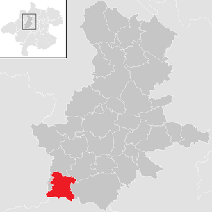
| Location of Geboltskirchen in the Grieskirchen district | ||
  |
||
| Source: Municipal data from Statistics Austria | ||

Geboltskirchen is a municipality in Upper Austria in the Grieskirchen district in the Hausruckviertel with 1445 inhabitants (as of January 1, 2020). The community is located in the judicial district of Grieskirchen .
geography
Geboltskirchen is located at an altitude of 555 m in the Hausruckviertel . The extension is 5.5 km from north to south and 5.4 km from west to east. The total area is 17.3 km². 32.9% of the area is forested, 57.2% of the area is used for agriculture.
Community structure
The municipality includes the following 29 localities (population in brackets as of January 1, 2020):
- Aigen (84)
- Arming (36)
- Aspet (44)
- Bergham (28)
- Brunau (27)
- Beech (10)
- Erlet (48)
- Geboltskirchen (420)
- Gschwendt (60)
- Wooden houses (2)
- Langau (13)
- Leithen (44)
- Lucka (8)
- Marshaling (54)
- Niederentern (64)
- Upper Entern (50)
- Odelboding (17)
- Piesing (75)
- Polzing (70)
- Riding (12)
- Rosswald (26)
- Disc (62)
- Stone (20)
- Thalham (14)
- Trattnach (17)
- Traunhof (29)
- Wiesing (43)
- Wilding (49)
- Zeißerding (19)
The community consists of the cadastral communities Geboltskirchen and Niederentern.
The following brooks flow in the municipality of Geboltskirchen: Trattnach , Entererbach, Furtbach, Geißbach, Sickingerbachl, Trattnach-Bach, Aigner-Bach, Sommerbach and the Brunauer Bach.
Neighboring communities
| Haag am Hausruck | Women | |
| Eberschwang ( District Ried im Innkreis ) |
.svg)
|
Gaspoltshofen |
| Ottnang am Hausruck ( District Vöcklabruck ) | Wolfsegg am Hausruck ( District Vöcklabruck ) |
history
Originally located in the eastern part of the Duchy of Bavaria , the place belonged to the Duchy of Austria since the 12th century. In 1180 the place is mentioned for the first time as "Gerbrulteskirch". Since 1490 it has been assigned to the Principality of Austria ob der Enns .
During the Napoleonic Wars , the place was occupied several times. Since 1918 the place belongs to the federal state of Upper Austria . After the annexation of Austria to the German Reich on March 13, 1938, the place belonged to the Gau Oberdonau . After 1945 the restoration of Upper Austria took place.
The community has been part of the judicial district of Grieskirchen since January 1, 2003, previously it belonged to the judicial district of Haag am Hausruck .
Population development
|
|
politics
The municipal council has a total of 19 members. With the municipal council and mayoral elections in Upper Austria in 2015 , the municipal council has the following distribution: 9 ÖVP, 5 SPÖ, 3 FPÖ and 2 ULG.
- mayor
- 1979 Hermann Pramendorfer (ÖVP)
- until 2014 Alois Kastner (ÖVP)
- 2014–2015 Franz Zöbl (ÖVP)
- since 2015 Friedrich Kirchsteiger (SPÖ) with direct election
coat of arms

Blazon : Over three golden tips in the red shield base, two golden, upright, entwined, crowned snakes facing each other with their heads. The municipality colors are yellow-red. The municipal coat of arms with the cross-twisted snakes after the seal image of the Zärtl refers to the former noblemen's seat, which this family held for around a hundred years from around 1450 to 1566. Today only the Hofbauerngut and the Hofmühle are reminiscent of the former castle surrounded by a pond.
Community partnerships
- Municipality of pottage-Lützel Hausen in Hesse since 1986th
Culture and sights
- Geboltskirchen parish church
- Origin of the Trattnach with nature trail in the village of Scheiben
- Crib building school : Every year around December 8th, the large exhibition of crib friends takes place in the Geboltskirchen parish hall: all cribs exhibited here were created in the crib building courses in the year in question. 50 nativity set makers do handicrafts twice a week in Upper Austria. Landeskrippenbauschule Geboltskirchen - whether oriental or native cribs, root cribs, window cribs or a crib for the parish church. Experienced nativity scene builders support them. Josef Ahammer is considered the "father" of crib construction in and around Geboltskirchen. In 1999 he held the first crib building course in Geboltskirchen. In 2003 a crèche association was founded and in 2006 the state crèche building school was opened, which is located in the attic of the primary school. The training lasts 4 years and ends with a master craftsman examination. Since 2007 the school has been run by master crib builder Wolfgang Seiringer. All year round, guided tours through the state nursery school are offered. In the anteroom of the school is the Ahammer landscape crib - a 10 m² home crib in the Ebenseer style, which was built in 15 years.
Personalities
- Hermann Pramendorfer (* 1933), politician
Web links
- Further information about the municipality of Geboltskirchen can be found on the geographic information system of the federal state of Upper Austria .
Individual evidence
- ↑ Statistics Austria: Population on January 1st, 2020 by locality (area status on January 1st, 2020) , ( CSV )
- ^ Province of Upper Austria, results of the 2015 elections. Accessed April 11, 2019 .
- ^ State of Upper Austria, history and geography, coat of arms. Retrieved April 11, 2019 .
- ↑ Geboltskirchen municipality, Info, partner municipality. Retrieved April 11, 2019 .
- ↑ Trattnach-Ursprung nature discovery trail. In: geboltskirchen.at. Retrieved February 20, 2018 .

Aistersheim | Bad Schallerbach | Eschenau im Hausruckkreis | Gallspach | Gaspoltshofen | Geboltskirchen | Grieskirchen | Haag am Hausruck | Heiligenberg | Hofkirchen an der Trattnach | Kallham | Kematen am Innbach | Meggenhofen | Michaelnbach | Natternbach | Neukirchen am Walde | Neumarkt im Hausruckkreis | Peuerbach | Pollham | Pötting | Pram | Rottenbach | St. Agatha | St. Georgen near Grieskirchen | St. Thomas | Schlüßlberg | Steegen | Taufkirchen an der Trattnach | Great | Waizenkirchen | Wallern an der Trattnach | Women | Wendling