
Hofkirchen an der Trattnach
|
market community Hofkirchen an der Trattnach
|
||
|---|---|---|
| coat of arms | Austria map | |
 |
|
|
| Basic data | ||
| Country: | Austria | |
| State : | Upper Austria | |
| Political District : | Grieskirchen | |
| License plate : | GR | |
| Surface: | 17.97 km² | |
| Coordinates : | 48 ° 13 ' N , 13 ° 44' E | |
| Height : | 389 m above sea level A. | |
| Residents : | 1,639 (January 1, 2020) | |
| Population density : | 91 inhabitants per km² | |
| Postal code : | 4716 | |
| Area code : | 07734 | |
| Community code : | 4 08 11 | |
| NUTS region | AT311 | |
| Address of the municipal administration: |
Hauptstrasse 30 4716 Hofkirchen an der Trattnach |
|
| Website: | ||
| politics | ||
| Mayor : | Alois Zauner ( ÖVP ) | |
|
Municipal Council : (2015) (19 members) |
||
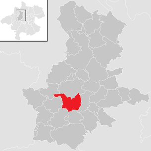
| Location of Hofkirchen an der Trattnach in the Grieskirchen district | ||
  |
||
| Source: Municipal data from Statistics Austria | ||

Hofkirchen an der Trattnach is an Austrian market town in Upper Austria in the Grieskirchen district in the Hausruckviertel with 1639 inhabitants (as of January 1, 2020). The community is located in the judicial district of Grieskirchen .
geography
Hofkirchen an der Trattnach is 389 m above sea level in the Hausruckviertel. The extension is 7.1 km from north to south, and 4.9 km from west to east. The total area is 17.9 km². 10.6% of the area is forested, 79.3% of the area is used for agriculture.
Community structure
The municipality includes the following 16 localities (population in brackets as of January 1, 2020):
- Aigen (90)
- Brunham (108)
- Alleys (83)
- Courtyard (48)
- Hofkirchen an der Trattnach (742)
- Jungroith (49)
- Panbruck (22)
- Pichl (40)
- Regnersdorf (67)
- Ruhringsdorf (83)
- Schallbach (26)
- Sinzing (16)
- Sommerfeld (31)
- Nursing (46)
- Strötting (67)
- Weng (121)
The community consists of the cadastral communities Gassen, Hofkirchen, Schallbach and Still.
Neighboring communities
| Wendling | Taufkirchen | |
| Rottenbach |
.svg)
|
St. Georgen |
| Women | Aistersheim |
history
After the Romans withdrew, the area was settled by the Bavarians in the 6th and 7th centuries . The oldest place names with the ending -ing, -ham and -kirchen are evidence of this. The noble seats Still, Sinzing, Brunham, Weng and Burgstall were created. During the reign of Duke Tassilo , the place was first mentioned in a document in 785. This oldest known document reports on the consensus donation by the Bavarian noble Lantperth, who lives here. He handed over large parts of his property to the Church of St. John in Trattnachtal and this to the bishopric of Passau.
After the victory over the Hungarians in 955 on the Lechfeld and the fortification of the Ostmark by the Babenbergs , the situation stabilized. The reclamation of the forests made it possible for the immigrant clans to take possession of the area.
The Thirty Years' War left its mark when Bavarian troops moved over the Hausruck in 1620 and, under their colonel Haslang, devastated the village for good. At that time the Gothic church also went up in flames and it took almost 100 years until it was restored as a baroque church by Pastor Prechensteiner 1712–1716.
The Peasants' War of 1626 and 1632, fought in the immediate vicinity, claimed great victims. The reprisals that began during the Counter-Reformation were even worse than the conditions during the war.
Under the French invasions in the years 1800–1801, 1805/1806 and 1809 Hofkirchen suffered from looting, forced deliveries and other coercive measures.
The liberation of the peasants by Hans Kudlich after 1848 released the population from serfdom and obedience.
The primary school was rebuilt in 1926, the market survey was in 1928.
The Second World War (1939–1945) claimed, as the war memorial testifies, numerous victims among the male population of the Hofkirche. After the end of the war, industrialization began and with it came economic prosperity. The municipal office, the secondary school were built, the local water pipeline was built, the place sewed, the Trattnach regulated and thereby the place protected from floods.
Population development
In 1991 the municipality had 1,478 inhabitants according to the census, in 2001 it had 1,508 inhabitants. If there was an emigration from 1991 to 2001, then from 2001 to 2011 both the birth balance and the migration balance are positive, so that the population rose to 1,596 in 2011.
Culture and sights
- The Catholic parish church Hofkirchen an der Trattnach was built between 1712 and 1716 under Dean Moritz Prechensteiner from Sarnthein in Tyrol with the baroque master builder Jakob Pawanger . The fresco painting was created by Wolfgang Andreas Heindl from Wels. The church tower was expanded with the Baroque master builder Johann Gotthard Hayberger from Steyr.
Economy and Infrastructure
traffic
Street
Hofkirchen is located directly on the B 141 Rieder Straße in the direction of Ried / Innkreis or Wels. The next motorway is the A8 (Innkreisautobahn) , which can be reached via the Haag or Meggenhofen driveways.
train
The nearest train stations are Obertrattnach-Markt Hofkirchen in the neighboring municipality of Taufkirchen an der Trattnach for regional trains and Grieskirchen and Neumarkt-Kallham for regional express connections to Linz and Passau.
Established businesses
- The heating technology company ETA Heiztechnik is based in Hofkirchen an der Trattnach.
education
- Primary school : The building was inaugurated in 1928. It was not until 1953 that the water pipe and in 1958 central heating was installed. Renovation work began in 1979 and lasted until 1981.
- New middle school : Construction began in 1973 and it was completed in 1975 (then as a secondary school ) and inaugurated in 1976. The NMS Hofkirchen is also used by the surrounding communities of Aistersheim , Taufkirchen an der Trattnach , Rottenbach , Weibern and St. Georgen .
- Landesmusikschule Hofkirchen an der Trattnach: the Landesmusikschule is a branch of the Landesmusikschule Grieskirchen and is located on the main road No. 24
politics
The municipal council has a total of 19 members. With the municipal council and mayoral elections in Upper Austria in 2015 , the municipal council has the following distribution: 10 ÖVP, 6 FPÖ and 3 SPÖ.
- Mayor since 1945
- 1945–1949 Karl Andessner
- 1949–1967 Johann Zahrhuber
- 1967–1990 Franz Eibelhuber (ÖVP)
- 1990–1991 Josef Königmair (ÖVP)
- since 1991 Alois Zauner (ÖVP)
coat of arms
The ibex is taken from the coat of arms of the pastor Moritz Prechensteiner, the greatest benefactor of the court church. The pale silver wave bar is reminiscent of the Trattnach. The four ears of wheat in the lower part of the escutcheon indicate and at the same time, with the green background, indicate the paramount importance of agriculture for the market.
Blazon : Divided by red and green by a silver, narrow wavy bar; above a silver, black armed, growing ibex, below four golden, fan-shaped outwardly inclined ears of wheat from the base of the shield.
The community colors are green-white-red
Town twinning
- Hofkirchen an der Donau in Bavaria , Germany , since 1976
Personalities
Sons and daughters of the church
- Johann Paul Kaltenbaeck (1804–1861), historical researcher
- Johann Anzengruber (1810–1844), writer, father of Ludwig Anzengruber
- Johann Pabst (1860–1926), politician ( CSP ), member of the House of Representatives 1907–1911
Web links
- Official website
- 40811 - Hofkirchen an der Trattnach. Community data, Statistics Austria .
- Further information about the municipality of Hofkirchen an der Trattnach on the geographic information system of the federal state of Upper Austria .
- Community data on Hofkirchen an der Trattnach. Upper Austrian provincial government, accessed on July 25, 2013 .
Individual evidence
- ↑ Statistics Austria: Population on January 1st, 2020 by locality (area status on January 1st, 2020) , ( CSV )
- ^ Statistics Austria, A look at the community Hofkirchen an der Trattnach, population development. Retrieved April 12, 2019 .
- ^ Community of Hofkirchen an der Trattnach, education. Retrieved April 12, 2019 .
- ^ Province of Upper Austria, results of the 2015 elections. Accessed on April 12, 2019 .
- ^ Province of Upper Austria, regional history of the municipality of Hofkirchen an der Trattnach
- ^ State of Upper Austria, history and geography, coat of arms. Retrieved April 12, 2019 .
- ^ Municipality of Hofkirchen an der Trattnach, worth knowing, partner municipality. Retrieved April 12, 2019 .
- ↑ https://www.parlament.gv.at/WWER/PARL/J1848/Pabst.shtml , accessed on June 21, 2020.

Aistersheim | Bad Schallerbach | Eschenau im Hausruckkreis | Gallspach | Gaspoltshofen | Geboltskirchen | Grieskirchen | Haag am Hausruck | Heiligenberg | Hofkirchen an der Trattnach | Kallham | Kematen am Innbach | Meggenhofen | Michaelnbach | Natternbach | Neukirchen am Walde | Neumarkt im Hausruckkreis | Peuerbach | Pollham | Pötting | Pram | Rottenbach | St. Agatha | St. Georgen near Grieskirchen | St. Thomas | Schlüßlberg | Steegen | Taufkirchen an der Trattnach | Great | Waizenkirchen | Wallern an der Trattnach | Women | Wendling