
Wendling
|
Wendling
|
||
|---|---|---|
| coat of arms | Austria map | |
 |
|
|
| Basic data | ||
| Country: | Austria | |
| State : | Upper Austria | |
| Political District : | Grieskirchen | |
| License plate : | GR | |
| Surface: | 12.82 km² | |
| Coordinates : | 48 ° 14 ′ N , 13 ° 40 ′ E | |
| Height : | 400 m above sea level A. | |
| Residents : | 854 (January 1, 2020) | |
| Population density : | 67 inhabitants per km² | |
| Postal code : | 4741 | |
| Area code : | 07736 | |
| Community code : | 4 08 34 | |
| NUTS region | AT311 | |
| Address of the municipal administration: |
Wendling 14 4741 Wendling |
|
| Website: | ||
| politics | ||
| Mayor : | Christian Perndorfer ( ÖVP ) | |
|
Municipal Council : (2015) (13 members) |
||
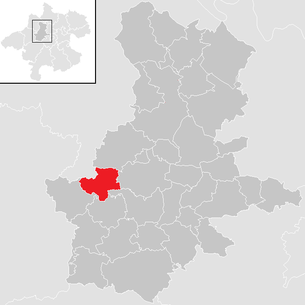
| Location of Wendling in the Grieskirchen district | ||
  |
||
| Source: Municipal data from Statistics Austria | ||

Wendling is a municipality in Upper Austria in the Grieskirchen district on the edge of the Hausruckviertel with 854 inhabitants (as of January 1, 2020). The community is located in the judicial district of Grieskirchen .
geography
Wendling is 400 m above sea level in the Hausruckviertel. The extension is 5.2 km from north to south and 4.5 km from west to east. The total area is 12.9 km². 9.3% of the area is forested, 79.1% of the area is used for agriculture.
Community structure
The municipality includes the following 21 localities (population in brackets as of January 1, 2020):
- Dötzledt (14)
- Corner (30)
- Fellhof (18)
- Alleys (9)
- Gugenedt (13)
- Hareding (8)
- Hub (13)
- Kubing (42)
- Fiefdom (13)
- March Village (14)
- Oberhof (37)
- Oberhöglham (34)
- Obernfurth (5)
- Pauredt (36)
- Penesedt (46)
- Perndorf (16)
- Unterhöglham (25)
- Weberndorf (22)
- Weeg (34)
- Wendling (379)
- Plucking (46)
The community consists of the cadastral communities Wendling and Zupfing.
Neighboring communities
| Dorf an der Pram ( district Schärding ) | Kallham | |
.svg)
|
Taufkirchen an der Trattnach | |
| Pram | Rottenbach | Hofkirchen an der Trattnach |
coat of arms
Blazon : In blue, two golden, diagonally crossed and overturned swords, including a silver water lily with a golden lug and golden sepals. The coat of arms was awarded to the municipality on March 3, 1980 by the Upper Austrian regional government. The origin of the coat of arms is the legend “The water lily of Wendling”, which Georg Stibler wrote in poetry on August 28, 1928 in Bad Goisern.
The community colors are green-yellow-green.
history
The settlement should have taken place in the 7th century. A naming Vuentilborth or Zuentipolch comes around 925 (927) in the Salzburg document book I.Bd. P. 154 in De complacitatione Adalungi nobilis diaconi . On January 9, 1475 it was called Wendelgering and around 1557 Wenndling . Until the founding of the local community in 1848 , the farmers were liable to pay ten fees to the Erlach , Starhemberg near Haag, Lambach monastery , Wels Castle , the parish of Kallham and others.
A church building dedicated to St. Ulrich appears around 1200 to 1220. In 1508 the originally Gothic church was rebuilt and enlarged. During the local fire on October 1, 1884 (total damage 76,021 guilders), the church tower also burned down. In 1901 the new tower was built. The pointed tower rises 48 m high and was the model for the church tower in Schwanenstadt. The branch church of St. Georg in Zupfing has been donated since 1466. The Wendling parish has been administered and looked after from Pram since August 1, 1970: it was an independent parish from 1891, previously the parish was a branch of Kallham.
The municipality of the cadastral communities Wendling and Zupfing was in the judicial district of Haag am Hausruck and since July 1, 1911 in the west of the political district of Grieskirchen (previously Ried im Innkreis). Since January 1st, 2003 it has been part of the judicial district of Grieskirchen.
politics
Mayor is Christian Perndorfer from the ÖVP.
Population development
In 1991 the community had 765 inhabitants according to the census, in 2001 it had 831 inhabitants. The increase occurred because both the birth balance and the migration balance were positive. From 2001 to 2011 there was an emigration that could no longer be offset by the birth balance, so that the population fell to 807.
Culture and sights
Others
The competition group of the volunteer fire brigade of the Weeg district won one of the silver medals for the first time at the Xth CTIF International Fire Brigade Competition in 1993 in Berlin. At the International Fire Brigade Competitions in Herning (Denmark) in 1997, in Kuopio (Finland) in 2001, in Varaždin (Croatia) in 2005, in Ostrava (CZ) in 2009 and in Mühlhausen (France) in 2013, the Weeg competition group won one of the 25 gold medals to be awarded .
Web links
- Community website
- Map in the Digital Upper Austrian Room Information System ( DORIS )
- Further information about the municipality of Wendling can be found on the geographic information system of the federal state of Upper Austria .
Individual evidence
- ↑ Statistics Austria: Population on January 1st, 2020 by locality (area status on January 1st, 2020) , ( CSV )
- ↑ Wendling's water lily . wendling.riskommunal.net. Retrieved November 12, 2019.
- ^ State of Upper Austria, history and geography, coat of arms. Retrieved April 13, 2019 .
- ^ Province of Upper Austria, results of the 2015 elections (PDF) Retrieved on April 13, 2019 .
- ^ Statistics Austria, A look at the community Wendling, population development. (PDF) Retrieved April 13, 2019 .

Aistersheim | Bad Schallerbach | Eschenau im Hausruckkreis | Gallspach | Gaspoltshofen | Geboltskirchen | Grieskirchen | Haag am Hausruck | Heiligenberg | Hofkirchen an der Trattnach | Kallham | Kematen am Innbach | Meggenhofen | Michaelnbach | Natternbach | Neukirchen am Walde | Neumarkt im Hausruckkreis | Peuerbach | Pollham | Pötting | Pram | Rottenbach | St. Agatha | St. Georgen near Grieskirchen | St. Thomas | Schlüßlberg | Steegen | Taufkirchen an der Trattnach | Great | Waizenkirchen | Wallern an der Trattnach | Women | Wendling