|
Municipality of Calabanga
|
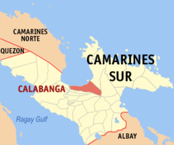
| Location of Calabanga in the Camarines Sur province
|
|
| Basic data
|
|
Region :
|
Bicol region
|
|
Province :
|
Camarines Sur
|
|
Barangays :
|
48
|
|
District:
|
2. District of Camarines Sur
|
|
PSGC :
|
051708000
|
|
Income class :
|
2nd income bracket
|
|
Households :
|
12,444 May 1, 2000 census
|
|
Population :
|
83.033 August 1, 2015 census
|
| Coordinates : |
13 ° 43 ' N , 123 ° 14' E Coordinates: 13 ° 43 ' N , 123 ° 14' E13.716666666667 123.23333333333
|
|
Mayor :
|
Evelyn S. Yu
|
| Geographical location in the Philippines
|
|
|
Calabanga is a Filipino municipality in the Camarines Sur Province . It has 83,033 inhabitants (August 1, 2015 census).
Barangays
Calabanga is politically divided into 48 barangays .
- Balatasan
- Balombon
- Balongay
- Belen
- Bigaas
- Binanuaanan Grande
- Binanuaanan Pequeño
- Binaliw
- Bonot Santa Rosa
- Burabod
- Cabanbanan
- Cagsao
- Camuning
- Comaguingking
- Del Carmen (Pob.)
- Dominorog
|
- Fabrica
- Harobay
- La Purisima
- Lugsad
- Manguiring
- Pagatpat (San Jose)
- Paolbo
- Pinada
- Punta Tarawal
- Quinale
- Sabang
- Salvacion-Baybay
- San Antonio Poblacion
- San Antonio (Quipayo)
- San Bernardino
- San Francisco (Pob.)
|
- San Isidro
- San Lucas
- San Miguel (Pob.)
- San Pablo (Pob.)
- San Roque
- San Vicente (Pob.)
- Santa Cruz Ratay
- Santa Cruz Poblacion
- Santa Isabel (Pob.)
- Santa Salud (Pob.)
- Santo Domingo
- Santo Niño (Quipayo)
- Siba-o
- Sibobo
- Sogod
- Tomagod death
|
politics
Mayor is Eddie Severo
economy
Coconut , rice , abacá and corn are the main agricultural products. Most of the residents are employed in agriculture or fishing.


