Bato (Camarines Sur)
| Municipality of Bato | ||
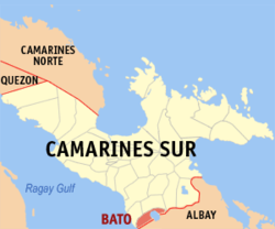
| Location of Bato in the Camarines Sur province | ||
|---|---|---|

|
||
| Basic data | ||
| Region : | Bicol region | |
| Province : | Camarines Sur | |
| Barangays : | 33 | |
| District: | 4. Camarines Sur district | |
| PSGC : | 051703000 | |
| Income class : | 3rd income bracket | |
| Households : | 7737 May 1, 2000 census
|
|
| Population : | 52,137 August 1, 2015 census
|
|
| Population density : | 528.1 inhabitants per km² | |
| Area : | 98.720 km² | |
| Coordinates : | 13 ° 21 ′ N , 123 ° 22 ′ E | |
| Mayor : | Jeanette Bernaldez | |
| Geographical location in the Philippines | ||
|
|
||
Bato is a Philippine municipality in the province of Camarines Sur . It has 52,137 inhabitants (August 1, 2015 census). The community lies on the important north-south connection, the Maharlika Highway . Bato is located on the shores of Lake Bato , which is part of the Bicol River catchment area .
Barangays
Bato is politically divided into 33 barangays .
|
|
|
