Cape St. Rochus
| Cape St. Rochus | ||
| Geographical location | ||
|
|
||
| Coordinates | 5 ° 28 '57 " S , 35 ° 15' 41" W | |
| Waters 1 | Atlantic Ocean | |
The Cape St. Rochus ( Portuguese Cabo de São Roque , Spanish Cabo San Roque , English Cape Saint Roch , French Cap Saint Roque (or Saint Roc )) in the far east of Brazil is the northeast tip of South America and is the nearest point of the South American continent for african coast . It is named after the 14th century popular Saint Roch of Montpellier , whose festival is celebrated on August 16th.
geography
The cape is located in the north of the Brazilian state Rio Grande do Norte about 50 km north of its capital Natal in the municipality of Maxaranguape.
The cape forms the dividing point between the two main coasts of Brazil. While the coast of French Guiana to Cape St. Roch mostly flat and swampy (especially in the Amazon - Delta ), it is in the south mountainous significantly from Cape St. Roch, with many bulges and bays where the greatest Cities in the country are located from Salvador (Bahia) to Rio de Janeiro .
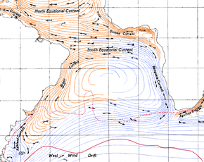
Similarly, the Cape forms a prominent point for ocean currents : Here comes from the Gulf of Guinea to the South Equatorial Current at which divides into two branches: the Brazil Current (to the south) and the current towards Guyana, along with the North Equatorial Current to the Caribbean , where it later continues in the Gulf Stream .
The RN-160 road (Avenida Cabo de São Roque) passes the cape. South of the cape is a lighthouse (Farol São Roque) and the Árvore do Amor ("Tree of Love").
history
The Cabo de São Roque played an important role in seafaring explorations at the end of the 15th and beginning of the 16th century: Amerigo Vespucci stopped here after following the South American coast from Maracaibo . On Jean de Léry's return journey from Antarctic France (France Antarctique) under Villegagnon in February 1558, the Cape "inhabited by savages" (habité de certains sauvages) was not called despite the shortage of food and the prospect of fresh water.
See also
References and footnotes
- ↑ Cabo de São Roque é o Brasil mais perto da África (photo)
- ↑ Video (Árvore do Amor - Cabo de São Roque - Maxaranguape)
- ↑ Location: 05º 29.33 'S / 35º 15.70' W ( Serviço de Sinalização Náutica do Nordeste ) - mar.mil.br
- ^ Jean de Léry: Histoire d'un voyage faict en la terre du Brésil . 1580, chap. 21 (Paris edition 1880) - fr.wikisource

