
Chamanna Jenatsch
| Chamanna Jenatsch SAC hut |
||
|---|---|---|
 Chamanna Jenatsch |
||
| location | At the back in Val Bever , between Piz Picuogl and Piz Jenatsch; Canton of Graubünden / Switzerland ; Valley location: Bever | |
| Mountain range | Albula Alps | |
| Geographical location: | 775 356 / 155666 | |
| Altitude | 2651 m above sea level M. | |
|
||
| builder | SAC section Bernina | |
| owner | SAC - Bernina section | |
| Built | 1908, reconstruction in 1974, new building in 1993 | |
| Construction type | hut | |
| Usual opening times | Opened from the end of June to approx. October 20, over Christmas / New Years and from the beginning of February to approx | |
| accommodation | 6 beds, 69 camps , 4 emergency camps | |
| Winter room | 18 bearings | |
| Web link | Chamanna Jenatsch | |
| Hut directory | SAC | |

The Chamanna Jenatsch ( , Rhaeto-Romanic in the idiom Puter for Jenatschhütte ) is a mountain hut of the Swiss Alpine Club (SAC), Bernina section, in the canton of Graubünden in Switzerland . The hut is located at 2651 m above sea level. M. in Val Bever on a hill (knoll next to the house 2653 m above sea level ), between Piz Picuogl and Piz Jenatsch. This makes it the highest SAC hut in Graubünden.
In addition to 75 beds, divided into five rooms between 4 and 19 camps, the three double rooms Armonia Dschimels , Muntanella Suita and Dschember Suita and, since summer 2017, a small wooden house with a double bed and a sauna with a wood stove. The three-story hut is manned from the end of June to approx. October 20, over Christmas / New Year and from the beginning of February to approx. The hut has toilets and washing facilities in the house as well as running water even in winter. There is also a landline telephone connection and an emergency radio.
history
The Chamanna Jenatsch was built in 1908 by the Bernina section of the Swiss Alpine Club. In 1974 a renovation took place and in 1993 a completely new building took place.
The hut is named after the rebellious pastor, military leader and Graubünden folk hero Jörg Jenatsch , who was responsible for the liberation of part of today's Canton of Graubünden during the Thirty Years' War by forcing the anti- Spanish French Duke Rohan to withdraw.
Approaches
From Spinas
- Starting point: Spinas ( 1816 m )
- Route: through the Val Bever , past the Alp Suvretta
- Difficulty: mountain hiking (T2)
- Time required: 4 hours
From the Julier Pass
- Starting point: road bend below La Veduta on the Julier Pass ( 2200 m )
- Route: Through the Val d'Agnel , across the Fuorcla d'Agnel ; first section of the Haute Route Graubünden
- Difficulty: Demanding mountain hiking (T3)
- Time required: 3.5 hours
From the Suvretta pass
- Starting point: Champfèr ( 1800 m ) or Piz Nair (cable car, 3022 m )
- Route: Pass Suvretta, over the Fuorcla Suvretta
- Difficulty: Alpine hiking (T4)
- Time required: 3.5 hours from Piz Nair, 5 hours from Champfèr
From the Oberhalbstein
- Starting point: Tigias on Alp Flix ( 1975 m )
- Route: Via the Fuorcla da Flix
- Difficulty: Alpine hiking (T4)
- Time required: 4.5 hours
From the Albula valley
- Starting point: Naz near Preda ( 1747 m )
- Route: Via the Fuorcla da Bever ; second section of the Haute Route Graubünden
- Difficulty: demanding alpine hiking (T5)
- Time required: 6.5 hours
Tours
The hut is suitable as a starting point for hikes along marked mountain trails as well as for glacier, ski and mountain tours in the pathless mountains. Typical of the tours from the Chamanna Jenatsch is the lonely, wide and calm landscape.
The next peaks are Piz Jenatsch , Piz d'Agnel , Tschima da Flix , Piz Calderas , Piz d'Err , Piz Picuogl , Piz Surgonda , Piz Suvretta and Piz Traunter Ovas .
The hut is a stage stop on the demanding, partly pathless long-distance hiking trail (in winter as a ski or snowshoe tour) Haute Route Graubünden (also Bündner Haute Route), which leads from the Julier Pass to the Flüela Pass.
location


panorama

gallery

Piz Traunter Ovas taken from Val Bever, on the way towards Chamanna Jenatsch

Flagpole of the Chamanna Jenatsch

Signpost at the Jenatschhütte
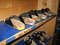
Chamanna Jenatsch slippers


Web links
- Site of the hut
- Panorama from the Chamanna Jenatsch
- Tour reports
- TV report on Swiss television
- Names of alpine refuges
- Bündner Haute Route
literature
- Manfred Hunziker: Club Guide Bündner Alpen Volume 6 (From Septimer to Flüela). 3rd edition, Verlag des SAC, 2000, ISBN 3859021877 .
- Vital Eggenberger: Ski tours Graubünden South (Oberhalbstein / Albula / Davos / Engadin). 1st edition, Verlag des SAC, 2010, ISBN 3859023012 .
- Remo Kundert, Marco Volken: Huts in the Swiss Alps. 9th edition, Verlag des SAC, 2011, ISBN 3859023462 .