
Piz d'Agnel
| Piz d'Agnel | ||
|---|---|---|
 Piz d'Agnel, taken from the Val d'Agnel |
||
| height | 3204.4 m above sea level M. | |
| location | Canton of Graubünden , Switzerland | |
| Mountains | Albula Alps | |
| Dominance | 0.83 km → Tschima da Flix | |
| Notch height | 140 m ↓ Fuorcla da Flix | |
| Coordinates | 773 705 / 153 633 | |
|
||
| First ascent | Johann Eschmann, August 1835, or Jakob Sulzberger, 1828 | |
| Normal way | Over the northwest slope | |
 Steinmann on the Piz d'Agnel, in the background Piz Julier , the Bernina group and Monte Disgrazia . |
||
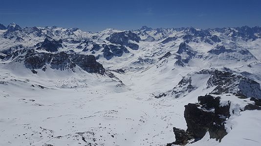
 Piz d'Agnel, recorded by Tschima da Flix |
||

The Piz d'Agnel (too Rhaeto-Romanic in the idiom Puter agnè , pl. Agnels for 'lamb') is a mountain northeast of Bivio and west of St. Moritz in the canton of Graubünden in Switzerland at an altitude of 3,204 m above sea level. M. It is often climbed from the Julier Pass or the Jenatschhütte , especially in winter . The main summit is a slender, steeply sloping rock pyramid to the east with a broad northwest ridge. In the east there are three other peaks that are not listed on the national map. The south ridge runs to Piz Campagnung . There are also two unlisted peaks there.
Location and surroundings

The Piz d'Agnel belongs to the Err area , a subgroup of the Albula Alps . The municipal boundary between Surses and Bever runs above the summit . The Piz d'Agnel is bordered in the east by the Val Savriez, in the south-east by the Val da Natons, in the south-west by the Val d'Agnel and in the north-east by the Val da Bever.
The neighboring peaks include the Tschima da Flix and Piz Picuogl in the north, the Piz Surgonda in the east, and Piz Bardella , Piz Campagnung and Piz Neir in the south.
On the northeast flank, the Piz d'Agnel has a glacier, the Vadret d'Agnel .
Valley locations are Bivio , Marmorera and Sur . Frequent starting points are the Julierpass and the Jenatschhütte .
Routes to the summit
Summer routes
Over the northwest slope
- Starting point: Tigias ( 1975 m ), Jenatschhütte ( 2652 m ) or Julierpassstrasse ( 2200 m )
- Via: Fuorcla da Flix ( 3065 m )
- From Tigias south of Ava da las Tigias, past the two ponds ( 2547 m and 2540 m ) to the saddle in the west ridge of Piz d'Agnel (P. 2741), then first over the ridge, later to the northeast to Fuorcla da Flix
- From the Jenatschhütte first on the way to Fuorcla d'Agnel to the apron of the Vadret d'Agnel. Then through the moraine valley and over firn to Fuoarcla da Flix
- From the Julier Pass road through the Val d'Agnel to Fuorcla d'Agnel, then with little loss of altitude over the northern slope of the Piz d'Agnel east ridge into the moraine valley and now to Fuoarcla da Flix
- 3½ hours from Tigias
- 2 hours from the Jenatschhütte
- 3½ hours from the Julier Pass road
- Comment: First ascent by Ludwig Theobald in August 1861
Over the east ridge
- Starting point: Jenatschhütte ( 2652 m ) or Julierpassstrasse ( 2200 m )
- Via: Fuorcla d'Agnel
- Difficulty: ZS
- Time required: 4½ hours from the Jenatschhütte or 6 hours from the Julierpass road (3½ hours from the Fuorcla d'Agnel)
- Comment: Not a solid rock
Over the south ridge
- Starting point: Piz Campagnung ( 2826 m )
- Via: P. 3001
- Difficulty: ZS
- Time required: 2½ hours from Piz Campagnung
- Note: For routes and duration to Piz Campagnung, see the Piz Campagnung article .
Winter routes

From the Jenatschhütte
- Starting point: Jenatschhütte ( 2652 m )
- Via: In safe conditions via the summer path, otherwise a short descent to P. 2487 and beyond up to Fuorcla da Flix ( 3065 m ), then over the western slope or without skis over the northwest ridge to the summit (note the wächten to the north).
- Exposures: NW
- Difficulty: WS +
- Time required: 2 hours
From the Julierpassstrasse
- Starting point: Julierpassstrasse ( 2200 m )
- Via: Val d'Agnel, Fuorcla d'Agnel ( 2983 m ), Vadret d'Agnel, Fuorcla da Flix ( 3065 m ), then over the western slope or without skis over the north-western ridge to the summit (note the widening glaciers to the north).
- Exposures: N, S
- Difficulty: WS +
- Time required: 3½ hours
Departure to Bivio or Marmorera
- Destination: Bivio ( 1769 m ) or Marmorera ( 1708 m )
- Via: Fuorcla da Flix ( 3065 m ), Val da Natons, Alp Natons
- Exposures: SW
- Difficulty: ZS
- Note: only in safe conditions, especially the avalanche danger in the Val da Natons due to the sun's rays. Protected area near Stalveder.
panorama

gallery

(from left to right) Piz d'Err , Piz Calderas , Tschima da Flix , Piz d'Agnel (just above the ridge) and Piz Neir , recorded between Riom and Parsonz .
View to the south through the Val d'Agnel to the Julier Pass road .

View to the southeast to (from left to right) Piz Surgonda , Piz Julier and the Bernina group .

View to the north to Tschima da Flix (left) and Piz Picuogl (right).


literature
- Manfred Hunziker: Club guide, Bündner Alps . From the Septimer to the Flüela. 3. Edition. Vi. Verlag des SAC, 2000, ISBN 3-85902-187-7 , p. 164-168 .
- Vital Eggenberger: Ski tours Graubünden South . Verlag des SAC, 2010, ISBN 978-3-85902-301-7 , pp. 222-224 .
- National map of Switzerland, sheet 1256 Bivio, 1: 25,000, Federal Office of Topography, 2011 edition.
Web links
Individual evidence
- ^ Manfred Hunziker: Club guide, Bündner Alps . From the Septimer to the Flüela. 3. Edition. Vi. Verlag des SAC, 2000, ISBN 3-85902-187-7 , p. 164 .
- ↑ Andrea Schorta: How the mountain got its name . Small Rhaetian name book with two and a half thousand geographical names of Graubünden. Terra Grischuna Verlag, Chur and Bottmingen / Basel 1988, ISBN 3-7298-1047-2 , p. 62 .