
Piz Calderas
| Piz Calderas | ||
|---|---|---|
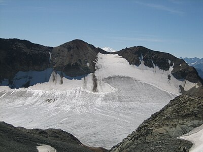
 Southwest view of the Piz Caldera |
||
| height | 3397 m above sea level M. | |
| location | Canton of Graubünden , Switzerland | |
| Mountains | Albula Alps | |
| Dominance | 16.45 km → Piz Kesch | |
| Notch height | 1085 m ↓ Albula Pass | |
| Coordinates | 773 147 / 156 393 | |
|
||
| First ascent | August 5, 1857 by J. Coaz and L. Rimathé | |
| Normal way | From the southeast over the Vadret Calderas, ( L ) | |
| particularities | Highest mountain in the Oberhalbstein | |

The Piz Calderas ( Romansh in the idiom Surmiran for boiler , pool , cirque , valley ) is a mountain northeast of Sur in the canton of Grisons in Switzerland with a height of 3397 m . It is the highest point on the Oberhalbstein .
Location and surroundings
The Piz Calderas belongs to the Calderas group in the Err area , which in turn belongs to the Albula Alps . The municipal boundary between Surses and Bever runs over the summit . The Piz Calderas is bordered in the east by the Val Bever and in the west by the Oberhalbstein .
The Piz Caldera's direct neighboring peaks include Piz d'Err in the north, Piz Jenatsch in the northeast , Piz Picuogl and Tschima da Flix in the south and Piz Cucarnegl in the west .
The Piz Calderas has two glaciers. In the north this is the Vadret d'Err and in the south the Vadret Calderas .
Valley locations are Sur and Bever. The starting points are the Chamanna Jenatsch and Spinas in the east, the Alp Flix near Sur in the west and the Julier Pass in the south.
Routes to the summit
The Piz Calderas is one of the most beautiful panoramic mountains in Central Grisons. It is easy to reach on skis and offers a rewarding descent. It is usually approached from Chamanna Jenatsch or from Alp Flix.
From the southeast over the Vadret Calderas
Normal and winter route.
- Difficulty: L
- Time required: 2.5 hours
- Starting point: Chamanna Jenatsch ( 2652 m )
From the southwest
Can only be recommended to good alpinists.
Over the southwest ridge
Over the Piz Cucarnegl.
Through the northwest couloir
In the upper part 45 ° inclination.
Over the north ridge
From the Chamanna Jenatsch
- Difficulty: ZS
- Time required: 2.5 hours
- Starting point: Chamanna Jenatsch ( 2652 m )
From Alp Flix
Over the east ridge
- Difficulty: ZS
- Time required: 3.5 hours
- Starting point: Chamanna Jenatsch ( 2652 m )
panorama

gallery

Summit of Piz Caldera from the northwest

Piz Calderas (r) and Piz d'Err , recorded in Riom-Parsonz

Piz Calderas, photographed by Tschima da Flix
Vadret Calderas and Tschima da Flix on the ascent to Piz Calderas

Very steep firn couloir below the glacier saddle between Piz Calderas and Tschima da Flix (see route from the southwest )


literature
- Eugen Wenzel, Paul Gross: Club Guide, Bündner Alpen, Volume VI (Albula) 2nd edition, Verlag des SAC, 1980, ISBN 3-85902-012-9 , pp. 84-88
- National map of Switzerland, sheet 1256 Bivio, 1: 25000, Federal Office of Topography, edition 2003
- Faust Signorell, Vocabulari - dictionary surmiran-tudestg / deutsch-surmiran , Lehrmittelverlag Graubünden 1999
Web links
- Panorama from Piz Calderas
- www.hikr.org Various tour reports
- www.summitpost.org Tourism