Chambly (Quebec)
| Chambly | ||
|---|---|---|
 View of the Saint-Joseph-de-Chambly church |
||
| Location in Quebec | ||
|
|
||
| State : |
|
|
| Province : | Quebec | |
| Administrative region : | Montérégie | |
| MRC or equivalent : | La Vallée-du-Richelieu | |
| Coordinates : | 45 ° 27 ′ N , 73 ° 17 ′ W | |
| Height : | 7 m | |
| Area : | 25.11 km² | |
| Residents : | 25,571 (as of 2011) | |
| Population density : | 1,018.4 inhabitants / km² | |
| Time zone : | Eastern Time ( UTC − 5 ) | |
| Municipality number: | 57005 | |
| Postal code : | J3L | |
| Area code : | +1 450 and 579 | |
| Mayor : | Denis Lavoie | |
| Website : | www.ville.chambly.qc.ca | |
 Location of Chambly in the MRC La Vallée-du-Richelieu |
||
Chambly is a city in the southwest of the Canadian province of Quebec . It is located in the Montérégie region , just under 30 kilometers southeast of Montreal . Chambly belongs to the regional municipality of La Vallée-du-Richelieu , has an area of 25.11 km² and has 25,571 inhabitants (2011).
geography
Chambly is located on the left bank of the Rivière Richelieu , a major tributary of the Saint Lawrence River . The city emerged at the bottom of a series of rapids . Ships can avoid this on the 19 kilometer long Chambly Canal , which leads south to Saint-Jean-sur-Richelieu . To the north of the rapids, the river widens to the Bassin de Chambly.
Neighboring municipalities are Carignan in the west and north, Saint-Mathias-sur-Richelieu in the northeast, Richelieu in the east, an exclave of Carignan in the southeast and Saint-Jean-sur-Richelieu in the south.
history
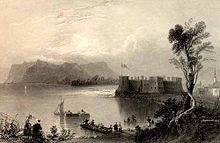
The name of the town refers to the officer Jacques de Chambly , commander of a garrison of the Carignan Salières regiment . He had Fort Saint-Louis built below the rapids in 1665. The two subsequent fortifications built in 1702 and 1709 were named Fort Chambly . For several decades, the fortress was a key part of the defense chain along the Rivière Richelieu, as this was the ideal place for an invasion of New France .
In 1760 the British took possession of the fort; in 1775/76 it was occupied by the American Continental Army. A settlement developed around the fort, which grew rapidly , especially after the opening of the Chambly Canal in 1843. Numerous industrial plants emerged, especially mills that used the river's water power. In 1848 the municipality of Chambly-Canton was founded, and seven years later the municipality of Bassin-de-Chambly. In 1952 it was renamed Fort-Chambly or Chambly. Eventually both parishes merged in 1965 to form the city of Chambly.
From 1912 to 1956, the Montreal and Southern Counties Railway , an interurban tram, connected Chambly with Montreal and Granby . Since 2000, Chambly has been a member of the Communauté métropolitaine de Montréal association . There are partnerships with the French cities of Chambly (Oise) and Fréhel .
Attractions
There are three historic sites in Chambly that are under special protection as National Historic Sites . These are Fort Chambly , the Chambly Canal and the Maison De Salaberry (built in 1815 as the residence of Major Charles-Michel de Salaberry ). Also worth seeing is the neo-Gothic church of Saint-Joseph de Chambly, built in 1880/81.
population
According to the 2011 census, Chambly had 25,571 inhabitants, which corresponds to a population density of 1018.4 inh / km². 91.5% of the population stated French as their main language, the share of English was 4.7%. 0.9% said they were bilingual (French and English), other languages and multiple answers accounted for 2.9%. Only French spoke 49.8%. In 2001, 89.7% of the population were Roman Catholic , 3.8% Protestant and 4.9% of no religion.
Economy and Transport
Chambly gained fame especially for the local brewery Unibroue and the annual beer festival that has been taking place since 2002. There are also other companies in the food and construction industries. Many residents are commuters who work in the Montreal area.
Autoroute 10 , the freeway between Montreal and Sherbrooke, runs south of the city . In addition, the Autoroute 35 branches off there to Saint-Jean-sur-Richelieu. Route 112 is an important main road . The bus company CIT Chambly-Richelieu-Carignan is responsible for public transport and also offers direct lines to Montreal and Longueuil .
Town twinning
Chambly has a partnership with the two French cities of Fréhel and Chambly (Oise) .
Personalities
- Emma Albani (1847–1930), soprano
- Denis Herron (* 1952), ice hockey player
- Cornélia Nelly Lajeunesse (1849 or 1845-after 1930), Canadian singer, pianist and music teacher
- Etienne Provost (1785–1850), trapper and explorer
- Ricardo Larrivée (* 1967), hotel manager, TV presenter and author
- David Coderre , creator of computerized accounting tools
photos
Web links
Individual evidence
- ↑ a b Chambly. Commission de toponymie du Québec, accessed January 3, 2013 (French).
- ↑ Historique. Ville de Chambly, accessed January 3, 2013 (French).
- ^ Montreal and Southern Counties Railway. TrainWeb, accessed January 3, 2013 .
- ↑ Population profile of the municipality of Chambly. In: 2011 Census. Statistics Canada , 2011, accessed January 8, 2014 (French).
- ↑ Population profile of the municipality of Chambly. In: 2001 Census. Statistics Canada , 2001, accessed January 8, 2014 (French).


