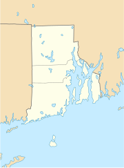
Cranston (Rhode Island)
| Cranston | ||
|---|---|---|
 |
||
| Location in Rhode Island | ||
|
|
||
| Basic data | ||
| Foundation : | 1754 | |
| State : | United States | |
| State : | Rhode Island | |
| County : | Providence County | |
| Coordinates : | 41 ° 46 ′ N , 71 ° 27 ′ W | |
| Time zone : | Eastern ( UTC − 5 / −4 ) | |
| Residents : | 80,387 (as of 2010) | |
| Population density : | 1,086.3 inhabitants per km 2 | |
| Area : | 77.5 km 2 (approx. 30 mi 2 ) of which 74 km 2 (approx. 29 mi 2 ) are land |
|
| Height : | 19 m | |
| Area code : | +1 401 | |
| FIPS : | 44-19180 | |
| GNIS ID : | 1218689 | |
| Website : | www.cranstonri.com | |
| Mayor : | Allan Fung | |
Cranston (formerly Pawtuxet ) is an American city in Rhode Island in Providence County . It is part of the Providence Metropolitan Area , a metropolitan area around the city of Providence with more than 1.5 million inhabitants on the Atlantic coast about 200 km northeast of New York .
geography
Cranston is located on the west side of Narragansett Bay , which stretches about 40 km south of Providence and flows into the Atlantic Ocean in the Rhode Island Sound . The distance to the city of Providence, which is almost due north of Cranston, is about ten kilometers.
The urban area has an area of 77.5 km². The city is crossed by four highways: Interstates I 95 and I 295 and Rhode Island Routes RI 10 and RI 37. There are also several federal highways running through the city. Rail transport does not play a role in the local transit system, because although an Amtrak line runs through the Cranston area, there is no stop there. Public transport is mainly handled by the Rhode Island Public Transit Authority (RIPTA) bus routes .
The city has several historic attractions, including the the National Register of Historic Places contained Sprague Mansion from the 18th century and one of the oldest houses in Rhode Iceland, the Thomas Fenner House of about 1677. In 1886, was in today's stage of Pawtucket the Racecourse of Narragansett Park opened, the first in the country.
population
The 2000 census showed 79,269 residents, making Cranston the third largest city in the state of Rhode Island. Almost 90% of the residents were white , the remaining proportion was almost equally divided between African-Americans , Asians and Hispanics . The per capita income was $ 21,978, with just over 7% of the population living below the poverty line.
history
In 1638 Roger Williams bought together with 12 other men from the Narraganset Indians in the "Pawtuxet Purchase" (analogous: Pawtuxet land purchase ) the area in the "South Woods". This area is now the eastern part of present-day Cranston, including Pawtuxet Village , which is partly on the area of present-day Warwick . William Arnold was the first European to settle in what is now the municipality; in 1638 he built a house about one and a half kilometers north of Pawtuxet Falls , near what is now Warwick Avenue.
In 1662, on the occasion of the "Meschanticut Purchase", the western part of the municipality of today's city was bought. Since the boundaries were not precisely described in this agreement, a dispute that lasted for years arose which was not settled until 1714, so that the south and west borders of Cranston could be determined.
In 1754 the parish of Cranston was founded as a self-governing area as it is today. At that time it had 1,460 inhabitants. When it was founded, the northern border was also determined, which has changed over time, because at that time it also included parts of South Providence, Elmwood and Washington Park. The city received city rights in 1910.
sons and daughters of the town
- William Sprague (1799-1856), politician
- Hugh Duffy (1866–1954), major league baseball player and manager
- Robert Aldrich (1918–1983), director
- William H. Sullivan (1922–2013), Foreign Service Diplomat
- George Masso (1926–2019), jazz musician
- Vinny Pazienza (* 1962), light, medium and super middleweight boxing world champion
- Carl V. Dupré (* 1965), screenwriter
- Jack Capuano (* 1966), ice hockey player and coach
- David Quinn (born 1966), ice hockey player and coach
- David Emma (born 1969), ice hockey player
- Rob Gaudreau (* 1970), ice hockey player
- Anthony Zinno (born 1981), poker player
Individual evidence
- ^ History of Cranston. The City of Cranston, RI - Historic District Commission
