
Crap Farreras
| Crap Farreras | ||
|---|---|---|
 Crap Farreras, taken from the south |
||
| height | 2227 m above sea level M. | |
| location | Canton of Graubünden , Switzerland | |
| Mountains | Oberhalbsteiner Alps | |
| Dominance | 0.05 km → Piz Martegnas | |
| Notch height | 3 m | |
| Coordinates | 761 510 / 160004 | |
|
||
 Barbecue, telescope, dining table and flagpole on the Crap Ferreras |
||

The Crap Farreras ( Surmiran crap , stone 'and Ferrera , iron mine') is a mountain southwest of Savognin in the canton of Grisons in Switzerland with a height of 2227 m above sea level. M. The proximity to the mountain lifts of Savognin lifts it in summer is an easy-to-reach mountain. In addition, the Naladas ski lift is only approx. 110 m north of Crap Farreras, which means that the mountain can be reached without great effort even in winter. At the culmination there is a grill with available firewood , a telescope where the names of the surrounding peaks are displayed, a terrace with dining table and benches and a flagpole with a summit book . On the southeast side there is a small climbing garden with some marked routes.
Location and surroundings
The Crap Farreras is a shoulder of the Piz Martegna Southeast Council. It belongs to the Piz Curvér group , a subgroup of the Oberhalbsteiner Alps and is located in the municipality of Surses .
The neighboring peaks include Piz Martegnas, Piz Bovs , Piz Cartas , Crest'Ota , Piz Mez and Piz Arlos .
The farthest visible point ( 46 ° 49 ′ 3 ″ N , 9 ° 48 ′ 27.9 ″ E ) from Crap Farreras is on the ridge between the Schiahorn and the Chlein Schiahorn northwest of Davos and is 33.9 km away .
The mountain is located in the middle of the Savognin Bergbahnen ski area . The mountain station of the Naladas ski lift is located northwest of the summit . 200 m to the north there is a milking stall belonging to the Kuhalp Alp Naladas. There is a small climbing garden on the southeast flank.
Valley locations are Riom and Parsonz . Frequent starting points are the mountain station of the Somtgant or Tigia cable car.
Routes to the summit
An alpine road leads up to 30 m before the summit.
From Somtgant
- Starting point: Somtgant ( 2103 m ), the mountain station of the Savognin Bergbahnen gondola lift
- Via: Colms da Parsonz
- Difficulty: T1 , B
- Time required: ½ hours
From Tigia
- Starting point: Tigia ( 1846 m )
- Via: Alp Naladas ( 2011 m )
- Difficulty: T1 , B
- Time required: 1¼ hours
panorama

gallery
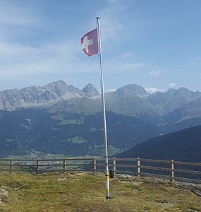
Flagpole with a container for the summit book on the Crap Farreras.

Mountain station of the Naladas ski lift of the Savognin Bergbahnen , which is located a little northwest of the summit.
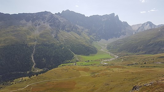
Looking south over radons, in the background v. l. No. Piz Arblatsch , Piz Forbesch , Piz Platta and Piz Cagniel .


literature
- Manfred Hunziker: Club guide, Bündner Alps . Obverse. 1st edition. tape III . Verlag des SAC, 1994, ISBN 3-85902-140-0 , p. 293 .
- National map of Switzerland, sheet 1236 Savognin, 1: 25,000, Federal Office of Topography, 2009 edition.
Web links
- Calculated 360 ° panorama of the Crap Farreras
- Tour reports on www.hikr.org
Individual evidence
- ↑ Andrea Schorta: How the mountain got its name . Small Rhaetian name book with two and a half thousand geographical names of Graubünden. Terra Grischuna Verlag, Chur and Bottmingen / Basel 1988, ISBN 3-7298-1047-2 , p. 80 .
- ↑ Andrea Schorta: How the mountain got its name . Small Rhaetian name book with two and a half thousand geographical names of Graubünden. Terra Grischuna Verlag, Chur and Bottmingen / Basel 1988, ISBN 3-7298-1047-2 , p. 86 .
- ↑ Calculated 360 ° panorama ( U. Deuschle ; information ) from Crap Farreras