Crusnes (river)
| Crusnes | ||
|
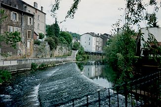
The river in Longuyon |
||
| Data | ||
| Water code | FR : B41-0200 | |
| location | France | |
| River system | Rhine | |
| Drain over | Chiers → Maas → Hollands Diep → North Sea | |
| River basin district | Meuse | |
| source | in the parish of Crusnes, 49 ° 25 ′ 40 ″ N , 5 ° 55 ′ 38 ″ E |
|
| Source height | approx. 380 m | |
| muzzle | in the urban area of Longuyon in the Chiers coordinates: 49 ° 26 '54 " N , 5 ° 35' 57" E 49 ° 26 '54 " N , 5 ° 35' 57" E |
|
| Mouth height | approx. 205 m | |
| Height difference | approx. 175 m | |
| Bottom slope | approx. 5.5 ‰ | |
| length | 32 km | |
| Catchment area | 266 km² | |
| Drain at the mouth |
MQ |
3.21 m³ / s |
| Left tributaries | Pienne | |
| Small towns | Longuyon | |
|
Iron Church of Sainte-Barbe before restoration |
||
The Crusnes is a river in France that runs in the Grand Est region , on the border with Germany and Luxembourg .
geography
course
The Crusnes rises in the territory of the municipality of the same Crusnes , near a former Minette - Mine , dehydrated generally in a westerly direction and opens to 32 kilometers in urban area of Longuyon as left tributary in the Chiers . On its way, the Crusnes crosses the Meurthe-et-Moselle department and, just before its confluence, forms the border with the neighboring Meuse department over a distance of about six kilometers .
Places on the river
history
The river runs near the Maginot Line , a French defensive wall that was fiercely contested during World War II . A large number of former fortifications and military cemeteries still bear witness to this today.
See also List of Ouvrages of the Maginot Line .
Attractions
- Church of Sainte-Barbe , in Crusnes, was built entirely of iron between 1937 and 1939 ( Monument historique )
Individual evidence
- ↑ a b geoportail.fr (1: 16,000)
- ↑ a b c The information on the length of the river is based on the information about the Crusnes at SANDRE (French), accessed on May 1, 2011, rounded to full kilometers.
- ↑ See web link: Débits caractéristiques de la Crusnes
- ↑ According to sandre.fr, however, the Crusnes has its source in the municipality of Errouville. Presumably it runs underground today due to the years of iron mining.
Web links
- Débits caractéristiques de la Crusnes (French; PDF; 17 kB)

