Dambach (Teichl)
| Dambach | ||
|
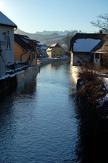
The Dambach in Windischgarsten |
||
| Data | ||
| location | Upper Austria | |
| River system | Danube | |
| Drain over | Teichl → Steyr → Enns → Danube → Black Sea | |
| source | on the eastern slope of the Schwarzkogel in the Ennstal Alps 47 ° 40 ′ 46 ″ N , 14 ° 25 ′ 32 ″ E |
|
| Source height | approx. 1250 m above sea level A. | |
| muzzle | west of Windischgarsten in the Teichl Coordinates: 47 ° 43 '27 " N , 14 ° 17' 43" E 47 ° 43 '27 " N , 14 ° 17' 43" E |
|
| Mouth height | approx. 570 m above sea level A. | |
| Height difference | approx. 680 m | |
| Bottom slope | approx. 40 ‰ | |
| length | 17 km | |
| Catchment area | 78.78 km² | |
| Discharge at the Windischgarsten A Eo gauge : 67 km² Location: 3.2 km above the mouth |
NNQ (1986-10-06) MNQ 1971–2013 MQ 1971–2013 Mq 1971–2013 MHQ 1971–2013 HHQ (2002-08-12) |
290 l / s 640 l / s 1.9 m³ / s 28.4 l / (s km²) 30.8 m³ / s 116 m³ / s |
| Left tributaries | Winklerbach, Edlbach | |
| Right tributaries | Salzabach | |
| Communities | Rosenau am Hengstpaß , Edlbach , Windischgarsten | |
The Dambach is a 17 km long right tributary of the Teichl in Upper Austria .
Run and landscape
The Dambach rises on the eastern slope of the Schwarzkogel in the Ennstal Alps at an altitude of around 1250 m above sea level. A. It first drops steeply and then runs through the Rosenau, a wide, partly swampy trough valley formed by the Ice Age to the north or northwest. At the end of the valley of the roll-call is Dambach origin to 968 meters above sea level. A. ( ⊙ ). The middle Dambachtal is a wooded narrow valley with overgrown southern slopes and flattening northern slopes. The Dambach then flows through the relatively flat Windischgarstner Basin and flows into the Teichl on its western edge.
Catchment area and water supply
The Dambach drains a catchment area of 78.8 km². The highest point in the catchment area is the Great Pyhrgas at 2244 m above sea level. A.
The mean discharge at the Windischgarsten gauge, 3.2 km above the mouth, is 1.90 m³ / s, which corresponds to a discharge rate of 28.4 l / s · km². The Dambach has a nivo-pluvial discharge regime . The mean runoff in the month with the most water in April, at 3.08 m³ / s, is twice as high as in the month with the least water in October with 1.35 m³ / s.
ecology
In the upper reaches of the Dambach is relatively natural, but in the agriculturally intensively used Windischgarstner Basin and in the local areas of Rosenau and Windischgarsten it is strictly regulated and straightened. At the lower Dambach, the river continuum is also interrupted by bed sills and a larger crash structure . The stream has water quality classes I-II throughout . The main species of fish are grayling , rainbow trout and brown trout .
use
In 1622 the Spital am Pyhrn Abbey granted the scythe blacksmith Wolfgang Moser permission to build a scythe factory on Dambach. This was in operation until 1904.
Web links
Individual evidence
- ↑ a b c d Digital Upper Austrian Room Information System (DORIS)
- ↑ Federal Ministry for Agriculture, Forestry, Environment and Water Management (Ed.): Area directory of the Austrian river basins: Enns area. Contributions to the hydrography of Austria, issue No. 61, Vienna 2011, p. 54 ( PDF; 3.9 MB )
- ↑ a b Federal Ministry of Agriculture, Forestry, Environment and Water Management (ed.): Hydrographic Yearbook of Austria 2013 . Volume 121 - data and evaluations, Vienna 2015, p. OG 218 ( online )
- ↑ Hans Krawarik: The settlement and desolation of the Rosenau. In: Oberösterreichische Heimatblätter, Volume 22, Issue 3/4, 1968, pp. 26–38, online (PDF; 595 kB) in the OoeGeschichte.at forum
- ↑ Helmut Mader, Theo Steidl, Reinhard Wimmer: Discharge regime of Austrian rivers. Contributions to a nationwide river typology. Federal Environment Agency, monographs Volume 82, Vienna 1996, p. 103 ( PDF; 14.7 MB )
- ↑ a b Office of Upper Austria. Provincial government (ed.): Mapping of natural areas Upper Austria - biotope mapping community Rosenau am Hengstpaß. Final report, Kirchdorf an der Krems 2007 ( PDF; 6 MB )
- ^ Office of Upper Austria. Provincial government (ed.): Nature and landscape - models for Upper Austria. Volume 40: Room Unit Windischgarstner Basin. Revised Version, Linz 2007 ( PDF; 1.4 MB )
- ↑ Landesfischereiverband Upper Austria: Teichl and Dambach
