
Daubhaus
| Daubhaus | ||
|---|---|---|
 View from the west-southwest over Runzhausen to Daubhaus (center left) and Allberg ( 527.7 m ; center right) |
||
| height | 551.8 m above sea level NHN | |
| location | near Rachelshausen ; District of Marburg-Biedenkopf , Hesse ( Germany ) | |
| Mountains | Gladenbacher Bergland | |
| Dominance | 4.9 km → Schindeberg (553.2 m, Lage ) | |
| Notch height | 49 m ↓ near Hülshof ( location ) | |
| Coordinates | 50 ° 47 '42 " N , 8 ° 31' 52" E | |
|
||
| particularities | Daubhaus ring wall system | |

Daubhaus is 551.8 m above sea level. NHN high mountain of the Bottenhorn plateaus . It is located near Rachelshausen in the Marburg-Biedenkopf district in central Hesse . The Daubhaus ring wall is on top of it .
geography
location
The Daubhaus rises in the east of the Bottenhorn plateau in the Lahn-Dill-Bergland nature park and in the west of the Hessian hinterland . Its summit is about 750 m north of Rachelshausen , a north-western district of Gladenbach , 2 km south-south-east of Holzhausen and 2 km west of Runzhausen . The Strichbach rises on the eastern flank of the mountain , the Hipperbach to the southeast and the Hinterbach to the southwest . To the west is the source of the Dautphe .
Natural allocation
The Daubhaus belongs to the natural spatial main unit group Westerwald (No. 32), in the main unit Gladenbacher Bergland (320) and in the subunit Lahn-Dill-Bergland (320.0) to the natural area Bottenhorn plateau (320.01). Its landscape falls to the east into the Damshauser Kuppen natural area (320.10) and to the south into the Salzbödetal natural area (320.12).
Daubhaus ring wall system
_(007).JPG)
On the Daubhaus there is a previously unexplored hilltop settlement, the Daubhaus ring wall system , with ramparts, podiums and terraces with long striped corridors, probably from the late Hallstatt or early La Tène period .
The ring wall Hünstein , which is located on the approximately 850 m north-northeast, Hünstein is also classified in the same time horizon .
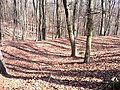
Northern part of the ramparts

Highest point within the ring wall system

_(002).JPG)
Traffic and walking
To the south past the Daubhaus leads through Rachelshausen in a west-east direction to Runzhausen, the state road 3288. For example, starting in Rachelshausen or at the parking lot at the Runzhausen refuge , which is near the Runzhausen cemetery a little off the road, the mountain can mostly on forest paths and trails can be hiked. The Lahn-Dill-Bergland-Path leads over its western slope and through the southern Rachelshausen .
Web links
Individual evidence
- ↑ a b Map services of the Federal Agency for Nature Conservation ( information )
- ^ Gerhard Sandner: Geographical land survey: The natural space units on sheet 125 Marburg. Federal Institute for Regional Studies, Bad Godesberg 1960. → Online map (PDF; 4.9 MB)
- ^ Heinrich Janke: Inventory of the prehistoric and early historical monuments of Hesse, Der Kreis Biedenkopf, Volume II , pp. 18/19, R. Habelt Verlag GmbH Bonn, 1973