Presidente Hayes Department
| Presidente Hayes Department | |||
|---|---|---|---|
| Symbols | |||
|
|||
| Basic data | |||
| Country | Paraguay | ||
| Capital | Villa Hayes | ||
| surface | 72,907 km² | ||
| Residents | 121,100 ( 2017 estimate ) | ||
| density | 1.7 inhabitants per km² | ||
| ISO 3166-2 | PY-15 | ||
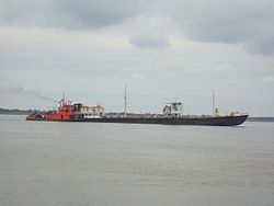
| Barge on the Paraguay River in front of Villa Hayes | |||
Coordinates: 25 ° 6 ′ S , 57 ° 32 ′ W
In terms of area, Presidente Hayes is the third largest of the 17 departments in Paraguay . It is named after the 19th US President Rutherford B. Hayes (President from 1877 - 1881 ). After the Triple Alliance War, Hayes settled a border dispute with Argentina and ruled in Paraguay's favor.
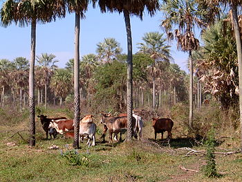
The main industry is livestock. But sweet potatoes, sorghum , sugar cane, cotton, manioc , corn and cruciferous milkweed are also grown. There is a boatyard in Villa Hayes that makes barges .
Districts
- Benjamin Aceval
- Dr. José Falcon
- General Bruguez
- Nanawa
- Pozo Colorado
- Puerto Pinasco
- Teniente Irala Fernández
- Villa Hayes
Web links
Commons : Presidente Hayes - collection of images, videos and audio files
Individual evidence
- ↑ XV departamento: Presidente Hayes abc.com.py , October 11, 2016, accessed November 4, 2018.


