
Tingri
.png)
Tingri ( Tibetan : དིང་ རི་ རྫོང་ , transcription after Wylie : ding ri , also Dingri Dzong ; Chinese 定日 县 , Pinyin Dìngrì Xiàn ) is a district on the northern flank of the Himalayas with importance for tourism and mountain sports such as mountaineering and mountain biking . It belongs to the administrative area of the city of Xigazê in the Tibet Autonomous Region of the People's Republic of China . In 1999 there were 45,157 residents in Tingri County. The main town and seat of the district administration is Shelkar ( tib. = Zhal dkar, chin. =协 格尔 Xiege'er) or Neu-Tingri, which has 8,767 inhabitants (2000).
geography
The area of Tingri County covers an area of 10,000 km², at an average altitude of 5000 meters. On the website of the Tingris district administration, a current estimated population of around 50,000 is given. Adjacent circles are Ngamring , Nyalam , Lhazê , Sa'gya, and Dinggyê . In the south of the district is the Tibetan northern side of several eight-thousand-meter peaks in the Himalayas, as well as the Buddhist Rongbuk monastery built at an altitude of 5100 meters . The valley and glacier with the same name represent the beginning of one of the ascent routes of the Qomolangma . The Rongbuk is one of the three arms of the Qomolangma glacier.
The highest natural or biosphere reserve in the world is also located here . In addition to the Rongpu monastery, there are other significant Buddhist monk centers in Tingri. Among others in Shelkar and in Nanguo. The upper reaches of the Arun , which rises as Bum Chu in the neighboring Nyalam district, flows through Tingri before it leaves Tibet for Nepal .
Administrative structure
At the community level, the district consists of two large communities and eleven communities . These are ( pinyin / chin.):
- Large community Xiege'er 协 格尔 镇
- Gangga municipality 岗 嘎 镇
- Qudang parish 曲 当 乡
- Zhaxizong Township 扎西 宗 乡
- Kema parish 克玛 乡
- Rongxia Municipality 绒 辖 乡
- Cuoguo Township 措 果 乡
- Quluo Parish 曲 洛 乡
- Changsuo Township 长 所 乡
- Nixia parish 尼 辖 乡
- Zhaguo Township 扎 果 乡
- Penji Township 盆 吉 乡
- Jiacuo Township 加 措 乡
climate
| Tingri County | ||||||||||||||||||||||||||||||||||||||||||||||||
|---|---|---|---|---|---|---|---|---|---|---|---|---|---|---|---|---|---|---|---|---|---|---|---|---|---|---|---|---|---|---|---|---|---|---|---|---|---|---|---|---|---|---|---|---|---|---|---|---|
| Climate diagram | ||||||||||||||||||||||||||||||||||||||||||||||||
| ||||||||||||||||||||||||||||||||||||||||||||||||
|
Average monthly temperatures and rainfall for Tingri County
Source: www.meteoblue.com
|
|||||||||||||||||||||||||||||||||||||||||||||||||||||||||||||||||||||||||||||||||||||||||||||||||||||||||
- Tingri

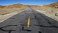
Lalung La to Shelkar
Friendship Highway

Snowleopard Guest House
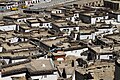
Shelkar (2014)

Tingri (1993)

New village

Mount Everest

Gyatso La 5248 m


See also
- Dingri Langkhor Nanguo Monastery
Individual evidence
- ^ Publications from Harvard University
- ↑ Université du Michigan GRUMP (Global Rural Urban Mapping Project)
- ↑ Website of the district dingri.gov ( Memento of the original from April 26, 2011 in the Internet Archive ) Info: The archive link has been inserted automatically and has not yet been checked. Please check the original and archive link according to the instructions and then remove this notice.
- ^ Publications of UNESCO UNESCO
- ↑ website ingher.at ingher.at
Coordinates: 28 ° 29 ' N , 87 ° 13' E