Espinar district
| Espinar district | |
|---|---|
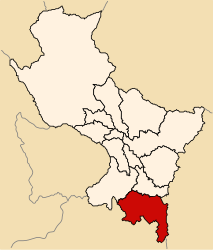
 The Espinar District is located in the central south of the Espinar Province (marked in red) |
|
| Basic data | |
| Country | Peru |
| region | Cusco |
| province | Espinar |
| Seat | Yauri |
| surface | 738 km² |
| Residents | 37,187 (2017) |
| density | 50 inhabitants per km² |
| founding | December 11, 1942 |
| ISO 3166-2 | PE-CUS |
| Website | www.muniespinar.gob.pe (Spanish) |
| politics | |
| Alcalde Provincial | Lolo Arenas Armendáriz (2019-2022) |
| Political party | Partido Democracia Directa |
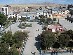
| Plaza de Armas in Yauri | |
Coordinates: 14 ° 48 ′ S , 71 ° 25 ′ W
The Espinar District is located in the Espinar Province in the Cusco Region in south-central Peru . The district founded on December 11, 1942 has an area of 738 km². In the 2017 census, 37,187 residents lived in the district. In 1993 the population was 25,510, in 2007 29,581. The district and provincial administration is located in the provincial capital Yauri at an altitude of 3976 m , with 30,845 inhabitants (as of 2017). Yauri is located about 155 km south-southeast of the regional capital Cusco . The Tintaya copper mine is located about 15 km southeast of Yauri.
Geographical location
The Espinar District is located in the Andean highlands in the central south of the Espinar Province. The Río Apurímac flows along the western district boundary , the left tributary of the Río Salado forms the northeastern district boundary.
The Espinar district borders in the west on the Coporaque district , in the northeast on the Pichigua , Alto Pichigua and Pallpata districts , in the east on the Ocoruro district and in the south on the Tisco district ( Caylloma province ).
Individual evidence
- ↑ a b Peru: Cusco - Provinces & Districts . www.citypopulation.de. Retrieved June 6, 2020.
