
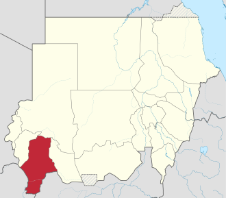
Janub Darfur
| Janub Darfur | |
|---|---|
  |
|
| Basic data | |
| Capital : | Nyala |
| Area : | 72,000 km² |
| Residents : | 3,672,400 (2017 calculation) |
| Population density : | 32.1 inhabitants per km² |
| ISO 3166-2 : |
SD-DS
|
| politics | |
| Governor : | Hammad Ismail Hammad Abdul-Karim |
Dschanub Darfur ( Arabic جنوب دارفور, German South Darfur ) is a federal state in Sudan .
It has an area of 127,300 km² and, according to the 2008 census, around 4 million inhabitants, a figure that is controversial, however, as it deviates significantly from earlier estimates (2.15 million) and also in the context of extensive displacement in the Darfur conflict stands. After the split of the new state of Sharq Darfur , the population is 3.7 million. Capital of the state is Nyala .
geography
The vegetation of Dschanub Darfur is characterized by a transition region between wet and dry savannas . The Bahr al-Arab roughly forms the border with South Sudan .
Another place besides the capital Nyala is Kafia Kingi , which is also claimed by South Sudan.
history
From 1919 to 1974 the area of what is now the state of Dschanub Darfur belonged to the province of Darfur . In 1974 the province of Dschanub Darfur was split off, at that time it also included the southern part of Gharb Darfur . 1991-1994 all of Darfur was reunited in the state of Darfur, which resembled the province of Darfur from 1919 to 1974. On February 14, 1994, the division of Darfur into three states created the state of Dschanub Darfur in its current form.
In 1960 the area around Kafia Kingi was spun off from the bordering province of Bahr al-Ghazal (today the state of Western Bahr el Ghazal in South Sudan) and transferred to the then province of Darfur. It has since been controversial between North and South Sudan.
economy
There are various oil deposits from which the oil is transported to Khartoum by pipeline .
Infrastructure
The capital Nyala is the terminus of the railway line from the Sudanese capital Khartoum.
See also
swell
- ↑ Archived copy ( Memento of the original dated December 29, 2011 in the Internet Archive ) Info: The archive link was automatically inserted and not yet checked. Please check the original and archive link according to the instructions and then remove this notice.
- ↑ Central Bureau of Statistics / Southern Sudan Center for Census Statistics and Evaluation: 5th Sudan Population and Housing Census - 2008 ( Memento of the original from May 20, 2013 in the Internet Archive ) Info: The archive link has been inserted automatically and has not yet been checked. Please check the original and archive link according to the instructions and then remove this notice. (PDF; 425 kB), Table: T02
- ↑ Darfur Relief and Documentation Center: 5th Population and Housing Census in Sudan - An Incomplete Exercise ( Memento of the original from April 12, 2013 in the Internet Archive ) Info: The archive link has been inserted automatically and has not yet been checked. Please check the original and archive link according to the instructions and then remove this notice. , 2010 (PDF; 744 kB)
- ^ Sudan: States, cities & agglomerations - population figures in maps and tables. Retrieved May 8, 2018 .
- ↑ www.statoids.com: Historical overview of the Sudanese states
- ^ Edward Thomas: The Kafia Kingi Enclave. People, politics and history in the north-south boundary zone of western Sudan ( Memento of the original from December 27, 2010 in the Internet Archive ) Info: The archive link was automatically inserted and not yet checked. Please check the original and archive link according to the instructions and then remove this notice. , 2010 (PDF; 2.6 MB)