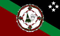
East New Britain Province
| East New Britain East New Britain |
|
|---|---|

|
|
| geography | |
| Country: | Papua New Guinea |
| Waters: | Pacific Ocean |
| Islands: | 14th |
| Geographical location: | 5 ° 20 ′ S , 152 ° 0 ′ E |
| Basic data | |
| Surface: | 15,320 km² |
| Residents: | 328,369 |
| Population density: | 21 inhabitants / km² |
| Capital: | Kokopo |
| Situation map | |
East New Britain Province is one of the 21 provinces of Papua New Guinea . It includes the eastern half of the island of New Britain (formerly New Britain) and 13 small Duke of York Islands (58 km²) in Saint George's Channel between the Gazelle Peninsula and the eastern neighboring island of New Ireland (New Ireland).
The province of East New Britain (ENB) covers 15,320 km² and in 2011 had around 328,369 inhabitants, mainly members of the Tolai people . The largest town and provincial capital was the port city of Rabaul - until the eruption of the Tavurvur volcano in 1994 buried the city under its ashes (5 dead). Many residents moved to Kokopo (formerly Herbertshöhe), 30 km away, during and after the volcanic eruption . As a result, Kokopo became the provincial capital, as the place offered more security due to its protected location and had an already developed infrastructure. Rabaul now has 4,000 inhabitants again, Kokopo around 22,000.
population
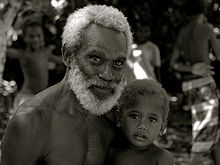
The most important language group in New Britain are the Tolai . They are considered to be enterprising and have been able to cope well with all changes, both in the colonial era and in independence. The Baining from the mountains have gained some notoriety with their ritual fire dance and penis stick . In addition, the Sulka settle south of the Gazelle Peninsula in eastern New Britain .
history
New Britain was discovered by William Dampier in 1700 . From 1885 to 1914 New Britain was part of the German colony of German New Guinea and was named Neupommern . The small York Island off the east coast was called Neulauenburg and was the starting point for the earliest colonial efforts around the Godeffroy trading house .
The eastern part of New Britain with the Gazelle Peninsula has been by far the more important since the early colonial days . From 1889 the main town of the colony in Kokopo (Herbertshöhe) was located here. From 1910 Rabaul (Simpsonhafen), a few kilometers away, became the capital. The inauguration of a Bismarck monument also took place in 1910 near the “Toma” rest home on the 400 m high Varzinsberg .
Eastern New Britain, along with New Ireland and York Island, could be considered the only part of the German colony that had been developed - the rest was only researched and administered at the edges.
Rabaul also remained the capital of New Guinea during the Australian period from 1918 to 1945. Only then were the two territories of Papua and New Guinea united, Port Moresby became the new capital and New Britain lost its importance.
Districts and LLGs
The East New Britain Province is divided into four districts. Each district consists of one or more "areas at the local administrative level", Local Level Government (LLG) Areas , which are divided into Rural (rural) or Urban (urban) LLGs.
| District | Administrative center | Designation of the LLG areas |
|---|---|---|
| Gazelle District | Kerevat | Central Gazelle Rural |
| Inland Baining Rural | ||
| Lassul Baining Rural | ||
| Livuan rhymes rural | ||
| Toma-Vunadidir Rural | ||
| Kokopo District | Kokopo | Bitapaka Rural |
| Duke of York Rural | ||
| Kokopo-Vunamami Urban | ||
| Raluana Rural | ||
| Pomio district | Pomio | Central-Inland Pomio Rural |
| East Pomio Rural | ||
| Melkoi Rural | ||
| Sinivit Rural | ||
| West Pomio-Mamusi Rural | ||
| Rabaul district | Rabaul | Balanataman Rural |
| Kombiu Rural | ||
| Rabaul Urban | ||
| Watom Island Rural |
See also
- West New Britain Province , New Britain (main island New Britain, formerly Neupommern)
- New Ireland (eastern neighboring island of New Ireland, formerly Neumecklenburg)
- List of provinces of Papua New Guinea
- List of German names for Papua New Guinea places
Web links
Individual evidence
- ↑ 2000 Census: Population by Province, PNG, 2000 Census. In: A Tourism Guide to Papua New Guinea , Papua New Guinea Business Directory. Retrieved August 1, 2013.
- ↑ Papua New Guinea: Provinces, Cities & Urban Settlements - Population Statistics in Maps and Tables. Retrieved April 6, 2018 .
-
↑
Isimel Puipui: Kokopo Urban Local Level Government. ( Memento of the original from April 4, 2011 in the Internet Archive ) Info: The archive link was inserted automatically and has not yet been checked. Please check the original and archive link according to the instructions and then remove this notice. (PDF; 1 MB; English; 7 pages with maps) Local Government Managers Australia, South Melbourne, Australia [undated], p. 2. Retrieved on August 1, 2013. Quotation: “After the devastation of Rabaul Township by the volcano in 1994, the obvious choice for the alternative government center was Kokopo; because of two reasons. Firstly, it offers a safe location from future threats from the volcano and secondly, that Kokopo already had the urban infrastructure to accommodate people in cases of emergencies. " Info: Puipui is Town Manager of the New British city of Kokopo.
-
↑
See the Ethnologue entry for Sulka language : Sulka: A language of Papua New Guinea. (English) In: M. Paul Lewis u. a. (Ed.): Ethnologue: Languages of the World. 17th Edition, SIL International, Dallas Texas 2013. Retrieved August 1, 2013. Citation: “Population: 2,500 (1991 SIL). Location: East New Britain Province, East Pomio district, Wide Bay coast. "
- ↑ Official website : National Statistical Office of Papua New Guinea. Port Moresby. Retrieved on August 1, 2013. Info: Without any information value, as no freely accessible data is offered!


