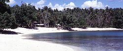
Madang Province
| Madang | |
|---|---|

|
|
| geography | |
| Country: | Papua New Guinea |
| Waters: | Pacific Ocean |
| Islands: | 4 larger, numerous small |
| Geographical location: | 5 ° 20 ′ S , 145 ° 20 ′ E |
| Basic data | |
| Surface: | 29,000 km² |
| Residents: | 493.906 |
| Population density: | 17 inhabitants / km² |
| Capital: | Madang |
| Situation map | |
Madang is one of 21 provinces in Papua New Guinea . With 29,000 km² it is almost as big as North Rhine-Westphalia , with only 493,906 inhabitants (NRW: 18 million). The capital of the province is the city of the same name, Madang .
history
Madang has been considered populated for 15,000 years. The first European arrived in the province in 1861 - a Russian biologist named Nicolai Miklouho-Maclay .
The city of Friedrich-Wilhelm-Hafen , today also called Madang, was founded in 1886 on Kaiser-Wilhelms-Land by the German New Guinea Company. Due to the tropical and humid climate, many of the first residents died of tropical diseases such as malaria . On September 17, 1892, the state administration of the New Guinea company was relocated from Stephansort to Friedrich-Wilhelmshafen under its newly appointed governor Georg Schmiele. Until the economic end of the company in 1899, the town remained the capital of German New Guinea. When the administrative headquarters were relocated from the previous capital, Stephansort , Papuans accompanied the German administrative officials. These locals named Friedrich-Wilhelmshafen after their home island Madang, this name was later adopted. After the New Guinea company was taken over by the German Empire in 1899, the capital was initially relocated to Herbertshöhe on the island of New Pomerania (now New Britain).
In 1904 there was a punitive action in Madang due to a suspected conspiracy and many locals were shot dead. In 1912 a small group of Papuans may have planned a revolt, but it would have been impractical. As a punishment, the Germans relocated entire villages.
Traces of the German colonial era can still be found today. The large, shady trees in Madang were planted by Germans. Tobacco , coconut , cocoa and coffee plantations , which were once planted by the Germans along the north coast and in Astrolabe Bay and Hansa Bay , still exist.
In 1918, Australia took over the German colony as a trust territory - Germany was no longer allowed to own any colonies after the loss of the First World War .
In the Second World War , the province then got into heavy acts of war. The Japanese conquered the province in 1942, and the Allies then bombed the Japanese positions, including the local settlements in their vicinity. There was also hunger and epidemics. The British and Americans retook Madang two years later in 1944.
After the Second World War, more and more agricultural cooperatives were formed . In November 1970 there was an earthquake with 18 dead.
Districts and LLGs
Madang Province is divided into six districts. Each district consists of one or more "areas at the local administrative level", Local Level Government (LLG) Areas , which are divided into Rural (rural) or Urban (urban) LLGs.
| District | Administrative center | Designation of the LLG areas |
|---|---|---|
| Bogia district | Bogia | Almami Rural |
| Iabu Rural | ||
| Yawar Rural | ||
| Madang District | Madang | Ambenob Rural |
| Madang Urban | ||
| Transgogol Rural | ||
| Middle Ramu District | Simbai | Arabaka Rural |
| Josephstaal Rural | ||
| Simbai Rural | ||
| Rai Coast District | Rai Coast | Astrolabe Bay Rural |
| Naho Rawa Rural | ||
| Saidor Rural | ||
| Sumkar District | Karkar | Karkar Rural |
| Sumgilbar Rural | ||
| Usino Bundi District | Usino | Bundi Rural |
| Usino Rural |
Attractions
Tourists often come to Bogia in Hansa Bay , 200 km northwest of the provincial capital, for the diving opportunities along the north coast , where wrecks of sunken warships and the like. Ä. Are a destination for divers.
There are high active volcanoes on the islands of Manam (83 km²) in Hansa Bay, Karkar (362 km²) and Long Island (414 km²). In the south-west the highway leads to the neighboring province of Morobe and its capital Lae , as well as to the mountains and the city of Goroka .
Web links
- On the history of Madang and Papua New Guinea:
- During the German colonial era:
- The German administration of New Guinea 1884-1914 and the following (II-IV)
- Ethnological:
- MM Brüll: Taro gardens and their magic. Rituals, everyday life and change in a Girawa village, Papua New Guinea (dissertation, University of Freiburg i. Br. 2002)
- To the landscape:


