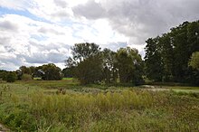
Oak forest moat
| Oak forest moat | ||
|
|
||
| Data | ||
| Water code | DE : 2421752 | |
| location |
Middle Franconian basin
|
|
| River system | Rhine | |
| Drain over | Entengraben → Rednitz → Regnitz → Main → Rhine → North Sea | |
| source | Forest southeast of Nuremberg-Worzeldorf 49 ° 21 ′ 54 ″ N , 11 ° 6 ′ 38 ″ E |
|
| Source height | approx. 345 m above sea level NN | |
| muzzle | near Nürnberg-Eibach in Entengraben Coordinates: 49 ° 23 '34 " N , 11 ° 2' 9" E 49 ° 23 '34 " N , 11 ° 2' 9" E |
|
| Mouth height | 298 m above sea level NN | |
| Height difference | approx. 47 m | |
| Bottom slope | approx. 6.2 ‰ | |
| length | 7.6 km | |
The Eichenwaldgraben is a small river in the south of Nuremberg that does not carry water all year round and is one of the land moats in Nuremberg . It is a left tributary of the Entengraben .
geography
course
The Eichenwaldgraben rises southeast of the Nuremberg district Worzeldorf in the Lorenzer Reichswald , flows westward along the Ludwig-Danube-Main Canal , then through Worzeldorf, crosses some fish ponds near Herpersdorf and passes Weiherhaus. In a narrow strip between settlement areas, meadows in the valley floor were shut down and cared for by the Federal Nature Conservation Federation with the help of farmers, and hedges with berry bushes and tall fruit trees (pears, apples and service trees) were planted.
The Eichwaldgraben crosses under the Main-Danube Canal and flows through alluvial forests as well as oak and hornbeam forests before it flows into a pond in Reichelsdorf together with the Entengraben . The pond is drained by the Entengraben and this flows into the Rednitz at Gerasmühle ( Nürnberg-Eibach ) . There is an arboretum on the opposite bank .
inflow
In the Eichenwaldgraben in the Eibacher Forst before Reichelsdorf, from the left and from the southwest, the Gaulnhofer Graben, which is around four kilometers long, flows into it .
nature and environment
ecology
The pollution of the oak forest ditch is moderate up to the outskirts of Reichelsdorf (quality class II) and then becomes critical (quality class II-III). In the Nuremberg zoning plan of 2006, maintenance plans were defined for the 23 most important water systems. At the Eichenwaldgraben in Reichelsdorf, the watercourse is to be made continuous again and rigid bank reinforcements removed. The city of Nuremberg works together with residents, nature conservation associations, schools, civic associations and the landscape conservation association.
In 1300 the Zeidelgut Pillenreuth was named on a royal clearing at the Eichenwaldgraben.
Protected areas
- The 344 hectare landscape between the port, Reichelsdorf, Neukatzwang, Weiherhaus and Gaulnhofen is designated as a nature reserve Eichenwaldgraben - Stockweiher .
- The Eichenwaldgraben flows east of Marthweg within the EU bird sanctuary Nuremberg Reichswald .
traffic
In the 1960s, an S-Bahn branch from Reichelsdorf via Weiherhaus to Langwasser was planned in the Weiherhaus / Herpersdorf area on a wide strip of green along the Eichenwaldgraben. According to the current project of a light rail to Kornburg, this should run along the oak forest ditch.
Individual evidence
- ↑ Bund Naturschutz: Press release 22/2004 Fight against giant hogweed ( memento of the original from March 4, 2016 in the Internet Archive ) Info: The archive link was inserted automatically and has not yet been checked. Please check the original and archive link according to the instructions and then remove this notice. (accessed June 29, 2015)
- ↑ 8.3.6 Duck oak forest ditch and Gaulnhofener ditch . In: Stadtentwässerung und Umweltanalytik Nürnberg (Hrsg.): Condition of small rivers in Nuremberg . 2006, p. 25 ( PDF 1 MB ).
- ↑ 5. Water care and maintenance . In: Stadtentwässerung und Umweltanalytik Nürnberg (Hrsg.): Condition of small rivers in Nuremberg . 2006, p. 5 ( PDF 1 MB ).
- ^ Wiltrud Fischer-Pache: Pillenreuth . In: Michael Diefenbacher , Rudolf Endres (Hrsg.): Stadtlexikon Nürnberg . 2nd, improved edition. W. Tümmels Verlag, Nuremberg 2000, ISBN 3-921590-69-8 ( complete edition online ).
- ↑ Ordinance on the establishment of landscape protection areas in the city of Nuremberg (Landscape Protection Ordinance - LSchVO). City of Nuremberg, December 21, 2010, accessed on August 22, 2017 .
- ↑ BayernAtlas - map viewer of the Free State of Bavaria with maps, aerial photos and various themed maps. Bavarian Surveying Administration, accessed on August 22, 2017 .
- ^ Ghost routes: Homepage of Klaus Schöner (accessed on June 29, 2015)

