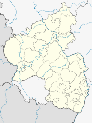
Eichheidetunnel
| Eichheidetunnel | ||
|---|---|---|
| traffic connection | High-speed route Cologne – Rhine / Main | |
| length | 1750 m | |
| Number of tubes | 1 | |
| construction | ||
| Client | Deutsche Bahn | |
| business | ||
| operator | DB network | |
| release | 2002 | |
| location | ||
|
|
||
| Coordinates | ||
| Northwest portal | 50 ° 25 ′ 44 " N , 7 ° 53 ′ 16" E | |
| Southeast portal | 50 ° 25 ′ 6 ″ N , 7 ° 54 ′ 30 ″ E | |
The Eichheidetunnel is a railway tunnel on the high-speed route Cologne – Rhine / Main in the area of the Rhineland-Palatinate municipality of Nomborn .
With a length of 1750 m, it is the third longest tunnel in Rhineland-Palatinate.
The structure takes up two tracks on a slab track that can be driven on at 300 km / h.
course
The structure lies between route kilometers 94.2 (north-west portal) and 96.0 (south-east portal). The route is located on the north west portal initially in a straight line, which merges into a left turn. The gradient drops in a south-easterly direction.
Among other things, the structure crosses under the K 163 district road. Immediately to the south is the Wiesengrund valley bridge . Due to the spatial proximity, a common rescue area was created for the north portal of the Eichheid tunnel with the south portal of the adjacent Dickheck tunnel. The 138 m long railway bridge lies between the two tunnels.
Over a length of approximately 500 meters, the building passes through the region of the in water protection zone III of class classified former drinking water production plant Helber Scheid .
An emergency exit leads, approximately in the middle of the tunnel (north-east of Schoenberger yard) at 50 ° 25 '19.2 " N , 7 ° 53' 51.7" O to the surface.
history
planning
At the end of 1997 the structure was planned with a length of 1750 m. This corresponds to today's length.
construction
Before construction work began, the Helberscheid drinking water extraction system was replaced by a new system east of Bladernheim . The cost of around one million Deutschmarks (around half a million euros ) was borne by Deutsche Bahn .
The structure was erected from north to south using mining techniques. The passage through a roughly 100 m long basalt shaft , a remnant of an old volcanic funnel, turned out to be particularly difficult . For this purpose, special safety measures had to be taken to protect the tunnel ceiling against breakouts.
Part of the excavation was used by the Nentershausen elementary school to build a dry stone wall. It was the first of numerous cases in which excavated material from the new line was given to schools free of charge.
Installation
When the new line opened on August 1, 2002, the structure was put into regular operation.
Individual evidence
- ↑ a b c d e DBProjekt GmbH Cologne – Rhein / Main, project management (publisher): New Cologne – Rhein / Main line: construction section middle, Lot B: Selters – Brechen , brochure (20 pages), Frankfurt am Main, January 1999, p . 4, 7.
- ↑ DBProjekt GmbH Cologne – Rhein / Main (Ed.): Route map: New Cologne-Rhein / Main line , Frankfurt am Main, November 1997.
- ↑ tunnel breakthroughs; Full closure of the A 3; New alluvial forest; TV thriller in the Fernthal tunnel; Primary school builds biotope . In: On the subject , ZDB -ID 2115698-0 , edition 2/2000, April 2000, pp. 6-8.

