Eifa (Schwalm)
| Eifa | ||
|
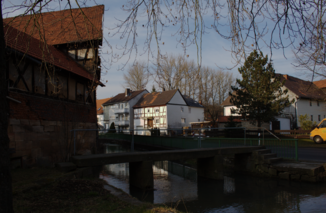
Pedestrian bridge over the Eifa in Eifa (Alsfeld) |
||
| Data | ||
| Water code | DE : 428812 | |
| location | Osthessisches Bergland , Vogelsbergkreis , Hesse ( Germany ) | |
| River system | Weser | |
| Drain over | Schwalm → Eder → Fulda → Weser → North Sea | |
| source | near Eifa in the Ottrauer Bergland 50 ° 42 ′ 56 ″ N , 9 ° 21 ′ 57 ″ E |
|
| Source height | approx. 381 m above sea level NHN | |
| muzzle | near Alsfeld in the Schwalm coordinates: 50 ° 45 '25 " N , 9 ° 17' 5" E 50 ° 45 '25 " N , 9 ° 17' 5" E |
|
| Mouth height | approx. 241 m above sea level NHN | |
| Height difference | approx. 140 m | |
| Bottom slope | approx. 13 ‰ | |
| length | 10.9 km | |
| Catchment area | 27.41 km² | |
The Eifa , also called Eifabach , is an approximately 10.9 km long, eastern and orographically right tributary of the Schwalm in the East Hessian highlands in the central Hessian Vogelsbergkreis and belongs to the river system and catchment area of the Weser .
course
The Eifa rises in the Ottrauer Bergland , a part of the Fulda-Haune-Tafelland in the East Hessian Bergland, between the Knüllgebirge in the north-northeast and Vogelsberg in the south-southwest. Its source is about 4 km south-southeast of the Alsfeld village of Eifa in the valley between the Auerberg ( 500.5 m above sea level ; nature reserve) in the east, the Kohlhaupt ( 480.4 m ) in the south and the Brunkelsberg ( 454.8 m ) in the West at about 381 m .
Initially, the Eifa, which runs predominantly northwest, flows north through the Ottrauer Bergland, where it crosses the former Niederaula – Alsfeld railway line for the first time a little below its origin , and then runs along its route and then crossed under it to and through Eifa . In the village, where it is bridged by federal highway 62 , it bends west. After the next bridge on the former railway line and also after crossing under the federal motorway 5 , it passes the "Höllhof" (also called "Hellhof").
Finally opens the Eifa something after passing under the B 254 m of about 140 and after overcoming vertical drop, at about 241 m m east of the height around 150 Alsfelder core city channeled in there and from the south coming Eder influx Schwalm .
Catchment area and tributaries
The catchment area of the Eifa covers 27.41 km². Its tributaries include with orographic allocation (l = left-hand side, r = right-hand side) , length of the water, mouth location with Eifabach kilometers and - if known - catchment area ( viewed downstream ):
- Wannbach (1; 2.2 km), above Eifa (near km 7.2), 2.167 km²
- Grethebach (r; 1.5 km), in Eifa (near km 5.95), 3.28 km²
