Eitra
| Eitra | ||
|
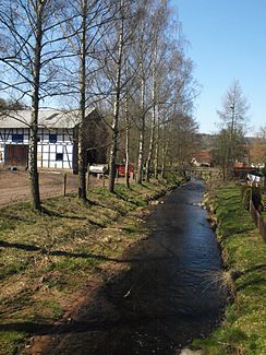
The Eitra in Eiterfeld-Buchenau |
||
| Data | ||
| Water code | EN : 4268 | |
| location | Hessen , Germany | |
| River system | Weser | |
| Drain over | Haune → Fulda → Weser → North Sea | |
| source | West of the Lichtberg (near the Eiterfeld-Leimbach district) 50 ° 44 ′ 46 ″ N , 9 ° 48 ′ 3 ″ E |
|
| Source height | 336 m above sea level NN | |
| muzzle | In Hauneck-Eitra in the Haune coordinates: 50 ° 48 '49 " N , 9 ° 43' 48" E 50 ° 48 '49 " N , 9 ° 43' 48" E |
|
| Mouth height | 214.6 m above sea level NN | |
| Height difference | 121.4 m | |
| Bottom slope | 10 ‰ | |
| length | 11.8 km | |
| Catchment area | 59.177 km² | |
| Drain |
MNQ MQ |
98 l / s 412 l / s |
| Communities | Eiterfeld , Hauneck | |
The Eitra is a small flowing body of water of water order III in the districts of Fulda and Hersfeld-Rotenburg in East Hesse .
The Eitra rises on the western slope of the Lichtberg in the Hessian skittles , in the district of Fulda . It only flows about 500 meters east of the Eiterfeld district of Leimbach in a northerly direction. After just over a kilometer, the brook reaches Eiterfeld , where it initially swings in a westerly direction. It flows south close to the town center of Eiterfeld and continues through Arzell . From here the direction of flow is north-westerly and the Eitratal becomes narrower from here. The stream finds its way between the Hisselsberg ( 399 m above sea level ) to the left of the stream and the Schoders ( 363 m above sea level ) on the right side of the stream. Then it passes the village of Buchenau and then flows between the Dicker Berg mountains ( 454.2 m above sea level ) and the Hauberg ( 412.8 m above sea level ). From around this point the stream flows into the district of Hersfeld-Rotenburg , through the Haunecker district of Bodes and southwest past the village of Eitra until it flows into the Haune just a few hundred meters further west of Eitra at river kilometer 7.9 .
history
In the early Middle Ages the brook was called Eitraha . The syllable "Eitr" goes back to a Germanic or Celtic term for moor or moder, "aha" is the syllable for water or river. The place name Eiterfeld (the field in the moor) and the village Eitra are derived from the Bach name.
The river fed a few watermills along its course. In the 19th century, a weir in Bodes was used to divert part of the stream to supply energy to the textile industry in Eitra at that time.
