Berlin-Falkenhagener Feld
|
Falkenhagener Feld district of Berlin |
|
|---|---|
| Coordinates | 52 ° 32 '49 " N , 13 ° 10' 40" E |
| surface | 6.879 km² |
| Residents | 38,759 (Dec. 31, 2019) |
| Population density | 5634 inhabitants / km² |
| Postcodes | 13583, 13589 |
| District number | 0508 |
| Administrative district | Spandau |
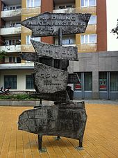
The Falkenhagener Feld is a district in the Berlin district of Spandau , which emerged as a large urban settlement at the end of the 20th century. The development corresponds to the large housing estate Heerstraße Nord . Both settlements are separated from the Lehrter Bahn and Hamburger Bahn lines.
geography
Berlin-Falkenhagener Feld lies in the natural area of the Zehdenick-Spandau Havel lowlands .
history
The Falkenhagener Feld was originally an area used for allotment gardens and agriculture and is located to the west of Spandau's old town , the core of the Spandau district . Due to the lack of housing in what was then West Berlin , the construction of a large housing estate began in 1962. The last buildings were not completed until the 1990s. Recently, the social problems of the Falkenhagener Feld, which is also preferred as a place of arrival for migrants of Turkish and Russian origin, have intensified . A neighborhood management has now been initiated by the district to prevent the social upheaval.
The Falkenseer Chaussee forms the main axis of the settlement. Once a small sandy path, later a normal-wide street, it was expanded into a six-lane main street in the early 1960s and today forms one of the most important connections to Falkensee , a neighboring city to the west of Berlin.
The houses along the Zeppelinstrasse with its four towers at the Falkenseer Chaussee intersection , which were built between 1923 and 1927 by the architect Richard Ermisch in the expressionist style, can be used as the entrance to Falkenhagener Feld . Architecturally interesting is the Catholic St. Mark's Church , which was built in 1977 by Hermann Jünemann and Hans appointed with an aluminum-clad, ribbed conical dome. The Protestant Jeremiah Church and the Refuge Church are also worth seeing.
The southern border of the Falkenhagener Feld forms the Spektegrünzug , a local recreation area for the residents of the settlement. To the north are the Spandau waterworks and the In den Kisseln cemetery . The Evangelical Forest Hospital is located on the northwest corner of Falkenhagener Feld . Originally built as a warehouse for the workers of the Great Hall planned in the 1930s , it was converted into a hospital from 1945 onwards. In 1947, the sponsor of the Protestant hospital work founded the Protestant Forest Hospital Spandau. Some of the barracks are still used today for clinical purposes, the hospital itself is housed in a modern large-scale hospital building.
In the vicinity of the Falkenhagener Feld there are several sports halls and fields that are also used intensively by school sports. A school center is located in the Spectrum field with a primary school (primary school in Beerwinkel), two comprehensive schools (Martin Buber secondary school, B. Traven secondary school) and vocational schools.
Local supply
Shops and service providers as well as dining facilities are traditionally well represented along the Falkenseer Chaussee. Various food discounters are located in the vicinity and a smaller shopping center has been built in the Am Kiesteich / Falkenseer Chaussee area with a supermarket, several retail outlets, service providers and a post office. The Paul Gerhardt Community distributes food to the needy every Friday.
traffic
The Falkenseer Chaussee is primarily available as a connection for private transport from downtown Berlin . Important feeder roads are also the Zeppelinstrasse and a new north-south passage on the local Kiesteich, which was only built in the 1990s.
A planned subway along Falkenseer Chaussee, first through the U7 line , then later through the then U1 line (today: U2 ) is no longer up for debate. The Bötzowbahn of the Havelländische Eisenbahn crosses the Falkenhagener Feld in a north-south direction. Passenger traffic on this route was stopped in 1950. The Falkenhagener Feld is therefore currently only accessible in public transport by bus lines (including the M37 line).
The Falkenhagener Feld is in the approach path until the planned closure of Tegel Airport .
See also
- List of streets and squares in Berlin-Falkenhagener Feld
- List of cultural monuments in Berlin-Falkenhagener Feld
- List of stumbling blocks in Berlin-Falkenhagener Feld
Web links
- Exhibition since February 26th, 2009: "What is the FF * for you?"
- Site of the district management in Falkenhagener Feld West
- Site of the district management in Falkenhagener Feld Ost
Individual evidence
- ↑ May 4th (1962) in daily facts of the Luisenstädtischer Bildungsverein (at the DHM ).


